 AT Backpacking journal/hiking record John Ausema
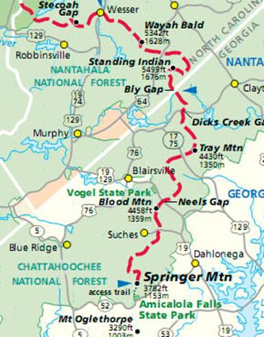
Narrative description of hikes – geographically arrived
from South to North.
Dick’s Creek Gap to
Amicalola Falls
Fri 3/25
Sat 3/26 Low Gap shelter 14.9 2935
Sun 3/27 Neels Gap hostel 10.6 2714
Mon 3/28
Tues 3/29
Wed 3/30 Amicalola Falls 9.0 1335
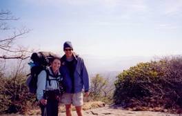
This hike was a backpacking trip during spring break. We had two weeks off, and spent the first
week touring historic sites and natural areas in
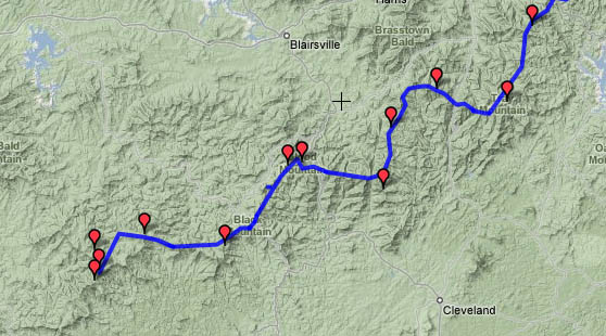
Terrain map of the Georgia route | another map of the Georgia route | Elevation profile of trip
Fri 3/25 Tray Mountain
 The trailhead at
Dicks Creek Gap is at a small roadside picnic area. As is typical in the southern Appalachians,
the trail loses elevation to cross the road, which in turn is at a local
The trailhead at
Dicks Creek Gap is at a small roadside picnic area. As is typical in the southern Appalachians,
the trail loses elevation to cross the road, which in turn is at a local
Sat 3/26 Low Gap shelter 14.9 Elevation
profile
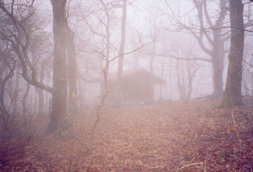
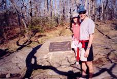
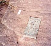
The next morning the mountaintop was wreathed in a sort of ethereal fog – as seen in the picture here, taken at Tray Mountain Shelter. Temperatures remained cool as we set off down the trail. The woods took on a very different feel, the contrast with the sunny atmosphere of the previous day stark. At Unicoi Gap there were some food for hikers left by a “trail angel”, next to one of the famous bronze plaques – similar to the one on top of Springer that we would see in a few days. I was hiking ahead of Tatiana, waiting every now and then for her to catch up. Although the hills were not overly demanding, they still provided enough challenge to separate us. Eventually we decided that I would keep hiking toward the shelter, in order to try and secure a spot for us to sleep. When I arrived at Low Gap Shelter, thunder was rattling the air and rain seemed imminent. I quickly discovered that not only was the shelter packed full, but most of the good tent sites had been taken – at least 10 tents were scattered about. I found a spot next to the trail, and began to set up when I realized that Tatiana had the ground cloth in her pack. Not wanting to wait, I set up the tent anyway, and hurried in as the rain began to fall. Perhaps 20-30 minutes later Tatiana arrived, and we spread the ground cloth inside the tent for extra protection from the rain. We ate cold food in the tent as night settled in and the rain came down steadily. We eventually felt compelled to emerge in order to hang our food bag on the available bear cable, so we braved the rain and got soaked in the process. The rain continued all night, accompanied by a howling wind that convinced Tatiana a tornado was coming.
Sun 3/27 Neels Gap hostel 10.6 Elevation
profile
 By morning the rain
had stopped, but the weather was still damp and cold. We stayed in our tent until most of the hikers
had moved on, then took down our wet tent and packed up. Tatiana’s pack had gotten soaked as well,
because her hastily applied rain cover acted as a funnel for water instead of
shedding the water. The rain continued
on and off through the morning, and temps remained cold – probably no more than
50 degrees, perhaps only mid 40s. It did
not seem like appropriate weather for Easter morning. There was more trail magic from one of the
local hostels at a road crossing, and we got some Cadbury Cream eggs. When we arrived at Neels Gap, the prospect of
making the steep climb to
By morning the rain
had stopped, but the weather was still damp and cold. We stayed in our tent until most of the hikers
had moved on, then took down our wet tent and packed up. Tatiana’s pack had gotten soaked as well,
because her hastily applied rain cover acted as a funnel for water instead of
shedding the water. The rain continued
on and off through the morning, and temps remained cold – probably no more than
50 degrees, perhaps only mid 40s. It did
not seem like appropriate weather for Easter morning. There was more trail magic from one of the
local hostels at a road crossing, and we got some Cadbury Cream eggs. When we arrived at Neels Gap, the prospect of
making the steep climb to
Mon 3/28 Gooch Mountain
 When we emerged from
the dungeon-like confines of the hostel the next morning, the blue skies had
returned. Cold temperatures still
gripped the mountains, however. The
climb up Blood
Mountain, highest point on the trail in
When we emerged from
the dungeon-like confines of the hostel the next morning, the blue skies had
returned. Cold temperatures still
gripped the mountains, however. The
climb up Blood
Mountain, highest point on the trail in
Tues 3/29 Springer Mountain
 Blue skies again greeted us in the
morning, and we set off down the trail on another beautiful day. The favorable weather seemed to have brought
the hikers “out of the woodwork” as well, and we passed dozens of northbound
hikers. Some were carrying a huge amount
of gear, and – based on brief conversations – appeared rather unprepared for
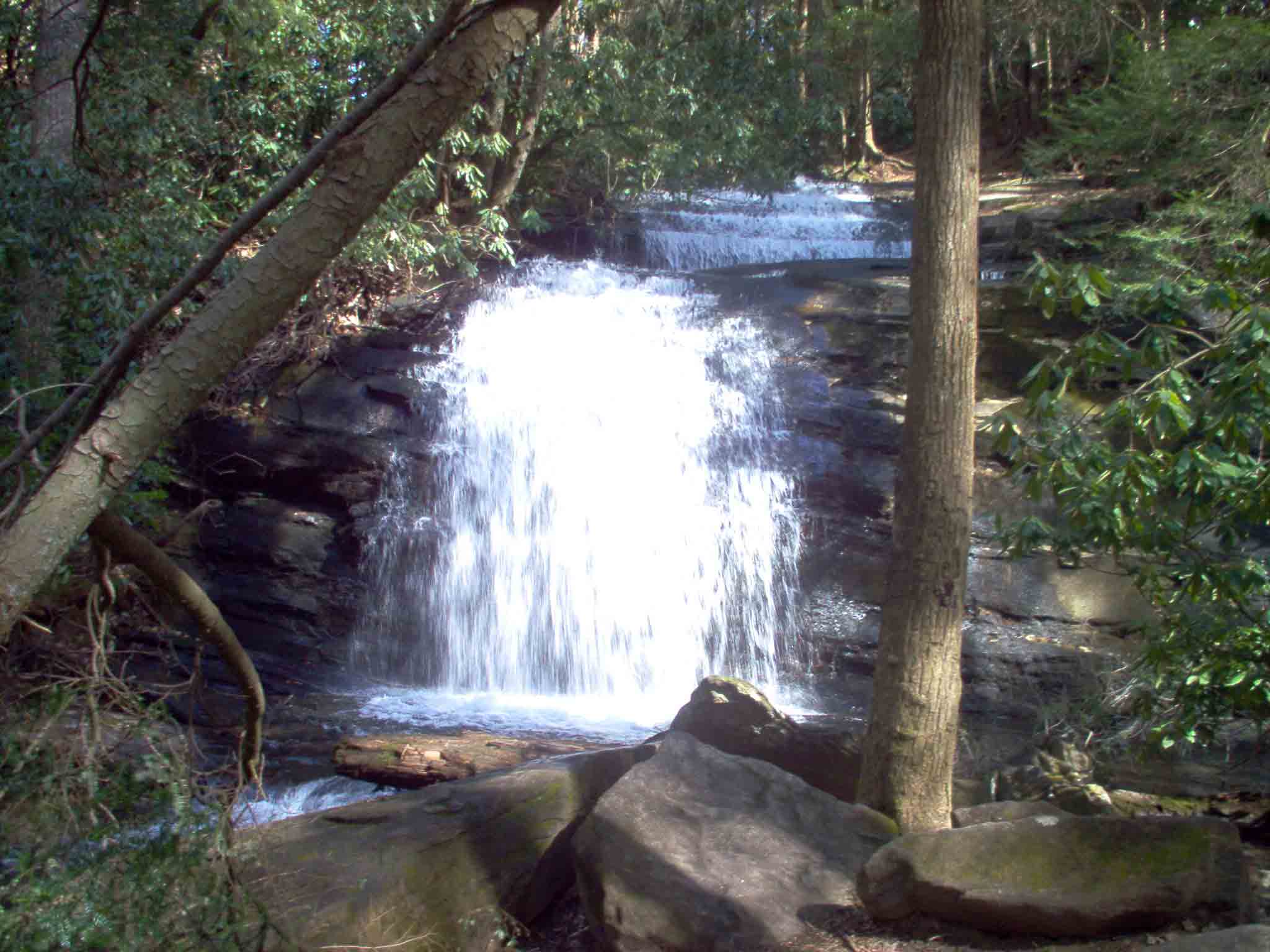
the challenges ahead. The trail wound
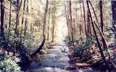
through rhododendron thickets and crossed rushing streams. Sometime in the afternoon we reached Long Creek Falls, a beautiful
cascading waterfall flanked by greenery.
Hikers seemed to be all over the place, as family members accompanied
thru-hikers down their first few miles of the trail. Eventually we reached Springer
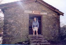
Mountain Shelter, which thankfully was not as full as I had
anticipated. The shelter
had a loft like the one at
Blue skies again greeted us in the
morning, and we set off down the trail on another beautiful day. The favorable weather seemed to have brought
the hikers “out of the woodwork” as well, and we passed dozens of northbound
hikers. Some were carrying a huge amount
of gear, and – based on brief conversations – appeared rather unprepared for
the challenges ahead. The trail wound
through rhododendron thickets and crossed rushing streams. Sometime in the afternoon we reached Long Creek Falls, a beautiful
cascading waterfall flanked by greenery.
Hikers seemed to be all over the place, as family members accompanied
thru-hikers down their first few miles of the trail. Eventually we reached Springer
Mountain Shelter, which thankfully was not as full as I had
anticipated. The shelter
had a loft like the one at
Wed 3/30 Amicalola Falls 9.0 Elevation
profile
In the morning the rain returned, although the temperatures
were still mild. We delayed starting our
hike for a bit, hoping for a break in the steady precipitation – but no such
luck. The 8 mile hike to Amicalola was
at least rather easy, given that it was mostly downhill – but the rain did not
let up and we were beyond thoroughly soaked on reaching the
bottom, where the approach trail passes through a stone arch near the park
visitor center. On the way down the
trail pass the top of
Amicalola Falls, which are in impressive high falls. We showered and changed into dry clothes, and
enjoyed browsing through the AT-themed visitor center and gift shop. We then drove up to the lodge, which sits
above the top of the falls, and enjoyed watching the clouds clear and reform as
we ate a hearty lunch. We drove a short
distance to the small trail town of Helen,
Georgia, which is a tourist-oriented town designed to look like an Alpine
village. We drove up to Brasstown
Bald, where a parking area and short trail brought us to the highest point in the
state of Georgia. The bald lies on
the next ridge west from the AT, and is reachable by a side trail. We also stopped at the