 Manchester to Gorham 2005
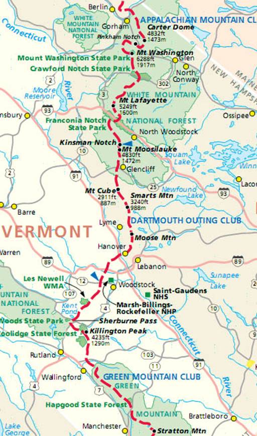
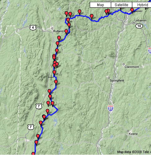
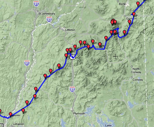
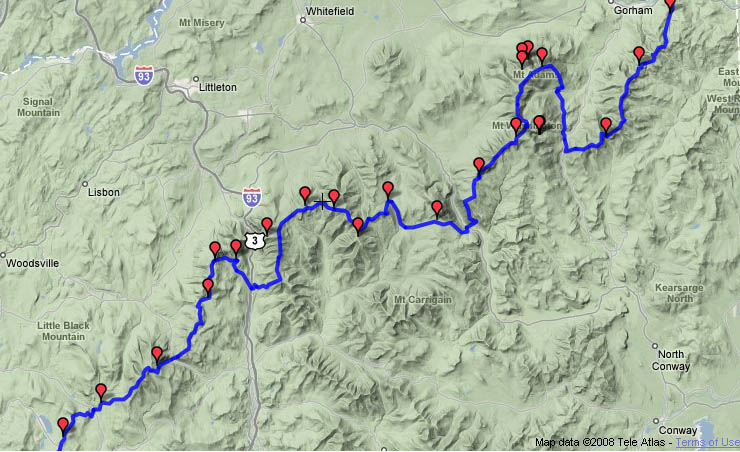
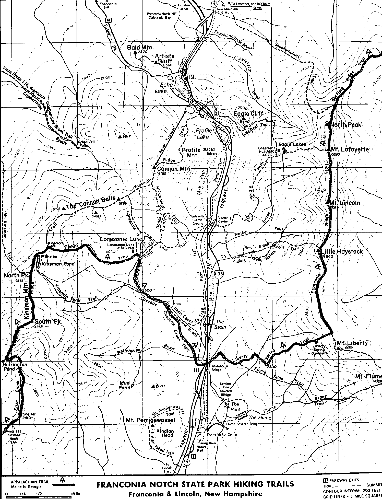
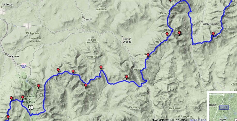
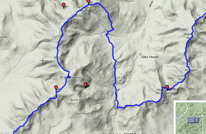
Maps of route: Vermont | New
Hampshire | White Mountains | White mountains with some
surrounding trails | Elevation
profile of entire route
Date Campsite Mileage feet climbed
Sat 7/2 Manchester (Rt 30) à
Lost Pond Shelter 14.8 2770
Sun 7/3 Lost
Pond à
Clarendon Shelter 18.6 2370
Mon 7/4 Clarendon
à Stony Brook Shelter 26.4 4675
Tues 7/5 Stony
Brook à Thistle Hill Shelter 21.5 2895
Wed 7/6 Thistle Hill à Moose Mtn 25.6 3980
Thurs 7/7 Moose Mtn à Hexacuba Shelter 17.7
4675
Fri 7/8 Hexacuba à Glencliff, NH (hostel) 15.2
2771
Sat 7/9 Glencliff à Beaver Brook 7.9 3662
Sun 7/10 Beaver Brook à Kinsman Pond 13.1 3743
Mon 7/11 Kinsman Pond à Garfield
Campsite 15.1 4487
Tues 7/12 Garfield à
Nauman tentsite 23.8 4789
Wed 7/13 Nauman à
Osgood tentsite 14.8 5266
Thurs 7/14 Osgood à
Carter Notch Hut 12.7 3018
Fri 7/15 Carter Notch – Rattle River 13.4 3592
Sat 7/16 Rattle
River à US
2 1.9 0
 By
the end of my first 2-week trip in 2004, I was feeling tired and ready to go
home. But after a few months of
reflecting on the experience, I knew I wanted to return to the trail and
continue hiking north. Because of other
schedule constraints, it turned out that I would need to be away during our
2-year anniversary, but we proceeded with plans anyway. We drove up to Vermont
from Greenbelt
on Friday, July 1st. We left
early so that we would arrive in Vermont in
time to visit the Marsh-Billings-Rockefeller
National Historic Site, the only such site dedicated to interpreting the
history of natural areas conservation and attitudes towards the importance of
conservation in the US. The site is a historic farm, which has been
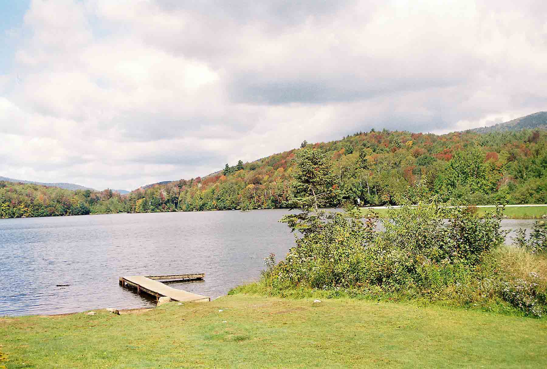
managed from a resource-conservation perspective for over 100 years. We spent some time in the visitor center and
took a short hike on the trails. We
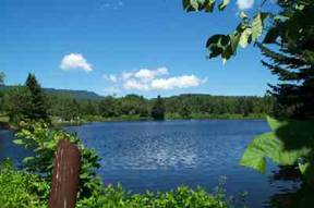
camped at Hapgood
Pond (pictured here), a Green
Mountain National Forest campground near the trailhead. The campground was quite full, but we found
an adequate site beneath some trees and set up our tent.
By
the end of my first 2-week trip in 2004, I was feeling tired and ready to go
home. But after a few months of
reflecting on the experience, I knew I wanted to return to the trail and
continue hiking north. Because of other
schedule constraints, it turned out that I would need to be away during our
2-year anniversary, but we proceeded with plans anyway. We drove up to Vermont
from Greenbelt
on Friday, July 1st. We left
early so that we would arrive in Vermont in
time to visit the Marsh-Billings-Rockefeller
National Historic Site, the only such site dedicated to interpreting the
history of natural areas conservation and attitudes towards the importance of
conservation in the US. The site is a historic farm, which has been
managed from a resource-conservation perspective for over 100 years. We spent some time in the visitor center and
took a short hike on the trails. We
camped at Hapgood
Pond (pictured here), a Green
Mountain National Forest campground near the trailhead. The campground was quite full, but we found
an adequate site beneath some trees and set up our tent.
Sat 7/2 Route 11/30 à Lost Pond Shelter Elevation
profile
 In
the morning we drove to the trailhead on Route11/30, where I had finished the
previous year’s hike. Tatiana set off
with me as we climbed Bromley Mountain. It was a moderately difficult climb –
steadily up, but the trail was not rugged.
At the top is a cleared grassy area and several buildings that are part
of a downhill ski area. We took a break
in the summit house, and took in the views from an observation tower. Then Tatiana headed back to the car and I
continued north on the trail. It was a
nice day for hiking, with blue skies and moderate temperatures. Lots of hikers were out enjoying the
day. I passed some hikers resting at Mad
Tom Notch, and shared the view at Peru Peak
with a number of day trippers and weekend backpackers. A number of people were also at the Griffith Lake tenting area. When I arrived at Old
Job Shelter, I expected to see a crowd – but surprisingly there were only
two other hikers. It probably helped
that there are two other shelters within 2 miles. The other two hikers were a father-son team
who were hiking the Long Trail. The
father had down an AT thru-hike back in the early 70s, when it was much less
popular. They were interesting to talk
to. Lost Pond, by the way, remained
true to its name – I saw no evidence of a pond near the shelter.
In
the morning we drove to the trailhead on Route11/30, where I had finished the
previous year’s hike. Tatiana set off
with me as we climbed Bromley Mountain. It was a moderately difficult climb –
steadily up, but the trail was not rugged.
At the top is a cleared grassy area and several buildings that are part
of a downhill ski area. We took a break
in the summit house, and took in the views from an observation tower. Then Tatiana headed back to the car and I
continued north on the trail. It was a
nice day for hiking, with blue skies and moderate temperatures. Lots of hikers were out enjoying the
day. I passed some hikers resting at Mad
Tom Notch, and shared the view at Peru Peak
with a number of day trippers and weekend backpackers. A number of people were also at the Griffith Lake tenting area. When I arrived at Old
Job Shelter, I expected to see a crowd – but surprisingly there were only
two other hikers. It probably helped
that there are two other shelters within 2 miles. The other two hikers were a father-son team
who were hiking the Long Trail. The
father had down an AT thru-hike back in the early 70s, when it was much less
popular. They were interesting to talk
to. Lost Pond, by the way, remained
true to its name – I saw no evidence of a pond near the shelter.
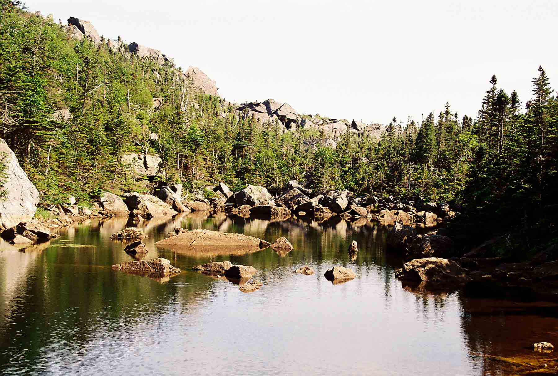
Sun 7/3 Lost Pond à Clarendon Shelter 18.6
Elevation
profile
 Favorable
weather continued as I set out from Lost Pond shelter the next morning. I soon passed the Big Branch shelter, which
was right on the trail. Several hikers
were still there, getting ready for their day.
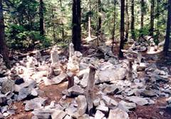
After about 5 miles I came to Little
Rock Pond (pictured here), another popular campsite with a caretaker
provided by Green Mountain Club (there had been 2 other such sites with
caretakers the previous day). I took a
break next to the lake, and observed the caretaker’s campsite. He had a large canvas tent set up over a
platform, and a 2-burner coleman type stove with a large external tank for
cooking. Looked like an interesting
setup. It would be an interesting summer
job for a college student. Later in the
day, along a ridgetop section, I came upon a clearing where a side trail led to
a view a White Rocks. Creative hikers
had created a field of small monuments using the flat white rocks scattered
about the site. Towards late afternoon I
came to Clarendon
Gorge, a deep narrow canyon that would have prevented passage were it not
for a substantial
suspension bridge. There were
several groups of kids camped nearby and swimming in the stream at the bottom
of the gorge, which was perhaps 30 feet deep.
They were probably from an organized camp. I stopped to go for a swim, scrambling down
into the gorge where a relatively easy route had been established. On continuing north I crossed the bridge and
route 103, then encountered a rather steep scramble up toward a high spot and
view. The Clarendon
Shelter was not too far beyond. The
shelter had the classic Vermont
style, looking like a rustic cabin with windows, a table, and bunk beds. I was the only one at the shelter.
Favorable
weather continued as I set out from Lost Pond shelter the next morning. I soon passed the Big Branch shelter, which
was right on the trail. Several hikers
were still there, getting ready for their day.
After about 5 miles I came to Little
Rock Pond (pictured here), another popular campsite with a caretaker
provided by Green Mountain Club (there had been 2 other such sites with
caretakers the previous day). I took a
break next to the lake, and observed the caretaker’s campsite. He had a large canvas tent set up over a
platform, and a 2-burner coleman type stove with a large external tank for
cooking. Looked like an interesting
setup. It would be an interesting summer
job for a college student. Later in the
day, along a ridgetop section, I came upon a clearing where a side trail led to
a view a White Rocks. Creative hikers
had created a field of small monuments using the flat white rocks scattered
about the site. Towards late afternoon I
came to Clarendon
Gorge, a deep narrow canyon that would have prevented passage were it not
for a substantial
suspension bridge. There were
several groups of kids camped nearby and swimming in the stream at the bottom
of the gorge, which was perhaps 30 feet deep.
They were probably from an organized camp. I stopped to go for a swim, scrambling down
into the gorge where a relatively easy route had been established. On continuing north I crossed the bridge and
route 103, then encountered a rather steep scramble up toward a high spot and
view. The Clarendon
Shelter was not too far beyond. The
shelter had the classic Vermont
style, looking like a rustic cabin with windows, a table, and bunk beds. I was the only one at the shelter.
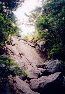
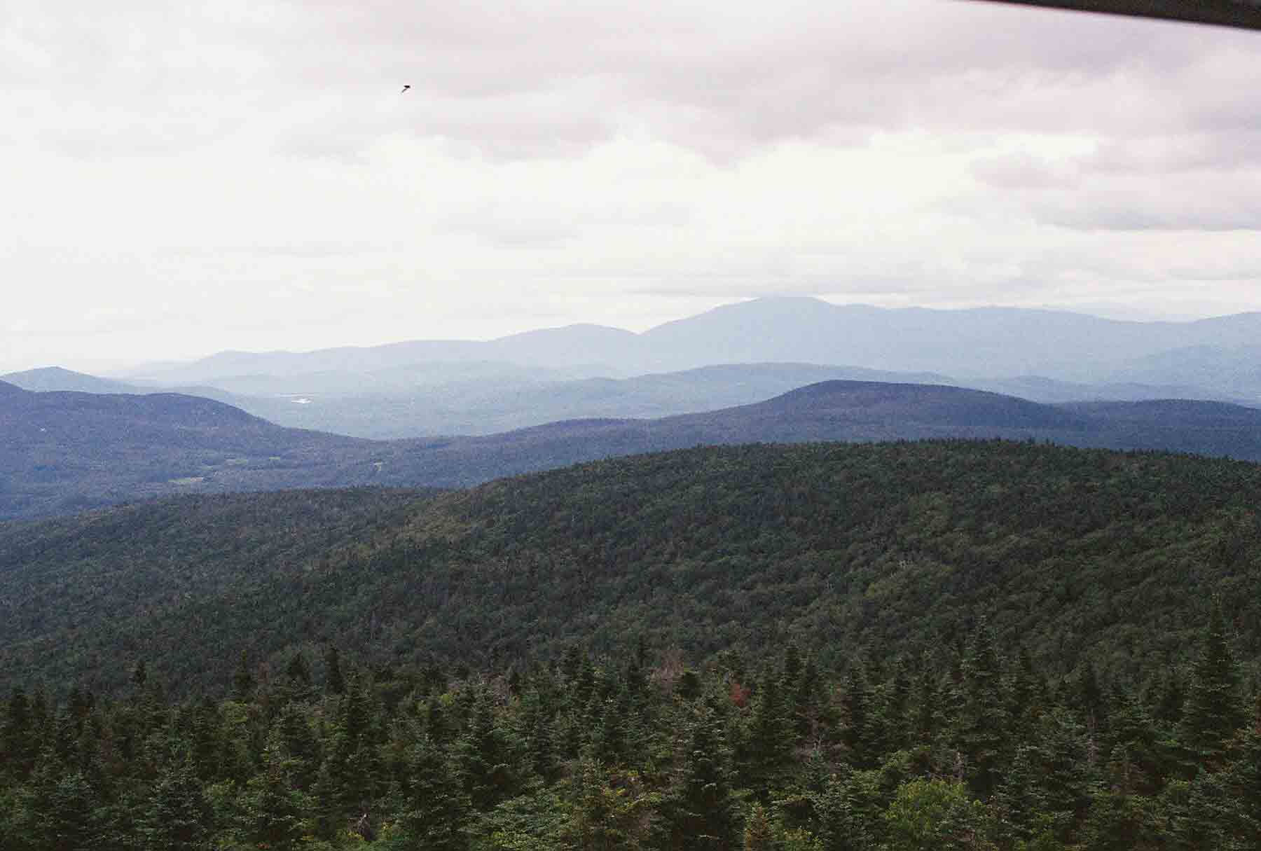
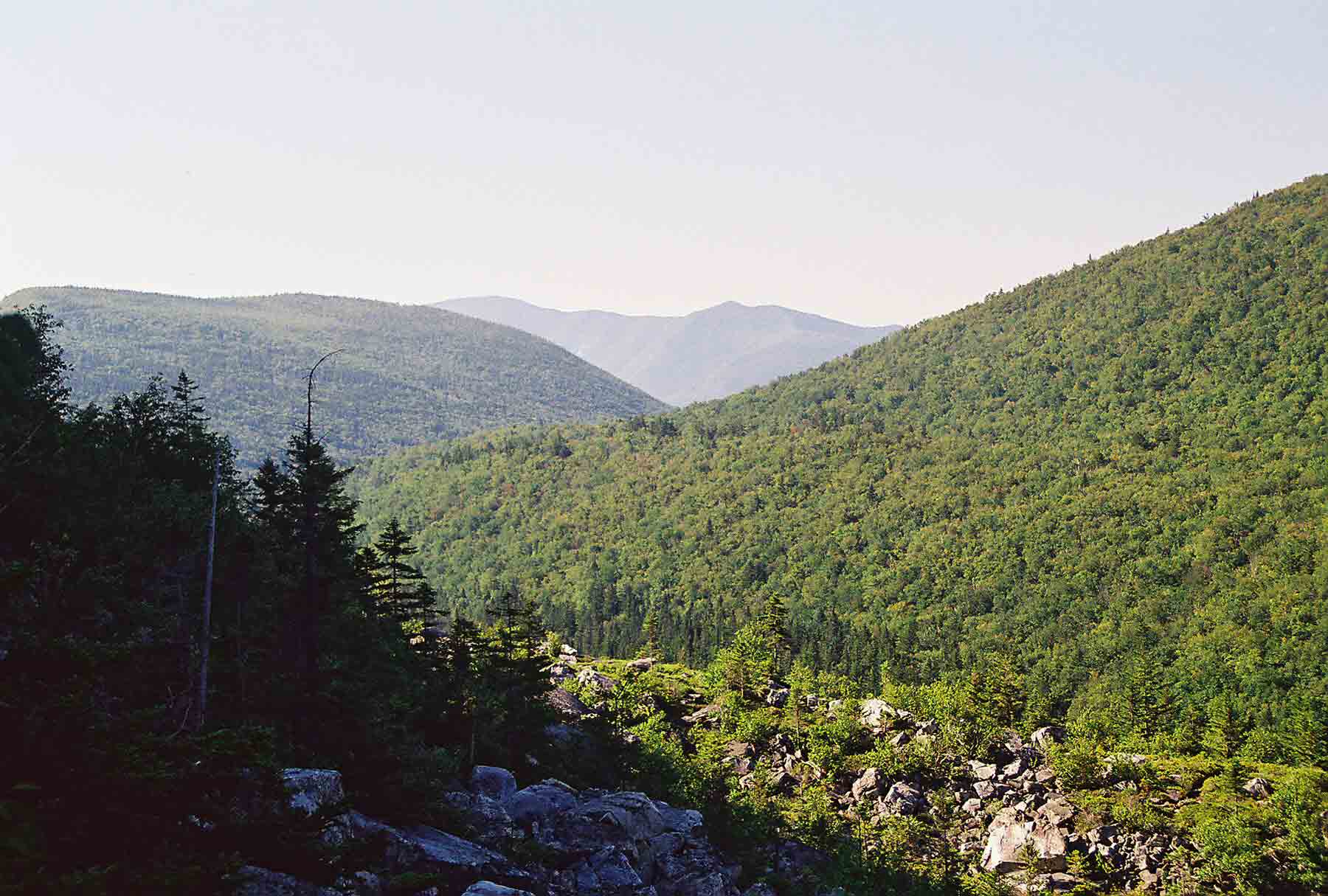
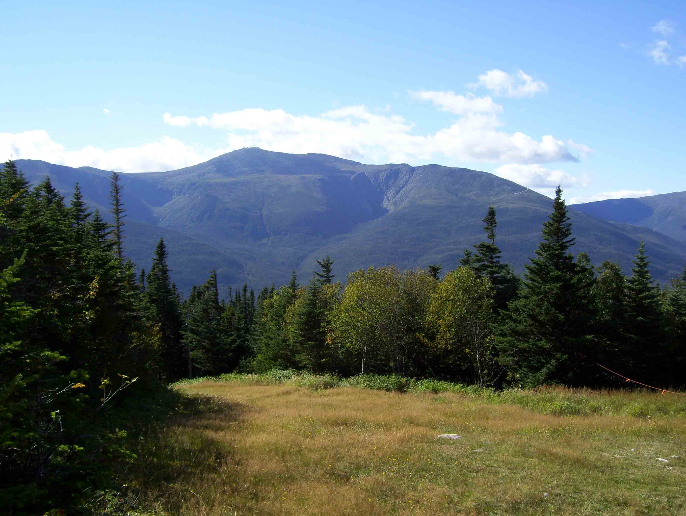
 I
got an early start on Independence Day, knowing that I had to cover a long
distance. In the morning I stopped at
the Governor Clement Shelter. This
shelter, made of rock, is in poor condition because it is easily accessible via
a primitive gravel road, and weekend parties frequently mar the site. The local hiking clubs recommend not staying
there because of the unsanctioned activity.
A nearby landowner has created a private shelter on their land for
through-hikers. In the morning I also
crossed a stream where someone had left cold sodas for hikers. I enjoyed a drink and left a thank you in the
notebook that was provided. Next was the
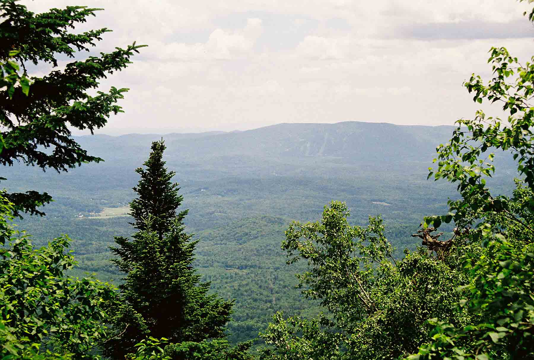
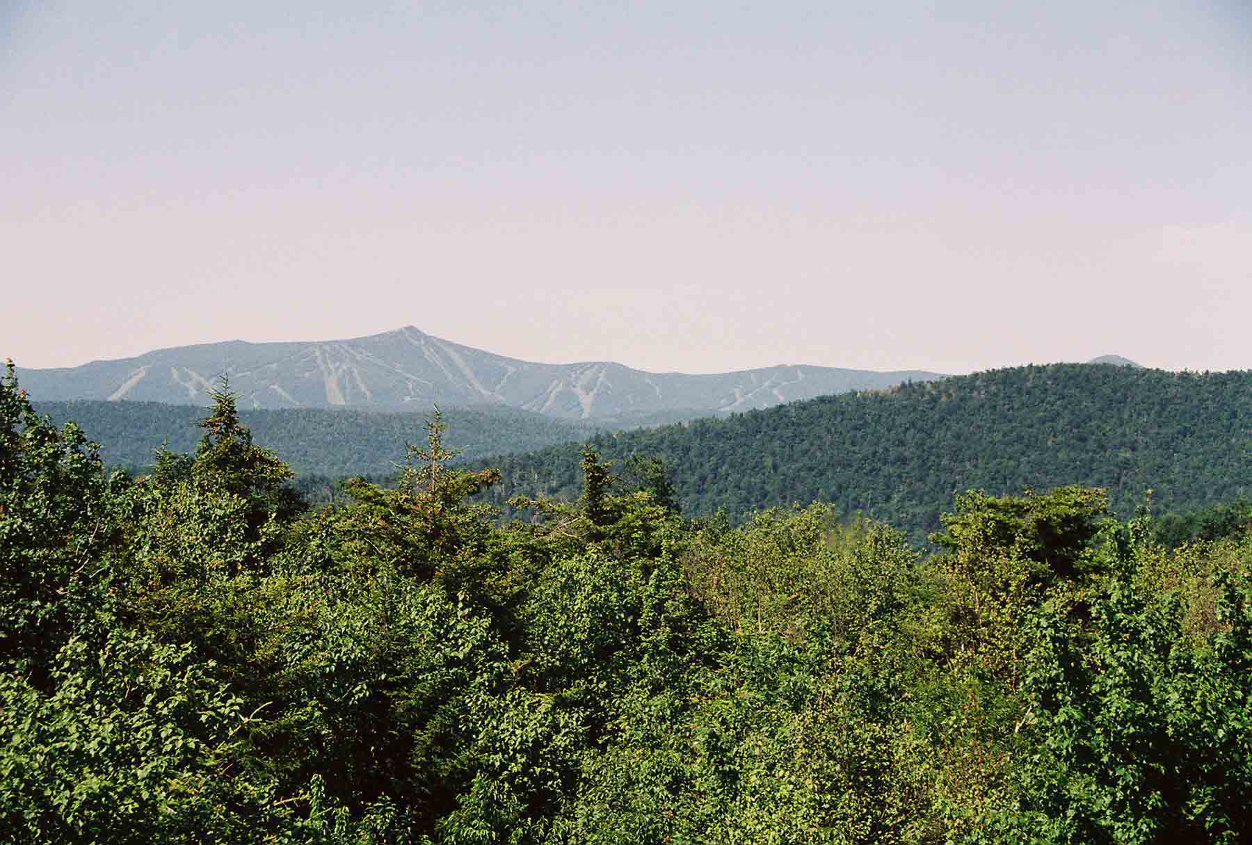
ascent of Killington, the highest
point on the trail in Vermont. The trail does not go over the peak, but
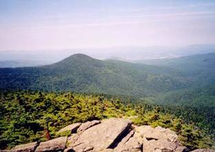
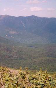
crests at an old 4-sided shelter called Cooper Lodge. From there, I scrambled up a rocky side trail
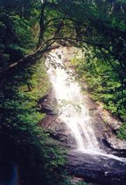
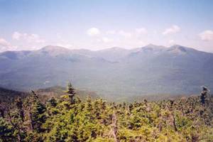
to the top, where there was an excellent view to the west and north (pictured
here). I also wandered over to the
summit building and was surprised to see the ski lift running. Tourists were riding up to catch the view,
and mountain bikers were bringing their bikes and then riding down. I found a phone and used it to call Tatiana,
who happened to be on the beach with her family in Chincoteague. We had a brief conversation because I had a
long way to go. The trail down from the
top was fairly easy, passing a new shelter with an interesting design that was
considered handicap accessible. The
trail from the nearest road was relatively easy for AT standards, but still
would have been a challenge to the disabled.
The trail soon crossed US Route 4, where a short walk would have lead me
to the Inn at the Long Trail. In other circumstances this would have been a
fun place to stay, but it did not work well in my itinerary so I moved on. I soon came to Maine
Junction, where the Long
Trail continues straight north towards Canada. I followed the AT, which veered east toward New Hampshire. I was now leaving the primary ridge of the
Green Mountains, and would be climbing relatively obscure mountains until
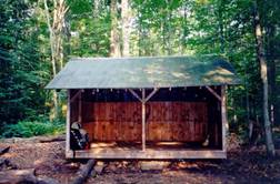
passing beyond Hanover. A few miles later I reached Gifford Woods State Park,
where the trail passed right through a developed
campground. The weather had warmed
quite a bit, and I was feeling hot and tired – and was grateful for a chance to
wash my face and get more water. After
leaving the campground the trail passed through a delightful stretch of woods
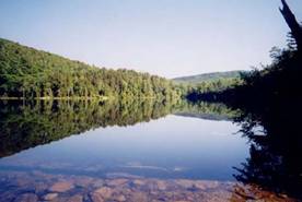
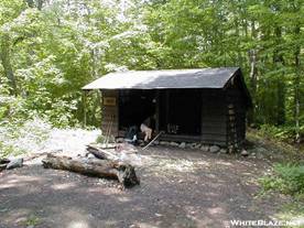
along the edge of Kent Pond. A mile or so later it crossed a secondary
road and then began what seemed like an endless series of ups and downs (it
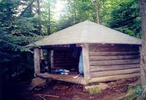
often feels this way toward the end of a long day) before finally reaching the Stony
Brook Shelter (pictured here, below).
It was around 7:00pm when I arrived, having hiked a personal record of
26.4 miles, not including the steep hike up and back to Killington Peak. There were two other hikers there, both on
heading northbound multiple day or week trips but both relatively
inexperienced. I did not see either of
them again.
I
got an early start on Independence Day, knowing that I had to cover a long
distance. In the morning I stopped at
the Governor Clement Shelter. This
shelter, made of rock, is in poor condition because it is easily accessible via
a primitive gravel road, and weekend parties frequently mar the site. The local hiking clubs recommend not staying
there because of the unsanctioned activity.
A nearby landowner has created a private shelter on their land for
through-hikers. In the morning I also
crossed a stream where someone had left cold sodas for hikers. I enjoyed a drink and left a thank you in the
notebook that was provided. Next was the
ascent of Killington, the highest
point on the trail in Vermont. The trail does not go over the peak, but
crests at an old 4-sided shelter called Cooper Lodge. From there, I scrambled up a rocky side trail
to the top, where there was an excellent view to the west and north (pictured
here). I also wandered over to the
summit building and was surprised to see the ski lift running. Tourists were riding up to catch the view,
and mountain bikers were bringing their bikes and then riding down. I found a phone and used it to call Tatiana,
who happened to be on the beach with her family in Chincoteague. We had a brief conversation because I had a
long way to go. The trail down from the
top was fairly easy, passing a new shelter with an interesting design that was
considered handicap accessible. The
trail from the nearest road was relatively easy for AT standards, but still
would have been a challenge to the disabled.
The trail soon crossed US Route 4, where a short walk would have lead me
to the Inn at the Long Trail. In other circumstances this would have been a
fun place to stay, but it did not work well in my itinerary so I moved on. I soon came to Maine
Junction, where the Long
Trail continues straight north towards Canada. I followed the AT, which veered east toward New Hampshire. I was now leaving the primary ridge of the
Green Mountains, and would be climbing relatively obscure mountains until
passing beyond Hanover. A few miles later I reached Gifford Woods State Park,
where the trail passed right through a developed
campground. The weather had warmed
quite a bit, and I was feeling hot and tired – and was grateful for a chance to
wash my face and get more water. After
leaving the campground the trail passed through a delightful stretch of woods
along the edge of Kent Pond. A mile or so later it crossed a secondary
road and then began what seemed like an endless series of ups and downs (it
often feels this way toward the end of a long day) before finally reaching the Stony
Brook Shelter (pictured here, below).
It was around 7:00pm when I arrived, having hiked a personal record of
26.4 miles, not including the steep hike up and back to Killington Peak. There were two other hikers there, both on
heading northbound multiple day or week trips but both relatively
inexperienced. I did not see either of
them again.
Tues 7/5 Stony Brook à Thistle Hill Shelter 21.5
Elevation
profile
Today’s section of trail was one of the
least-memorable. This stretch of trail
in Vermont
passes through second-growth forest along minor mountains, with little in the
way of views or scenery. The weather was
also hazy and humid, which probably contributed to the negative memory I have of
this section. The one notable spot was a
short side trail to a private shelter, where a set of stairs provided access to
a flat roof platform with a view. Towards late afternoon a rain shower left
everything wet. I arrived at an empty
shelter and dried off. Nobody else
showed up, so I was able to take advantage of every hook and space in the
shelter to dry out my wet clothes and gear.
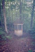
The shelter
featured a privy build to look like a gazebo.
Wed 7/6 Thistle Hill à Moose Mtn 25.6 Elevation
profile
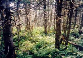
 The
next morning the weather was still humid, and vegetation along the trail was
soaking wet. In such conditions I have
found it impossible to keep my feet dry, and soon both socks and boots were
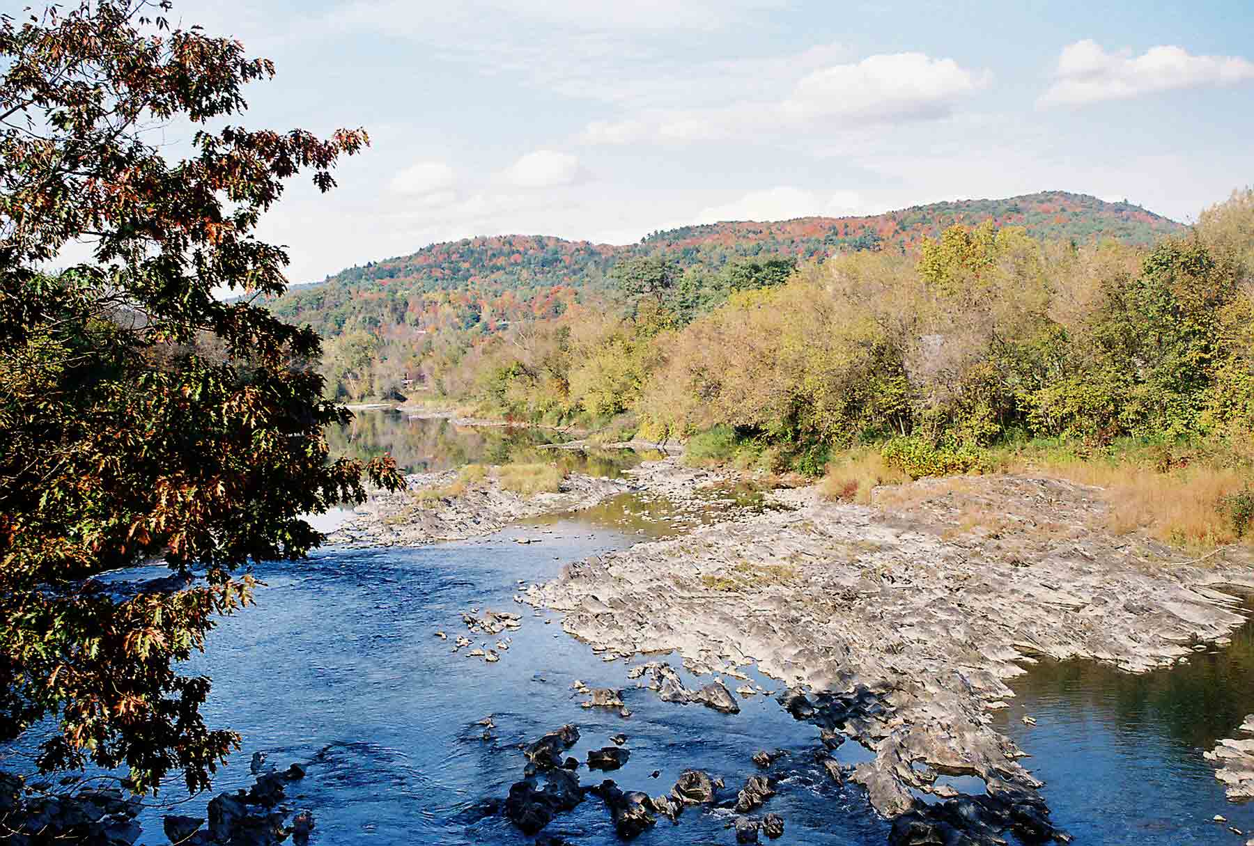
soaking wet. After 5 miles I reached the
White River and the small town of West Hartford. I crossed the river on an old iron bridge,
which construction crews were in the process of replacing with an adjacent
modern structure. There was a small
library with a picnic table next to the trail, and I stopped to dry out a bit
before continuing. The town consisted of
a few houses and a general store, which was not open, in addition to the
library. The trail soon turned down a
side street, crossed under I-89, and climbed into the woods again. Another 6 miles of easy hiking through
wooded, moderately hilly terrain and I found myself in Norwich, VT. The trail followed a main street through this
quintessential New England town, then cross under I-91 and over the Connecticut
River into Hanover, New Hampshire. Hanover is
home to Dartmouth College, and the main
street was lined with attractive shops and mobbed with shoppers. It was easily the most crowded stretch of
official trail I have ever walked. I ate
a late lunch at a pizza place, then walked the rest of the way through town and
back into the woods. Perhaps it was
because I knew I was in another state, but I immediately noticed evidence
of changes in trail conditions, as exposed roots lay underfoot and large
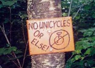
boulders lined the trail. The Dartmouth
Outing Club maintains this section of trail, and has provided some humorous
signs along the way. About halfway up
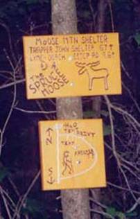
the climb to Moose
Mountain, along a narrow, steep, and rocky section of trail, I came upon a
sign prohibiting the use of unicycles!
Signs pointing to the Moose
Mountain shelter at the
top of the climb included drawings of moose and people. And the next day, there was a sign warning
hikers to beware of tourists at an upcoming viewpoint. At the shelter I was joined by one other
hiker, and middle-aged thru-hiker from Georgia. Thru-hikers generally come in two varieties:
college or pre-graduate school students who are taking an opportunity they know
they won’t have for a long time, or mid-life crises/early retirement types. This guy was in the latter category. He was quite active in the club that
maintains the Georgia
section of the AT, and told me about some of the maintenance work they had done
near Blood Mountain – one of the most heavily-used
sections of the entire trail. It began
raining soon after I reached the shelter, and continued for much of the night –
obscuring what would otherwise have been a nice view. I had not seen many other thru-hikers so far,
and I sign I had seen tacked to a tree outside Norwich today explained why. Some hikers had organized an Independence Day
party in Hanover. Most hikers that heard about it and were
within striking distance hiked extra miles to arrive by the 4th –
and thus the middle part of Vermont
was unusually lacking in thru-hikers around July 4th.
The
next morning the weather was still humid, and vegetation along the trail was
soaking wet. In such conditions I have
found it impossible to keep my feet dry, and soon both socks and boots were
soaking wet. After 5 miles I reached the
White River and the small town of West Hartford. I crossed the river on an old iron bridge,
which construction crews were in the process of replacing with an adjacent
modern structure. There was a small
library with a picnic table next to the trail, and I stopped to dry out a bit
before continuing. The town consisted of
a few houses and a general store, which was not open, in addition to the
library. The trail soon turned down a
side street, crossed under I-89, and climbed into the woods again. Another 6 miles of easy hiking through
wooded, moderately hilly terrain and I found myself in Norwich, VT. The trail followed a main street through this
quintessential New England town, then cross under I-91 and over the Connecticut
River into Hanover, New Hampshire. Hanover is
home to Dartmouth College, and the main
street was lined with attractive shops and mobbed with shoppers. It was easily the most crowded stretch of
official trail I have ever walked. I ate
a late lunch at a pizza place, then walked the rest of the way through town and
back into the woods. Perhaps it was
because I knew I was in another state, but I immediately noticed evidence
of changes in trail conditions, as exposed roots lay underfoot and large
boulders lined the trail. The Dartmouth
Outing Club maintains this section of trail, and has provided some humorous
signs along the way. About halfway up
the climb to Moose
Mountain, along a narrow, steep, and rocky section of trail, I came upon a
sign prohibiting the use of unicycles!
Signs pointing to the Moose
Mountain shelter at the
top of the climb included drawings of moose and people. And the next day, there was a sign warning
hikers to beware of tourists at an upcoming viewpoint. At the shelter I was joined by one other
hiker, and middle-aged thru-hiker from Georgia. Thru-hikers generally come in two varieties:
college or pre-graduate school students who are taking an opportunity they know
they won’t have for a long time, or mid-life crises/early retirement types. This guy was in the latter category. He was quite active in the club that
maintains the Georgia
section of the AT, and told me about some of the maintenance work they had done
near Blood Mountain – one of the most heavily-used
sections of the entire trail. It began
raining soon after I reached the shelter, and continued for much of the night –
obscuring what would otherwise have been a nice view. I had not seen many other thru-hikers so far,
and I sign I had seen tacked to a tree outside Norwich today explained why. Some hikers had organized an Independence Day
party in Hanover. Most hikers that heard about it and were
within striking distance hiked extra miles to arrive by the 4th –
and thus the middle part of Vermont
was unusually lacking in thru-hikers around July 4th.
Thurs 7/7 Moose Mtn à Hexacuba Shelter 17.7 Elevation
profile
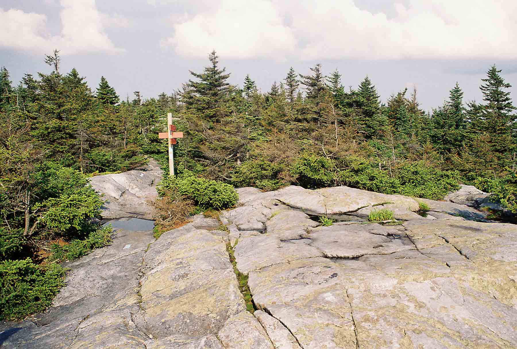
 The
next day I got my first taste of rugged trail.
The morning was spent on a relatively easy section, which opened out to
some views of clearing clouds. After
dropping down to cross a road, the trail began a steep, rocky ascent of Smarts Mountain. Although easier than
much of the trail through the White Mountains, this was easily the most
difficult section of trail a northbound hiker would have seen . . . perhaps
since starting in Georgia. At the top of Smarts Mountain
was a fire
tower with a view, and an old fire
wardens cabin, which now served as a shelter.
It was mid-afternoon when I arrived, and I wanted to make it a bit
further, so I continued northeast, down from Smarts
Mountain and beginning the ascent of Mount Cube. Partway up the climb was the Hexacuba
Shelter, which looks a bit like a southwestern “Hogan” – a traditional
native American dwelling. The floor had
6 sides, 4 of them with walls and 2 open.
A roof covered all of the floor space.
The accompanying privy is termed “penta-privy”, because it has 5
sides. Much of the shelter space was
already taken up by a group of girls from a nearby camp, but they made room for
me. I was a bit apprehensive about
staying, but it was not a problem. A bit
later a southbound thru-hiker showed up.
He was wearing sandals, and I discovered that he had used that same
footwear for his entire journey thus far.
He had climbed Katahdin while there was still some snow on the trail in
early June, and caught some flack from a ranger for it, since the trail was
officially closed.
The
next day I got my first taste of rugged trail.
The morning was spent on a relatively easy section, which opened out to
some views of clearing clouds. After
dropping down to cross a road, the trail began a steep, rocky ascent of Smarts Mountain. Although easier than
much of the trail through the White Mountains, this was easily the most
difficult section of trail a northbound hiker would have seen . . . perhaps
since starting in Georgia. At the top of Smarts Mountain
was a fire
tower with a view, and an old fire
wardens cabin, which now served as a shelter.
It was mid-afternoon when I arrived, and I wanted to make it a bit
further, so I continued northeast, down from Smarts
Mountain and beginning the ascent of Mount Cube. Partway up the climb was the Hexacuba
Shelter, which looks a bit like a southwestern “Hogan” – a traditional
native American dwelling. The floor had
6 sides, 4 of them with walls and 2 open.
A roof covered all of the floor space.
The accompanying privy is termed “penta-privy”, because it has 5
sides. Much of the shelter space was
already taken up by a group of girls from a nearby camp, but they made room for
me. I was a bit apprehensive about
staying, but it was not a problem. A bit
later a southbound thru-hiker showed up.
He was wearing sandals, and I discovered that he had used that same
footwear for his entire journey thus far.
He had climbed Katahdin while there was still some snow on the trail in
early June, and caught some flack from a ranger for it, since the trail was
officially closed.
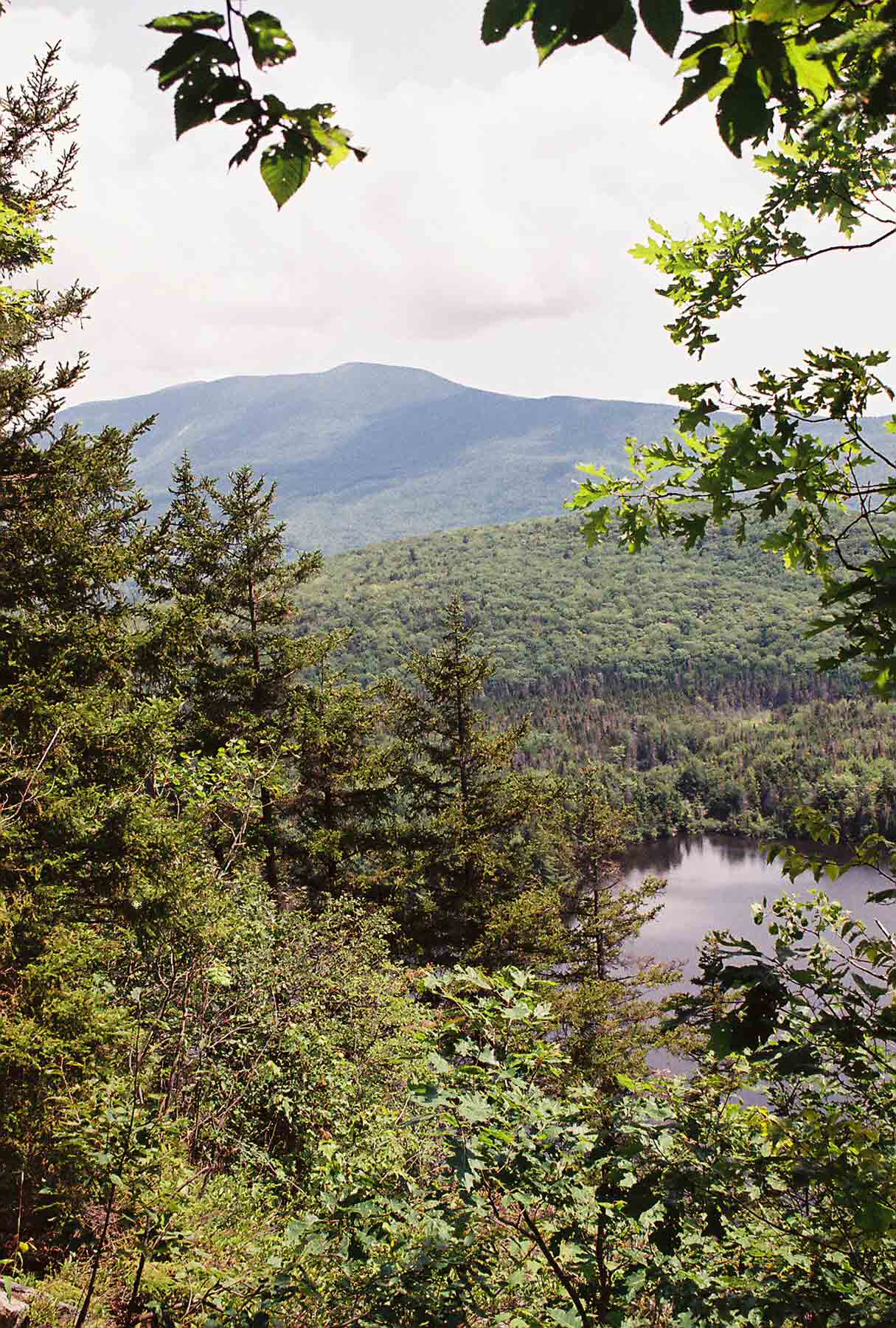
Fri 7/8 Hexacuba à Glencliff, NH (hostel) 15.2
Elevation
profile
 The
girls got up early so that they could catch the sunrise on top of Mount Cube.
I crossed the open, rocky summit
that morning as well, and as I proceeded down the other side clouds moved in
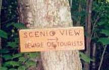
again and it began to rain. Along the
way I passed a short side trail to an overlook, featuring a lake and Mr. Mooislauke. A sign at the intersection warned trail users
to “beware
of tourists”. I was already quite
wet from the rain when I arrived at the tiny town of Glencliff, where I intended to pick up a box
of food I had mailed from home. My plan
had been to re-stock my pack, then climb
Mt. Moosilauke before
ending the day. I knew, however, that
this was an ambitious climb, the first peak above treeline on the entire
trail. With steady rain falling, I
decided it was unwise to attempt the climb and got a bunk in the hostel across
the road from the post office.
Glencliff hardly seems to deserve a post office – it consisted of an
old community building, a couple of houses, and the post office. That’s it.
The Hikers
Welcome hostel was a good place to get out of the rain thought. I was able to take a shower, do laundry, and
check email.
The
girls got up early so that they could catch the sunrise on top of Mount Cube.
I crossed the open, rocky summit
that morning as well, and as I proceeded down the other side clouds moved in
again and it began to rain. Along the
way I passed a short side trail to an overlook, featuring a lake and Mr. Mooislauke. A sign at the intersection warned trail users
to “beware
of tourists”. I was already quite
wet from the rain when I arrived at the tiny town of Glencliff, where I intended to pick up a box
of food I had mailed from home. My plan
had been to re-stock my pack, then climb
Mt. Moosilauke before
ending the day. I knew, however, that
this was an ambitious climb, the first peak above treeline on the entire
trail. With steady rain falling, I
decided it was unwise to attempt the climb and got a bunk in the hostel across
the road from the post office.
Glencliff hardly seems to deserve a post office – it consisted of an
old community building, a couple of houses, and the post office. That’s it.
The Hikers
Welcome hostel was a good place to get out of the rain thought. I was able to take a shower, do laundry, and
check email.
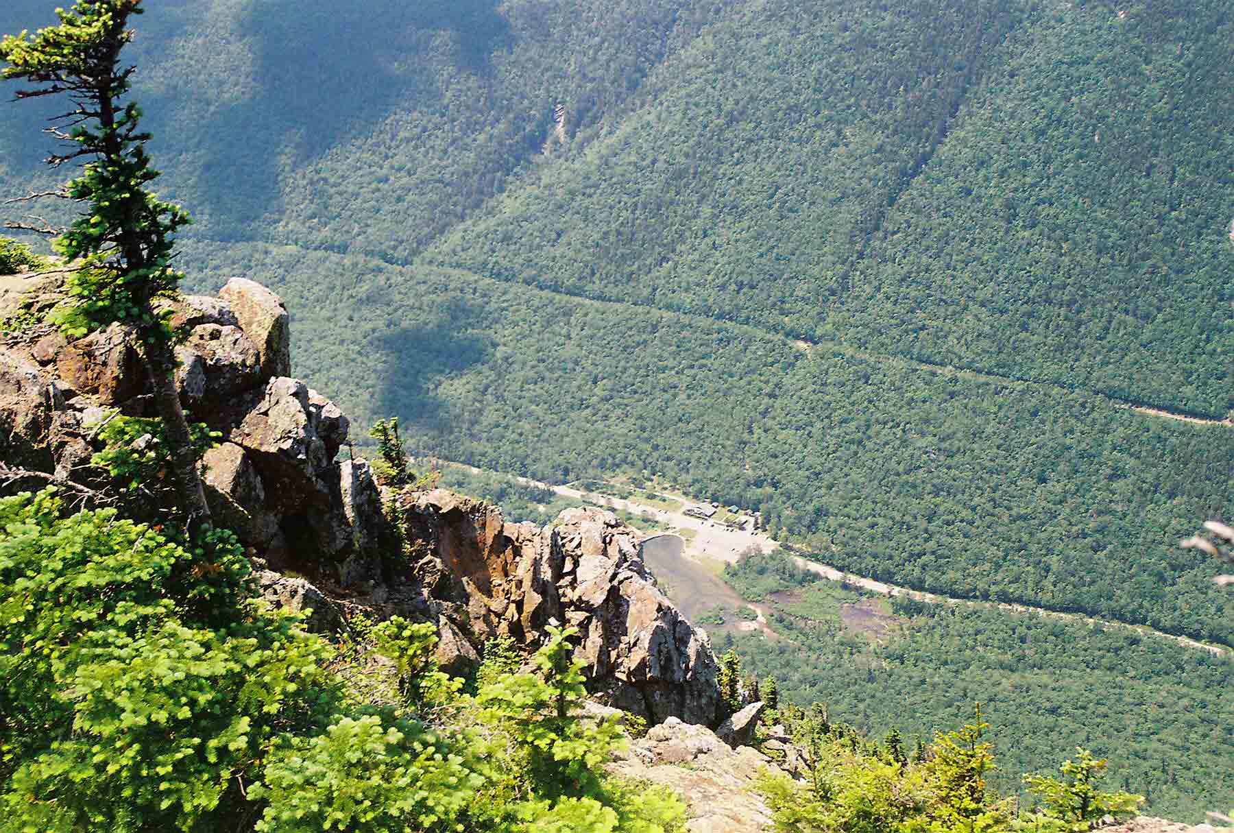
Sat 7/9 Glencliff à Beaver Brook 7.9 Elevation
profile
By morning the steady rain had not let up. I checked the forecast, and it looked like
things might clear up later in the day.
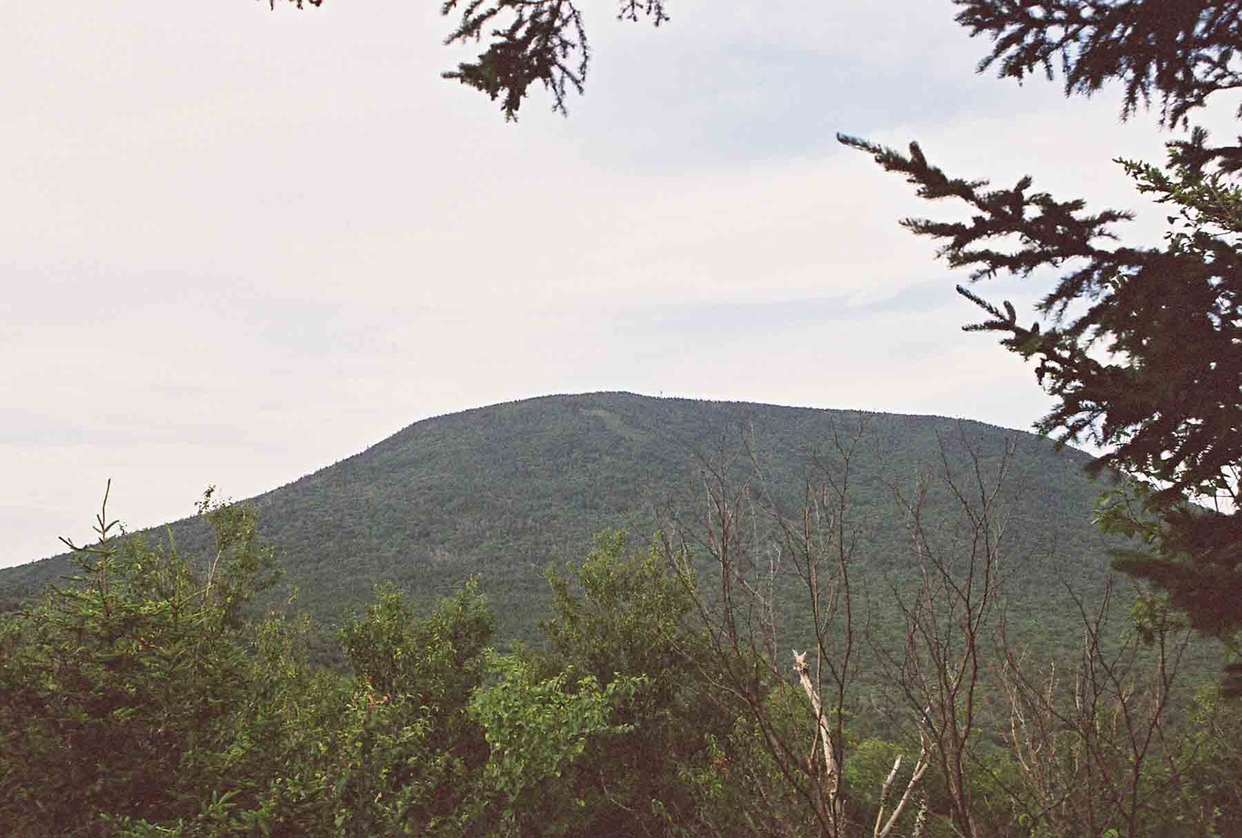
So I decided to hike up Moosilauke and stay at the shelter near the top,
waiting until the following day to attempt the precipitous descent on the other
side. Around late morning the weather
cleared and the sun was out as I headed for the trail. I had to detour around high water at
Oliverian Brook, then began the steep ascent.
As I neared the top, the clouds returned and a fierce wind came up. Across the relatively flat top of the
mountain the trail coursed through a stunted forest of spruce and was lined
with blooming Canada
dogwood. I was reminded of hiking in the
High Peaks region in the
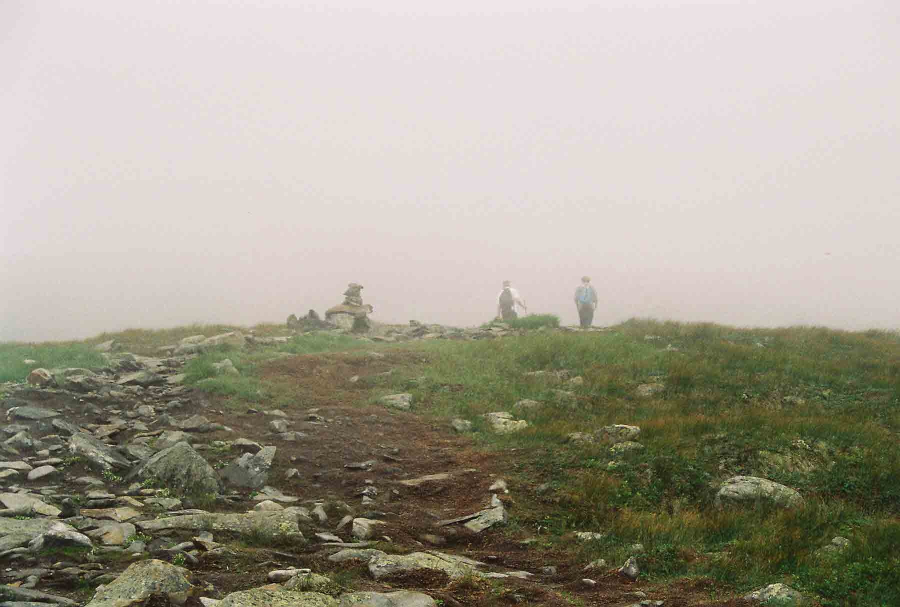
Adirondacks. At the top there were
no trees, and a jumbled pile of rocks provided the only shelter – some of which
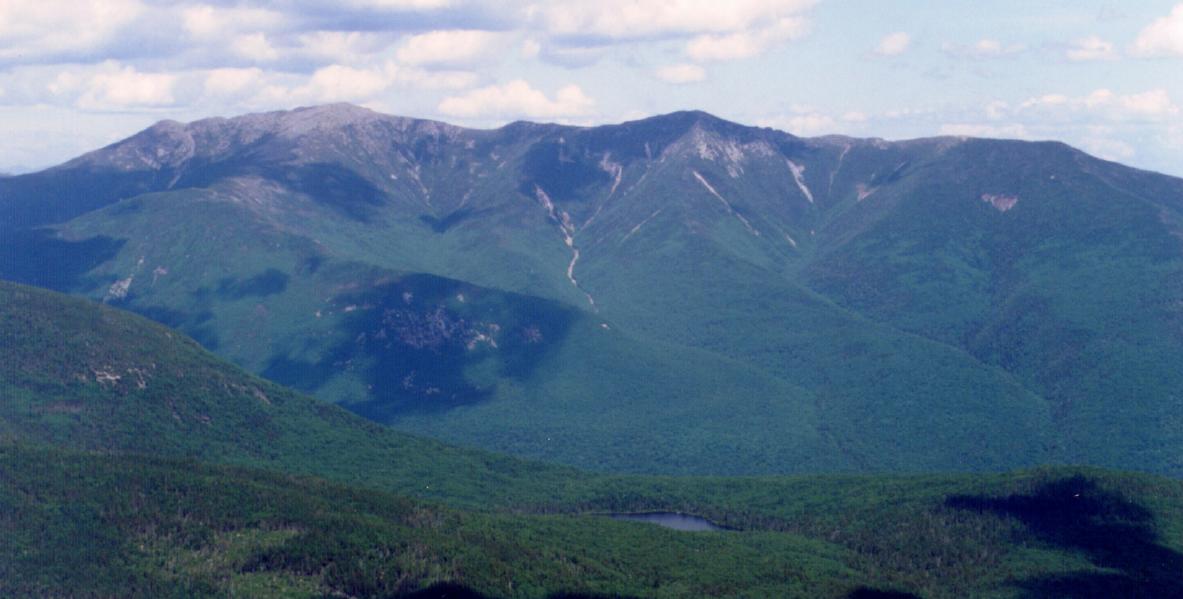
were probably remains of a lodge that once stood at the summit. In better weather there would certainly be
a great view (it looked a bit more like
this). I was startled when I young
guy jumped out from behind a rock, where I noticed he had set up a tarp for
some additional shelter. He was a “peak
steward”, employed by the Dartmouth Outing Club to keep an eye on the fragile
high-elevation ecosystem. Similar
stewards can be encountered in the Adirondacks,
and a normal summer Saturday would probably have found a number of hikers
clustered at the top, admiring the view.
Today there was nobody, and after a few brief words with the steward, I
pressed on to get away from the wind.
Soon I reached the shelter,
and the rain started again, coming down heavy at times. It was still mid-afternoon, so I settled down
and finished reading the book I had brought with me. Two other hikers showed up as darkness
approached. They had been staying at the
hostel, and had waited until late afternoon before starting out. They did not have much to say, and eventually
I went to sleep.
Sun 7/10 Beaver Brook à Kinsman Pond 13.1 Elevation
profile
 The
descent from Beaver Brook Shelter to Kinsman Notch is probably the steepest and most challenging
of the entire trail. The elevation
drops 1835 feet in 1.6 miles, descending next to Beaver
Brook. In places bolts or wooden wedges have been fastened to the rock
as an aid to those navigating the trail.
Many times I approached a particular steep stretch of rock and wondered
how I would manage it. I am not sure how
long it took, but I think that perhaps 2 hours had passed by the time I reached
the bottom. There was a parking area in Kinsman Notch, and a road
they lead toward the privately operated Lost River Reservation, a scenic area
with waterfalls. As I continued north,
the difficulty of the trail relaxed somewhat, but the going was still slow. It seemed that no stretch of trail continued
straight for more than 10 years, and there were continual small climbs and
descents over rocky sections. The mud
and water on the trail slowed things down further. When I finally arrived at Eliza Brook around
mid-afternoon, I was glad for a break.
The route continued as a scenic section along the brook for a mile or so
before turning
rather steep in its ascent towards South Kinsman
Peak. I thought I had been climbing long enough to
reach the top when I emerged at a boggy area, where a small pond was edged with
pitcher plants. I was dismayed to look
up and see Kinsman
Mountain still looming
above me. When I finally reached the top
there was a fantastic view. The weather had cleared and I could see back
towards Moosilauke, as well as north and east to the Cannon Mountain
ski area and Franconia Notch. I also spotted Kinsman Pond far below – it
was there that I intended to spend the night.
The remaining trail provided much challenge; down over a rocky route to
a notch, then up again to North Kinsman before descending steeply to the pond. An Appalachian Mountain Club caretaker
managed the campsite, featuring designated sites and a shelter. I was the only hiker at the shelter, although
many of the campsites were occupied. I
talked to the caretaker for a bit and noticed that his canvas tent was situated
as a small room, and was outfitted with a comfortable chair and many
books. Kinsman Pond was a short distance
from the shelter,
and I enjoyed the view from the pond in the evening and the next morning.
The
descent from Beaver Brook Shelter to Kinsman Notch is probably the steepest and most challenging
of the entire trail. The elevation
drops 1835 feet in 1.6 miles, descending next to Beaver
Brook. In places bolts or wooden wedges have been fastened to the rock
as an aid to those navigating the trail.
Many times I approached a particular steep stretch of rock and wondered
how I would manage it. I am not sure how
long it took, but I think that perhaps 2 hours had passed by the time I reached
the bottom. There was a parking area in Kinsman Notch, and a road
they lead toward the privately operated Lost River Reservation, a scenic area
with waterfalls. As I continued north,
the difficulty of the trail relaxed somewhat, but the going was still slow. It seemed that no stretch of trail continued
straight for more than 10 years, and there were continual small climbs and
descents over rocky sections. The mud
and water on the trail slowed things down further. When I finally arrived at Eliza Brook around
mid-afternoon, I was glad for a break.
The route continued as a scenic section along the brook for a mile or so
before turning
rather steep in its ascent towards South Kinsman
Peak. I thought I had been climbing long enough to
reach the top when I emerged at a boggy area, where a small pond was edged with
pitcher plants. I was dismayed to look
up and see Kinsman
Mountain still looming
above me. When I finally reached the top
there was a fantastic view. The weather had cleared and I could see back
towards Moosilauke, as well as north and east to the Cannon Mountain
ski area and Franconia Notch. I also spotted Kinsman Pond far below – it
was there that I intended to spend the night.
The remaining trail provided much challenge; down over a rocky route to
a notch, then up again to North Kinsman before descending steeply to the pond. An Appalachian Mountain Club caretaker
managed the campsite, featuring designated sites and a shelter. I was the only hiker at the shelter, although
many of the campsites were occupied. I
talked to the caretaker for a bit and noticed that his canvas tent was situated
as a small room, and was outfitted with a comfortable chair and many
books. Kinsman Pond was a short distance
from the shelter,
and I enjoyed the view from the pond in the evening and the next morning.
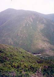
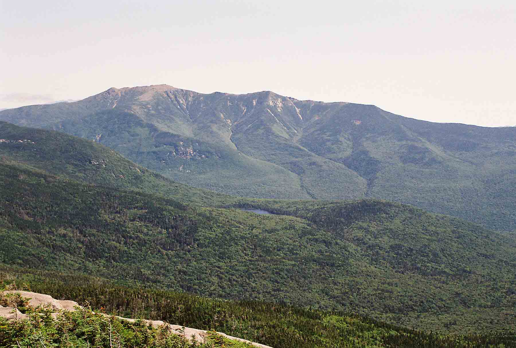
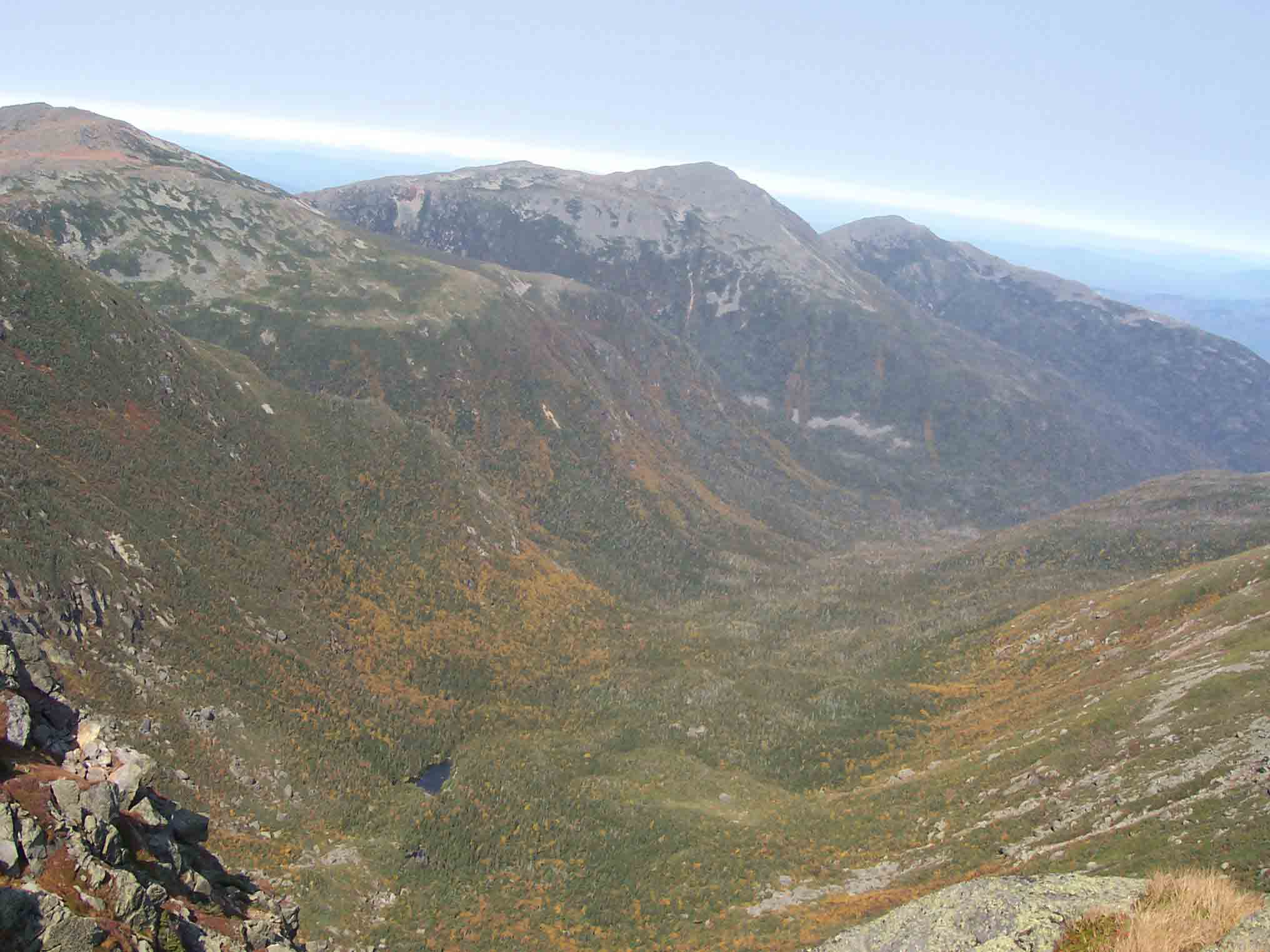
 Monday
morning dawned clear, and promised to be a great day for hiking. The trail descended over a moderately rocky
section and soon reached Lonesome
Lake, where the southernmost of the White Mountain
“huts” is found. These huts are really
high-elevation lodges, provided bunk space and meals. I stopped to get water and check out the architecture
(each of the 8 huts is unique). This
particular hut is one of the easiest to access, and thus is oriented towards
families – and I noticed a number of kids in the 5-year-old range. The hut is also one of three that remains
open in the winter, reachable by those traveling on skis or snowshoes. Beyond Lonesome
Lake, it was an easy hike down to Franconia Notch, where I crossed under
I-93 and briefly brushed with civilization as the AT followed a paved bike path
for a short distance. Franconia Notch is
a narrow gap in the mountains, and has been a tourist mecca since the
1800s. Among its most famous attractions
is the Old Man in the Mountain, a natural rocky cliff that looks like the
profile of a man. The image adorns the New Hampshire quarter,
license plate, road signs, and other documents.
A few years earlier, the rocks had succumbed to the harsh winter and
slid off the cliff – so the face can no longer be seen. I could not have seen it from the trail
anyway, but the site was not far away.
Also nearby was another gorge with waterfalls, a ski area with a lift
operating for site-seeing tourists in the summer, and other attractions. The trail quickly began to ascend a steep
climb toward Franconia Notch. I felt
good, and the climb
did not seem like too much of a challenge.
Near the top, I stopped to get water at a spring near the Liberty Spring
tent site, and then continued to the ridge.
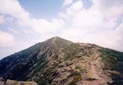
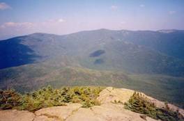
The Franconia Ridge
is a beautiful stretch of trail. Spruce and fir trees, giving off a
pleasant aroma, surrounded the section I first encountered. Blooming Canada dogwood, ferns, and other
plants grew in profusion, and old logs covered with moss and fungus added to
the atmosphere. After a couple of miles,
the trail climbed above tree line and began a steady
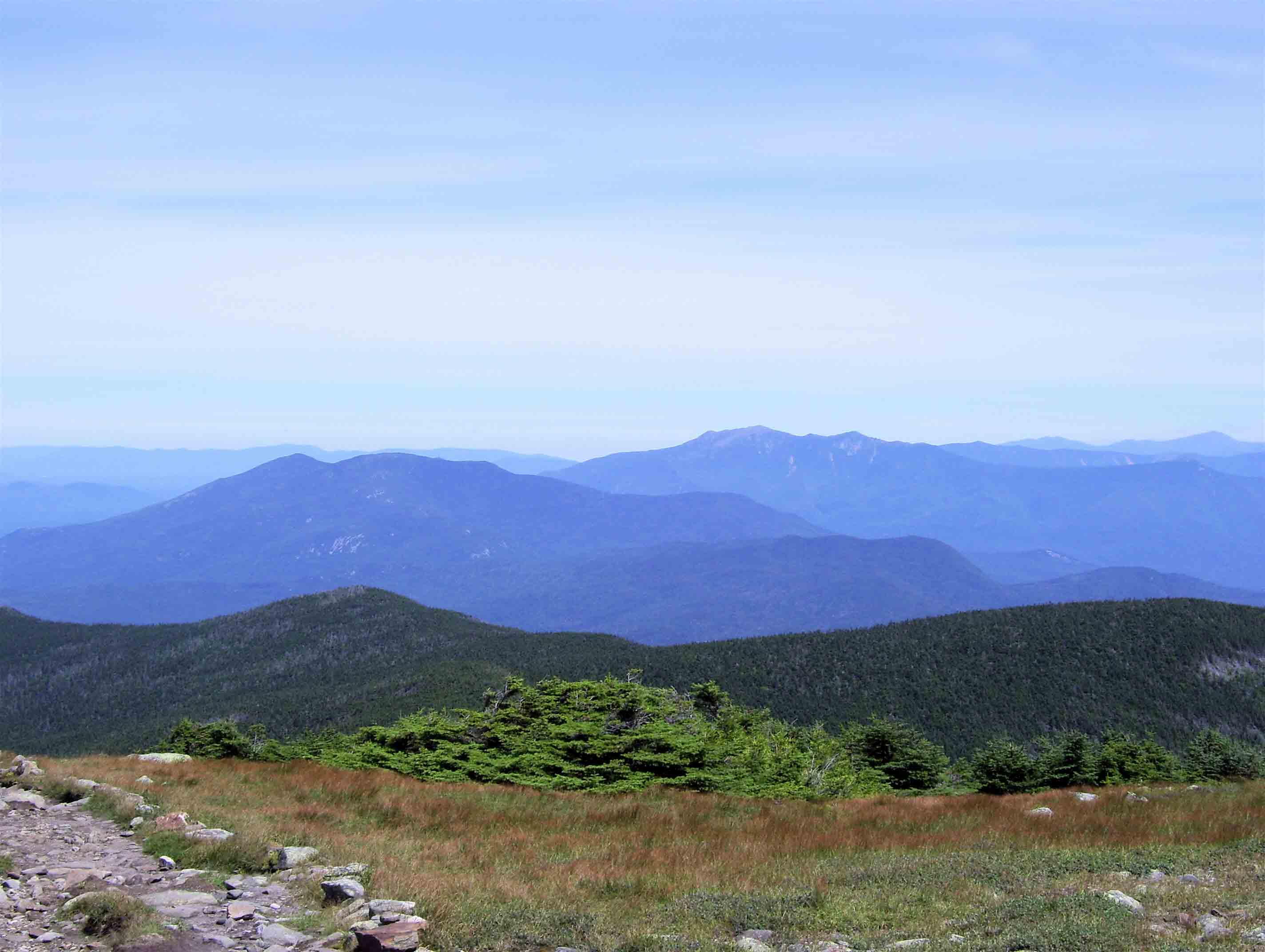
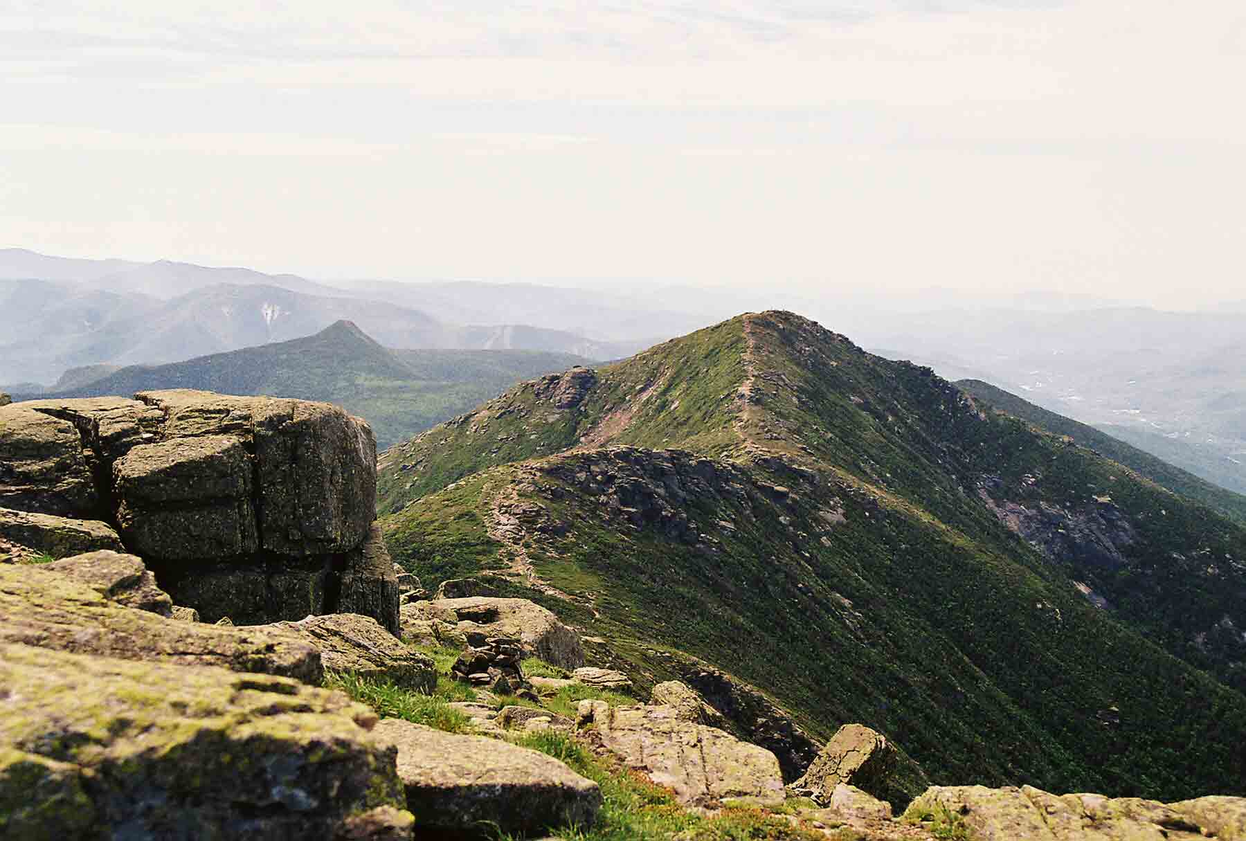
ascent to Mount Lincoln. The open ridgetop is quite impressive (more pics
here) – more so than the Presidentials in some ways. After a short drop, it then reached the even
higher Mount Lafayette (5249’). I could see Franconia
Notch, the entire Franconia Ridge, and the Greenleaf Hut just below the
peak. I escaped the crowds of hikers
gathered at the top and followed the trail off Lafayette and on to the
rocky summit of Mt. Garfield, where I enjoyed
a memorable solitary break, then continued to a campsite and shelter located a
short distance beyond. I had considered
hiking to the Mt.
Guyot campsite, but it
was late afternoon and I was not sure I could make it that far. A caretaker also managed the shelter
at Garfield, and a few other hikers were staying there. The shelter had an unusual design – it was
longer than most, but the front side had sections of wall on either side of the
opening. This made for a rather dark
interior. There was an interesting
viewpoint with a hand-made chair near the shelter, and I spent a good part of
the evening there.
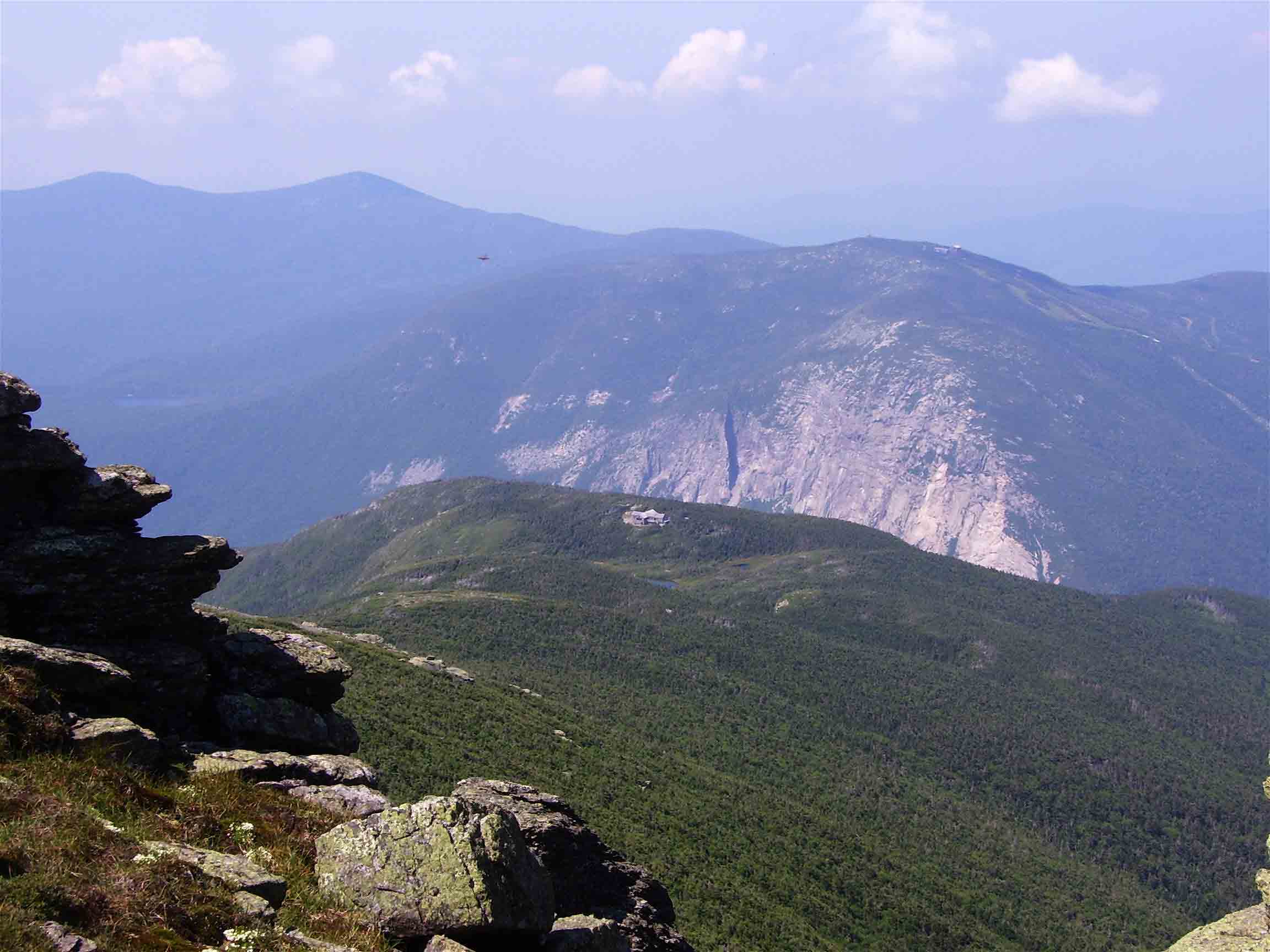
Monday
morning dawned clear, and promised to be a great day for hiking. The trail descended over a moderately rocky
section and soon reached Lonesome
Lake, where the southernmost of the White Mountain
“huts” is found. These huts are really
high-elevation lodges, provided bunk space and meals. I stopped to get water and check out the architecture
(each of the 8 huts is unique). This
particular hut is one of the easiest to access, and thus is oriented towards
families – and I noticed a number of kids in the 5-year-old range. The hut is also one of three that remains
open in the winter, reachable by those traveling on skis or snowshoes. Beyond Lonesome
Lake, it was an easy hike down to Franconia Notch, where I crossed under
I-93 and briefly brushed with civilization as the AT followed a paved bike path
for a short distance. Franconia Notch is
a narrow gap in the mountains, and has been a tourist mecca since the
1800s. Among its most famous attractions
is the Old Man in the Mountain, a natural rocky cliff that looks like the
profile of a man. The image adorns the New Hampshire quarter,
license plate, road signs, and other documents.
A few years earlier, the rocks had succumbed to the harsh winter and
slid off the cliff – so the face can no longer be seen. I could not have seen it from the trail
anyway, but the site was not far away.
Also nearby was another gorge with waterfalls, a ski area with a lift
operating for site-seeing tourists in the summer, and other attractions. The trail quickly began to ascend a steep
climb toward Franconia Notch. I felt
good, and the climb
did not seem like too much of a challenge.
Near the top, I stopped to get water at a spring near the Liberty Spring
tent site, and then continued to the ridge.
The Franconia Ridge
is a beautiful stretch of trail. Spruce and fir trees, giving off a
pleasant aroma, surrounded the section I first encountered. Blooming Canada dogwood, ferns, and other
plants grew in profusion, and old logs covered with moss and fungus added to
the atmosphere. After a couple of miles,
the trail climbed above tree line and began a steady
ascent to Mount Lincoln. The open ridgetop is quite impressive (more pics
here) – more so than the Presidentials in some ways. After a short drop, it then reached the even
higher Mount Lafayette (5249’). I could see Franconia
Notch, the entire Franconia Ridge, and the Greenleaf Hut just below the
peak. I escaped the crowds of hikers
gathered at the top and followed the trail off Lafayette and on to the
rocky summit of Mt. Garfield, where I enjoyed
a memorable solitary break, then continued to a campsite and shelter located a
short distance beyond. I had considered
hiking to the Mt.
Guyot campsite, but it
was late afternoon and I was not sure I could make it that far. A caretaker also managed the shelter
at Garfield, and a few other hikers were staying there. The shelter had an unusual design – it was
longer than most, but the front side had sections of wall on either side of the
opening. This made for a rather dark
interior. There was an interesting
viewpoint with a hand-made chair near the shelter, and I spent a good part of
the evening there.
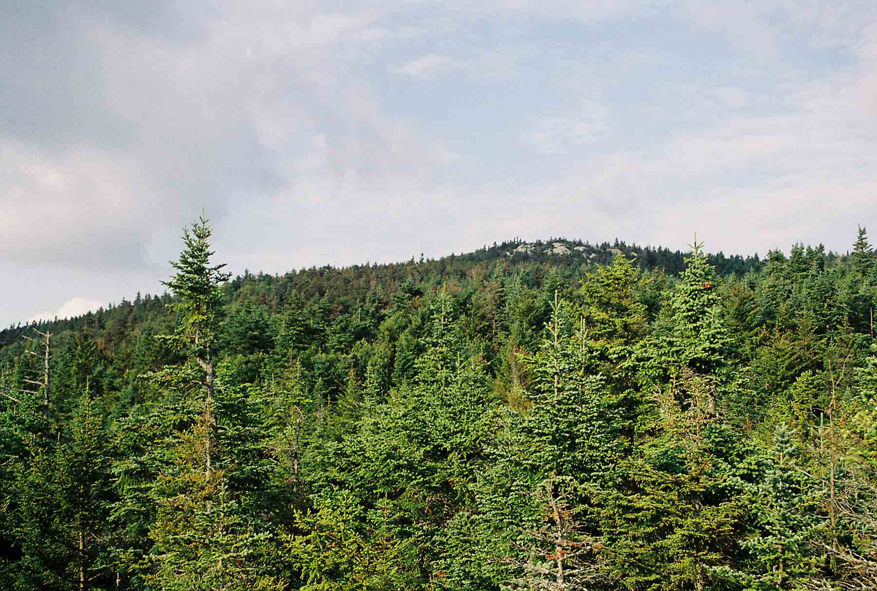
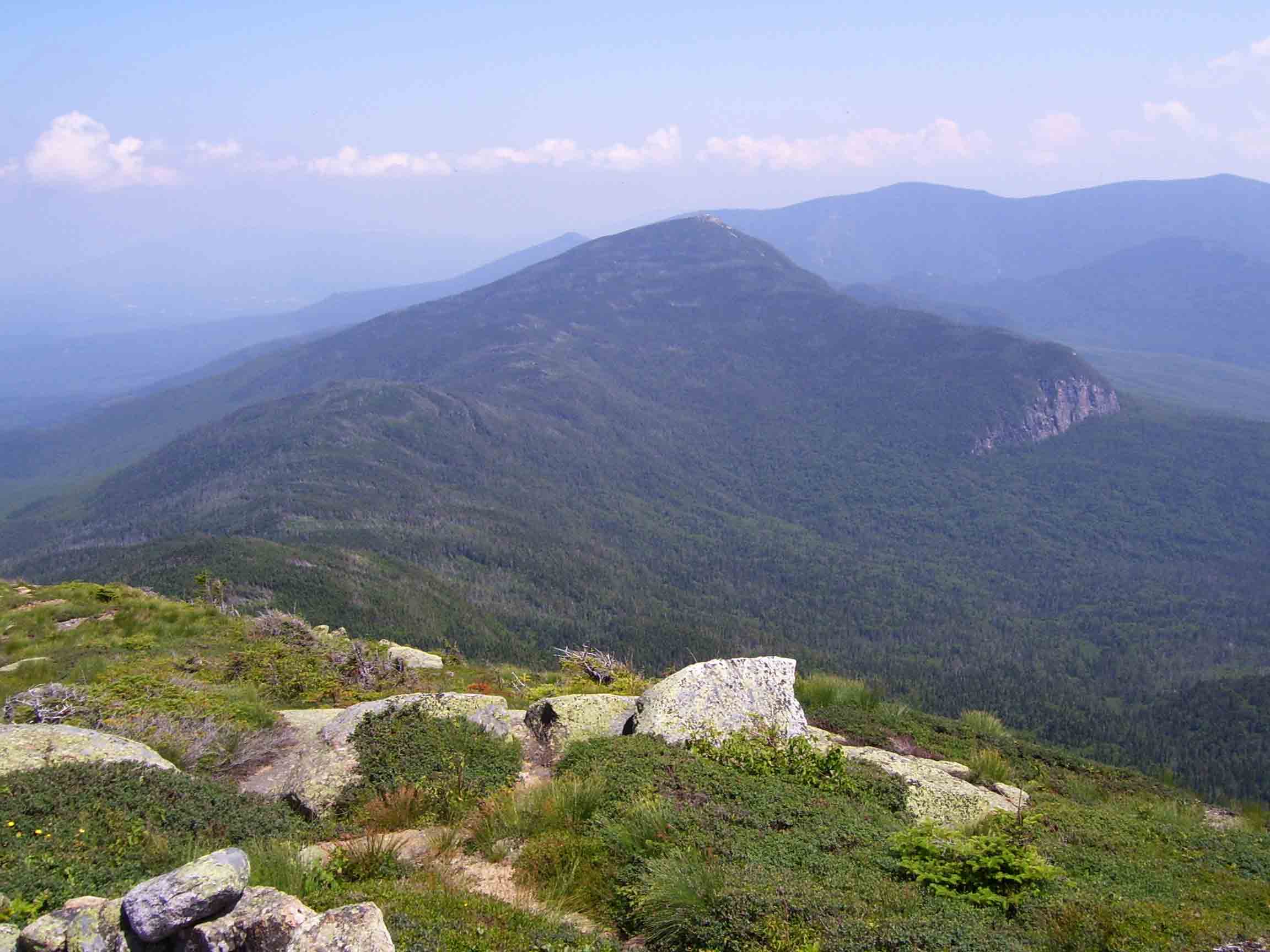
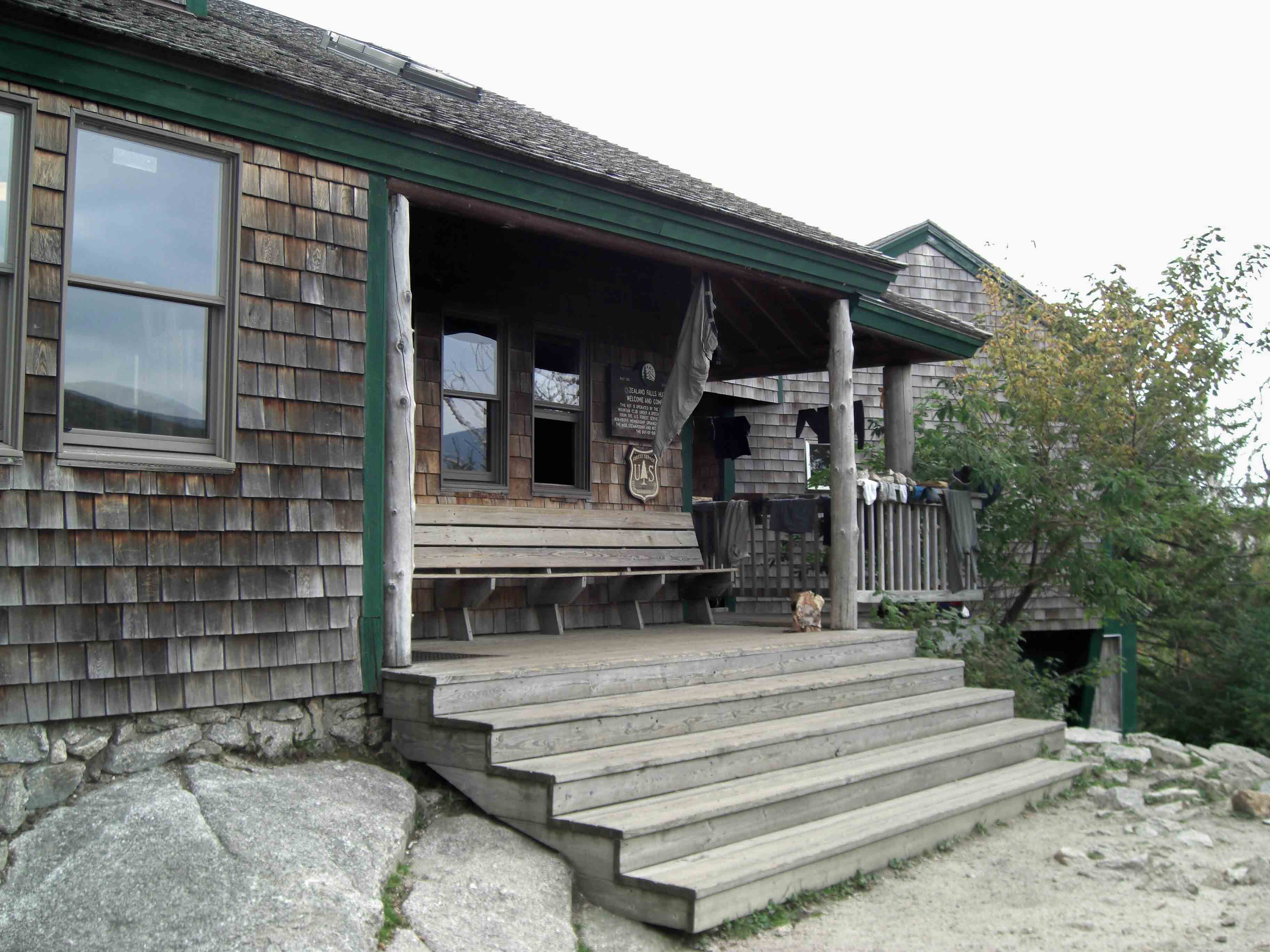
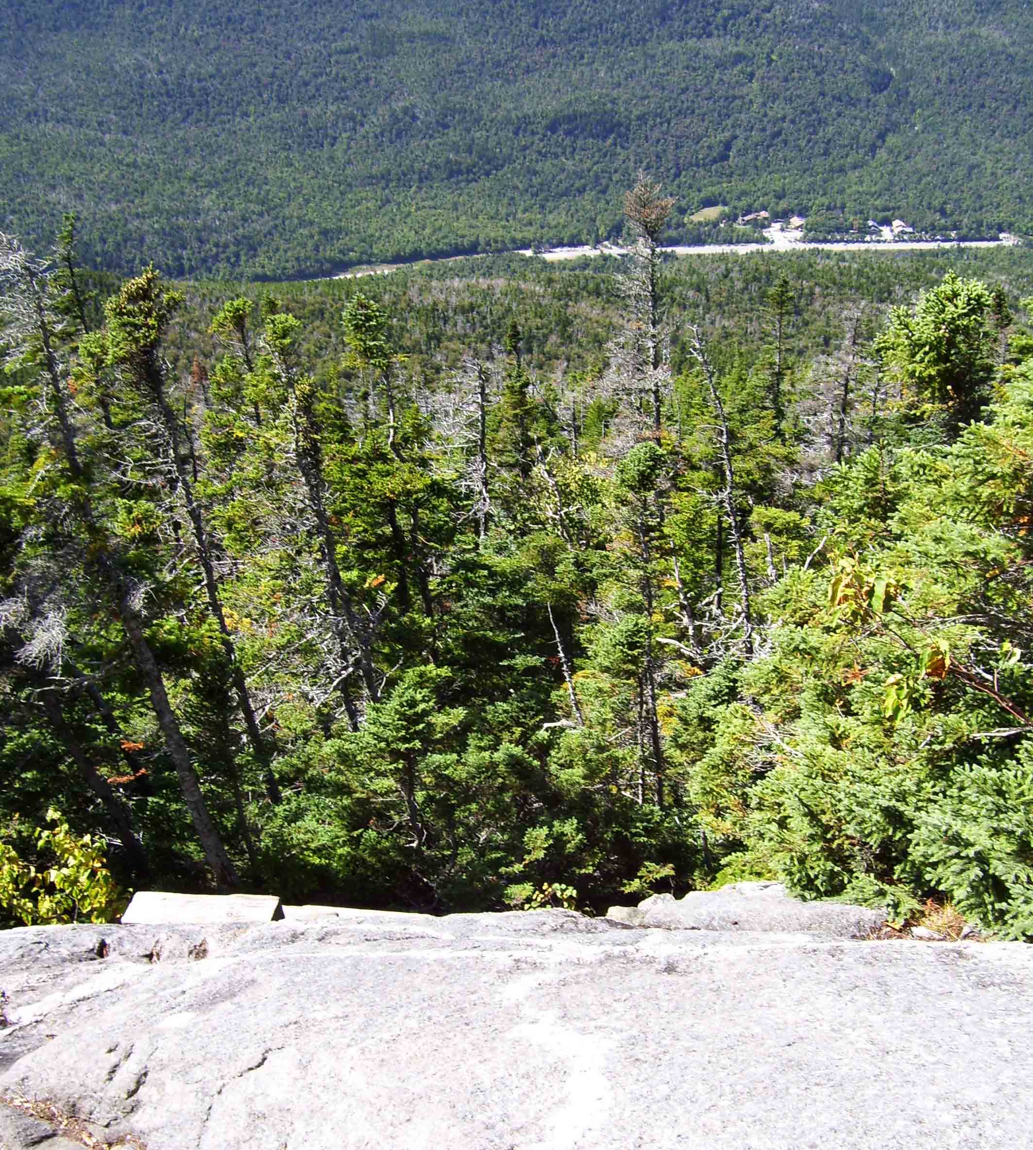
Tues 7/12 Garfield
à Nauman tentsite 23.8 Elevation
profile
 Hiking
in the White Mountains is a challenge for a
number or reasons. In addition to the rocky
and steep terrain, one must plan carefully for suitable places to
camp. Unlike in the southern Appalachians, one does not come upon natural campsites on
a regular basis. The region is also
popular, leading to highly-regulated camping.
The challenge is particularly high when crossing the Presidential Range,
where the trail is above tree line for 13 miles. Many thru-hikers stay at the AMC huts, often
exchanging an hour or two of work for a free night. I wanted to make it through the region
without using the huts, but I also did not want to stray a mile or more off the
trail, with considerable loss of elevation, to reach campsites long the route
of the Presidential range. In order to
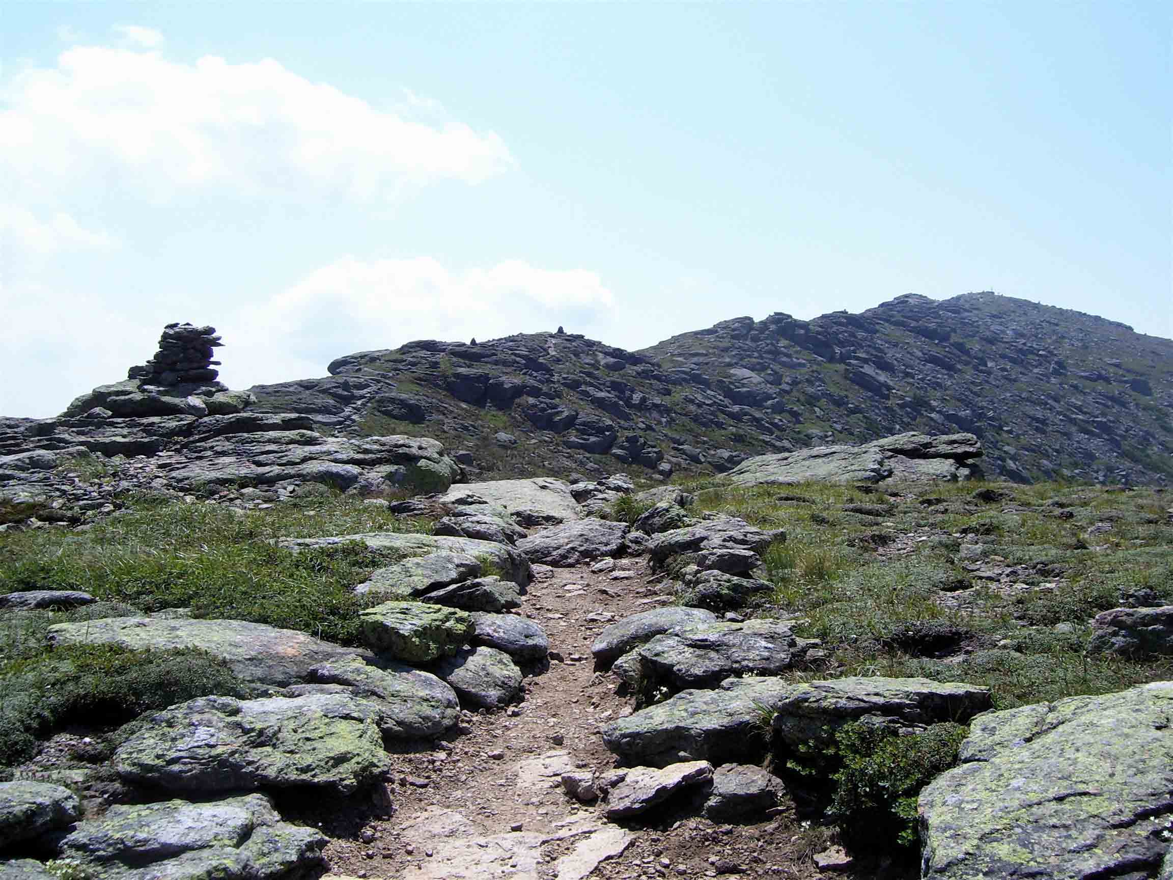
make it all work, I needed to hike almost 24 miles today. So I started off early, crossing a rocky section of trail (the link shows
a typical rocky section in the Whites) to reach the Galehead Hut shortly after
breakfast. After a short break I made
the steep climb to South Twin and then Guyot
Mountain, then continued along a scenic but rugged ridge toward Zealand Falls.
I reached this hut, situated in a
scenic spot
Hiking
in the White Mountains is a challenge for a
number or reasons. In addition to the rocky
and steep terrain, one must plan carefully for suitable places to
camp. Unlike in the southern Appalachians, one does not come upon natural campsites on
a regular basis. The region is also
popular, leading to highly-regulated camping.
The challenge is particularly high when crossing the Presidential Range,
where the trail is above tree line for 13 miles. Many thru-hikers stay at the AMC huts, often
exchanging an hour or two of work for a free night. I wanted to make it through the region
without using the huts, but I also did not want to stray a mile or more off the
trail, with considerable loss of elevation, to reach campsites long the route
of the Presidential range. In order to
make it all work, I needed to hike almost 24 miles today. So I started off early, crossing a rocky section of trail (the link shows
a typical rocky section in the Whites) to reach the Galehead Hut shortly after
breakfast. After a short break I made
the steep climb to South Twin and then Guyot
Mountain, then continued along a scenic but rugged ridge toward Zealand Falls.
I reached this hut, situated in a
scenic spot 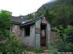 near
a cascading stream, around lunch time.
Caretakers often provide “all you can eat” baked goods or soup for $1.00
and I took advantage of the opportunity to get some extra calories. The long day was made possible by the next
several miles of trail, which followed an
old railroad bed for an unusually easy walk. I reached the Ethan Pond campsite around
3:00, and new I still had time for hiking to Nauman tentsite. After a short break and pressed on, gradually
descending to cross a paved road in Crawford Notch. The steep, rocky climb following the notch
was one of the hardest sections of trail I have done – probably in part because
of my fatigue. Several times the trail
reached a rocky viewpoint that appeared initially to be the top of the climb,
only to plunge back downhill for a short stretch in the woods before climbing
again. At each viewpoint the road and
parking lot in Crawford Notch
appeared smaller and less significant . When I finally reach the top of Mt. Webster,
and I was ready to give up for the day.
I could see Mizpah
Springs Hut, which I knew was next to the campsite, in a clearing – and it
appeared impossibly far away. But I
trudged on, arrived at the campsite around 7:00pm. I hopefully asked the caretaker about
remaining sites, and he cheerfully informed me that there was one left. I gladly paid for the site (using a credit
card that would be charged the next time the caretaker hiked off the mountain)
and set up my tent on a wooden platform.
Platforms are used in northern New England
to reduce erosion and impact on the soil, and because flat spots are rather
difficult to find. I took advantage of
the nearby Hut to get water, and enjoyed relaxing at my site while I ate
dinner. I was about a day behind my
original schedule, having been delayed by the rain at Moosilauke. This presented a problem, because simply slowing
down my overall pace by a day would leave me in the middle of the Mahoosuc
range on the day I was planning to be picked up. The Mahoosucs are one of the most remote
sections of the trail, with over 30 very rugged miles between road
crossings. So I decided to push my way
across the Presidential Range the next day, and then slow down the last two
days and finish the hike at the Androscoggin
River near Gorham.
near
a cascading stream, around lunch time.
Caretakers often provide “all you can eat” baked goods or soup for $1.00
and I took advantage of the opportunity to get some extra calories. The long day was made possible by the next
several miles of trail, which followed an
old railroad bed for an unusually easy walk. I reached the Ethan Pond campsite around
3:00, and new I still had time for hiking to Nauman tentsite. After a short break and pressed on, gradually
descending to cross a paved road in Crawford Notch. The steep, rocky climb following the notch
was one of the hardest sections of trail I have done – probably in part because
of my fatigue. Several times the trail
reached a rocky viewpoint that appeared initially to be the top of the climb,
only to plunge back downhill for a short stretch in the woods before climbing
again. At each viewpoint the road and
parking lot in Crawford Notch
appeared smaller and less significant . When I finally reach the top of Mt. Webster,
and I was ready to give up for the day.
I could see Mizpah
Springs Hut, which I knew was next to the campsite, in a clearing – and it
appeared impossibly far away. But I
trudged on, arrived at the campsite around 7:00pm. I hopefully asked the caretaker about
remaining sites, and he cheerfully informed me that there was one left. I gladly paid for the site (using a credit
card that would be charged the next time the caretaker hiked off the mountain)
and set up my tent on a wooden platform.
Platforms are used in northern New England
to reduce erosion and impact on the soil, and because flat spots are rather
difficult to find. I took advantage of
the nearby Hut to get water, and enjoyed relaxing at my site while I ate
dinner. I was about a day behind my
original schedule, having been delayed by the rain at Moosilauke. This presented a problem, because simply slowing
down my overall pace by a day would leave me in the middle of the Mahoosuc
range on the day I was planning to be picked up. The Mahoosucs are one of the most remote
sections of the trail, with over 30 very rugged miles between road
crossings. So I decided to push my way
across the Presidential Range the next day, and then slow down the last two
days and finish the hike at the Androscoggin
River near Gorham.
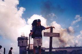
Wed 7/13 Nauman à Osgood tentsite 14.8 Elevation
profile
 Favorable
weather continued the next morning, and I felt remarkably fresh after my long
day. This was good, because I had
another tough one coming up. I crossed Mt. Clinton
and Franklin, and skirted Eisenhower and Monroe, en route to a
morning break at Lakes of the Clouds. I
had hiked some of this stretch before, and was familiar with the terrain – vast
acres of rocky land with no tree cover and outstanding views. I took a break at Lakes of the Clouds Hut, the
largest, most popular, and highest of the huts.
Next was the ascent of Mt.
Washington. When I reached the top,
the wind was remarkably calm and the summit was
Favorable
weather continued the next morning, and I felt remarkably fresh after my long
day. This was good, because I had
another tough one coming up. I crossed Mt. Clinton
and Franklin, and skirted Eisenhower and Monroe, en route to a
morning break at Lakes of the Clouds. I
had hiked some of this stretch before, and was familiar with the terrain – vast
acres of rocky land with no tree cover and outstanding views. I took a break at Lakes of the Clouds Hut, the
largest, most popular, and highest of the huts.
Next was the ascent of Mt.
Washington. When I reached the top,
the wind was remarkably calm and the summit was  experiencing
near-record temperatures of almost 70 degrees.
I have hiked Mt.
Washington three times,
and have been blessed to experience clear weather each time! Since the Presidential Range has a reputation
for nasty weather, I was very grateful. I took a break at the summit house,
and made a call to reserve a spot at the Carter Notch Hut for the next
day. Then I pressed on, knowing that I
still had miles of challenging trail above tree line to cover. The trail does not look particularly
difficult once you reach the high elevations, but appearances are deceiving:
the elevation changes considerably along the ridge, and for much of the route
the way lies over large, human-sized rocks that one much navigate by jumping or
taking awkward, strenuous steps. The
trail skirts the summits of Clay, Jefferson, and Adams, all the while providing a
view into the Great Gulf,
a glacially-carved cirque valley. Eventually I reached Madison Hut, as some of the overnight guests were
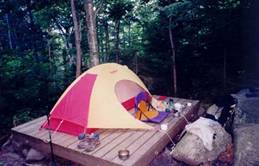
beginning to arrive. I pressed on,
climbing the rocky route to the top of Mt. Madison, where a
tremendous view of the entire range and the Androscoggin
valley to the north awaited. The descent
from Mt. Madison rivaled the one from Moosilauke
in difficulty. This time the difficulty
was more from dropping off of 5+ foot ledges, with much knee-jarring as a
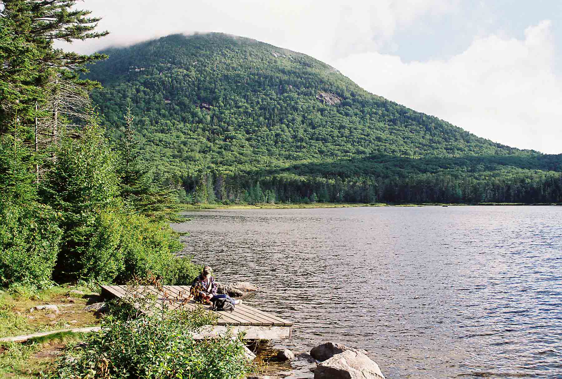
result. I finally reached the bottom and
put up my tent at Osgood tentsite (pictured here at left).
experiencing
near-record temperatures of almost 70 degrees.
I have hiked Mt.
Washington three times,
and have been blessed to experience clear weather each time! Since the Presidential Range has a reputation
for nasty weather, I was very grateful. I took a break at the summit house,
and made a call to reserve a spot at the Carter Notch Hut for the next
day. Then I pressed on, knowing that I
still had miles of challenging trail above tree line to cover. The trail does not look particularly
difficult once you reach the high elevations, but appearances are deceiving:
the elevation changes considerably along the ridge, and for much of the route
the way lies over large, human-sized rocks that one much navigate by jumping or
taking awkward, strenuous steps. The
trail skirts the summits of Clay, Jefferson, and Adams, all the while providing a
view into the Great Gulf,
a glacially-carved cirque valley. Eventually I reached Madison Hut, as some of the overnight guests were
beginning to arrive. I pressed on,
climbing the rocky route to the top of Mt. Madison, where a
tremendous view of the entire range and the Androscoggin
valley to the north awaited. The descent
from Mt. Madison rivaled the one from Moosilauke
in difficulty. This time the difficulty
was more from dropping off of 5+ foot ledges, with much knee-jarring as a
result. I finally reached the bottom and
put up my tent at Osgood tentsite (pictured here at left).
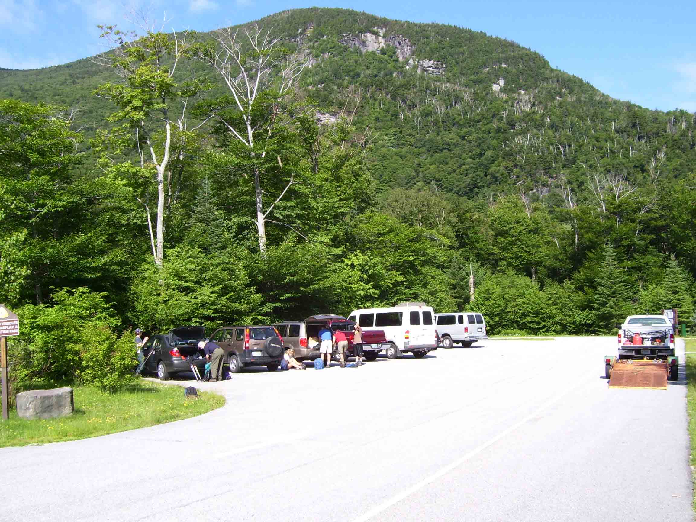
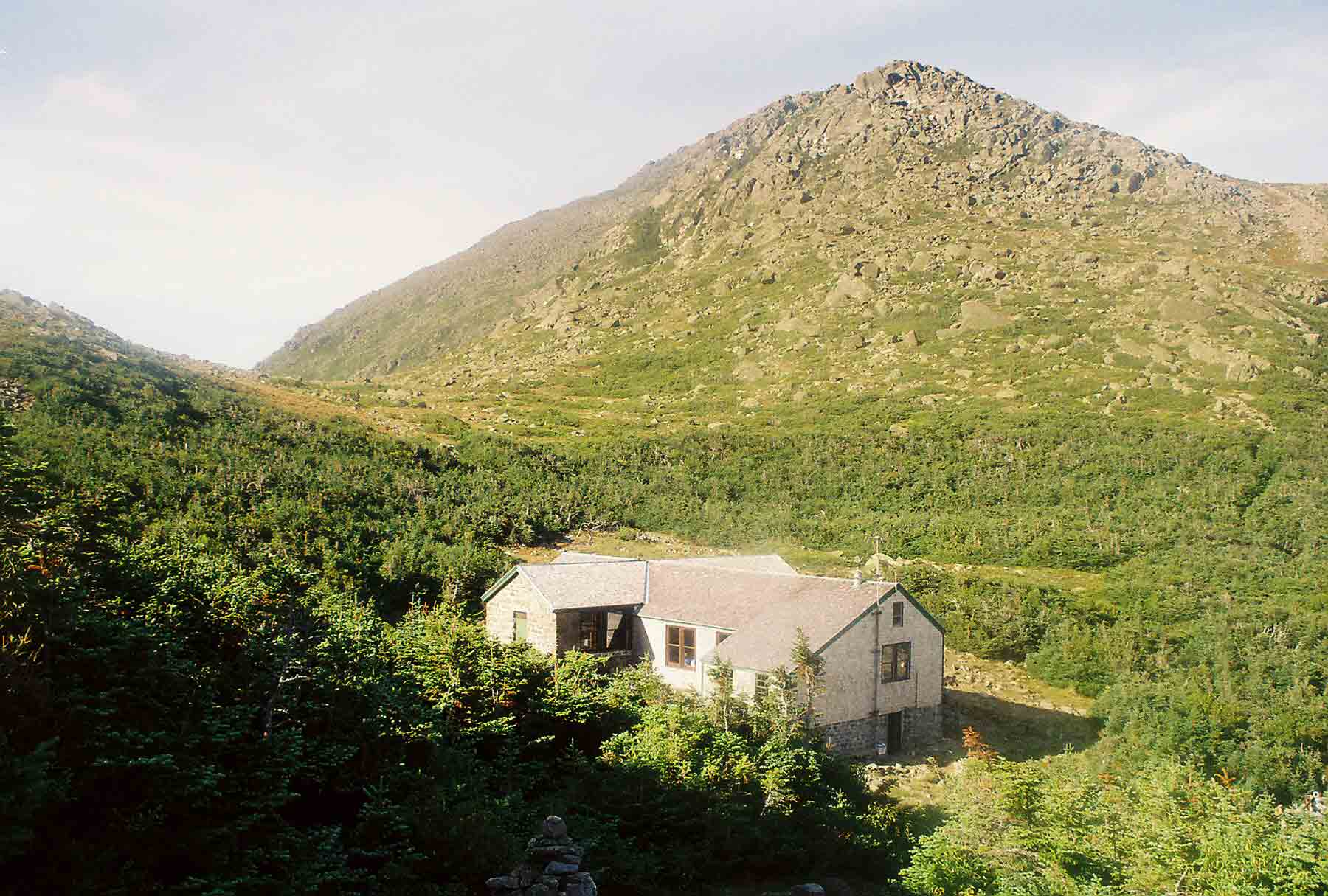
Thurs 7/14 Osgood à Carter Notch Hut 12.7 Elevation
profile
 I awoke feeling good, knowing that the
rest of my trip would be relatively easy.
The hike to Pinkham
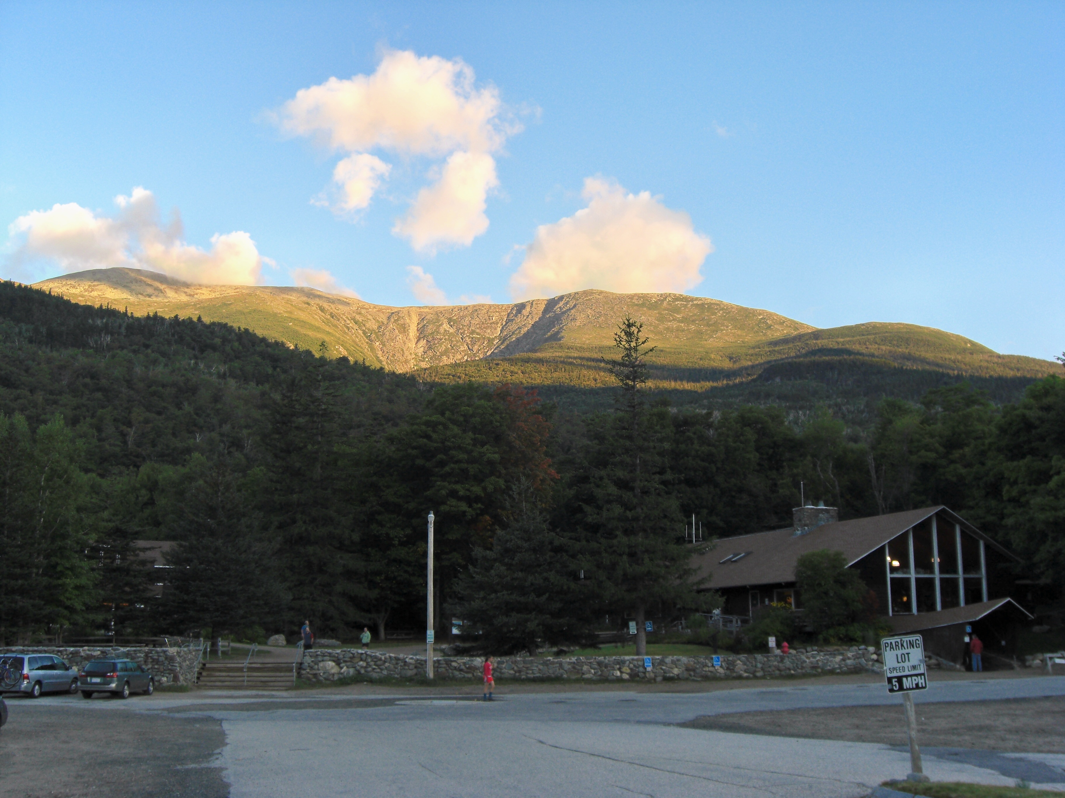
Notch was moderate, and I arrived around mid morning. Pinkham Notch is one of the more developed
areas along the trail, with an expansive
visitor center run by the AMC and the Forest Service, as well as a lodge
and other facilities. I took a break
here before returning to the trail to climb the Wildcat range. The Wildcats are a series of 5 peaks, with
small but steep drops between each. Near
the top of the first one is a ski lift.
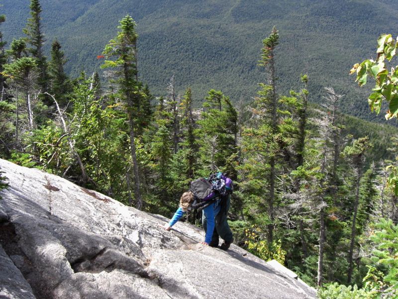
The climb was quite challenging, with several of the rocky pitches (the view at the link is actually
the trail!) aided by means of bolts or ladder
rungs fastened to the rock. At the
top a light rain began to fall, and the tourists, most of whom had arrived via
ski lift to check out the view, scattered
while I continued hiking. The rain did
not amount to much, and before long I was following a steep descent into Carter
Notch. At the bottom were two small lakes, and a cluster of buildings. The central building was the common area,
dining room and kitchen for the hut. The
other buildings were bunkrooms. This hut
is considered “self-service”: guests have use of the kitchen, and meals are not
provided as they are in the other huts.
Several through-hikers, including a south bounder and the guys I had
stayed with on Moosilauke, where there, as well as a large group of middle-aged
women – probably at least 20 of them – who were hiking together. They had accessed the hut via a relatively
easy route that follows the notch from a road, rather than over the
Wildcats. I enjoyed hanging out in the
common area, and read bits and pieces from “Not Without Peril”, a book about
people who have died from exposure to harsh weather on Mount
Washington and the surrounding peaks.
I awoke feeling good, knowing that the
rest of my trip would be relatively easy.
The hike to Pinkham
Notch was moderate, and I arrived around mid morning. Pinkham Notch is one of the more developed
areas along the trail, with an expansive
visitor center run by the AMC and the Forest Service, as well as a lodge
and other facilities. I took a break
here before returning to the trail to climb the Wildcat range. The Wildcats are a series of 5 peaks, with
small but steep drops between each. Near
the top of the first one is a ski lift.
The climb was quite challenging, with several of the rocky pitches (the view at the link is actually
the trail!) aided by means of bolts or ladder
rungs fastened to the rock. At the
top a light rain began to fall, and the tourists, most of whom had arrived via
ski lift to check out the view, scattered
while I continued hiking. The rain did
not amount to much, and before long I was following a steep descent into Carter
Notch. At the bottom were two small lakes, and a cluster of buildings. The central building was the common area,
dining room and kitchen for the hut. The
other buildings were bunkrooms. This hut
is considered “self-service”: guests have use of the kitchen, and meals are not
provided as they are in the other huts.
Several through-hikers, including a south bounder and the guys I had
stayed with on Moosilauke, where there, as well as a large group of middle-aged
women – probably at least 20 of them – who were hiking together. They had accessed the hut via a relatively
easy route that follows the notch from a road, rather than over the
Wildcats. I enjoyed hanging out in the
common area, and read bits and pieces from “Not Without Peril”, a book about
people who have died from exposure to harsh weather on Mount
Washington and the surrounding peaks.
Fri 7/15 Carter Notch – Rattle River 13.4 Elevation
profile
 Although
more rain had fallen overnight, my next-to-last day of hiking dawned clear and
pleasant. The route would be
challenging, and started with a steep climb out of Carter Notch up to Carter
Dome. The rocky trail continued in typical
White Mountain fashion, dropping and climbing steeply, over South, Middle, and North
Carter Mountains. The clear weather
afforded superb views back across toward the Presidential Range, where I had
been two days earlier. I took a break at
the Imp Shelter, then continued to a final viewpoint at Mt. Moriah. The name always reminds me of a song we sang
at Camp Roger, and I am sure it was going
through my head as I enjoyed the view, taking plenty of time because I knew it
would be the last one of the trip.
Beyond, the trail dropped steadily, eventually following a scenic, rocky river. As I neared the bottom, the forest started to
change, and hardwoods such as maple and birch became common, replacing the
spruce and fir that I become familiar with over the past week. I stayed the night at Rattle
River Shelter, which was in a clearing adjacent to a beautiful stream.
Although
more rain had fallen overnight, my next-to-last day of hiking dawned clear and
pleasant. The route would be
challenging, and started with a steep climb out of Carter Notch up to Carter
Dome. The rocky trail continued in typical
White Mountain fashion, dropping and climbing steeply, over South, Middle, and North
Carter Mountains. The clear weather
afforded superb views back across toward the Presidential Range, where I had
been two days earlier. I took a break at
the Imp Shelter, then continued to a final viewpoint at Mt. Moriah. The name always reminds me of a song we sang
at Camp Roger, and I am sure it was going
through my head as I enjoyed the view, taking plenty of time because I knew it
would be the last one of the trip.
Beyond, the trail dropped steadily, eventually following a scenic, rocky river. As I neared the bottom, the forest started to
change, and hardwoods such as maple and birch became common, replacing the
spruce and fir that I become familiar with over the past week. I stayed the night at Rattle
River Shelter, which was in a clearing adjacent to a beautiful stream.
Sat 7/16 Rattle
River à US
2 1.9

This final day of hiking was so easy it was almost not worth
mentioning. The trail was an easy route through
the woods, going slightly downhill to meet US route 2, several miles east of
Gorham. I arrived earlier than our
pre-arranged meeting time, so I decided to follow the trail along to road to
where it entered the woods again. The
route followed the highway and then turned right on a side road and across a
dam on the Androscoggin
River. From there it turned left on a gravel road
into the woods. It was here that I would
be dropped off on my hike next year.
Tatiana arrived to pick me up, and we drove through Gorham, Crawford
Notch, Franconia Notch, and across the scenic Kancamagus Highway before
returning to Pine Ellis B&B in Andover, Maine,
a hiker-oriented hostel where we had arranged to stay. The next day we drove to Boston to spend a few days with Tatiana’s
Aunt Donna – which was quite a change after two weeks of hiking! When I had finished hiking the year before, I
was ready to be finished. This time, I
felt like I could continue – and in other circumstances would have been glad to
re-supply and then continue north. The Maine woods beckoned!