 Smokies to Roan Mountain 2007
date Shelters/campsites mileage feet climbed
Sun 6/10 Fontana à
Russell Field 13.1
4190
Mon 6/11 Russell Field à
Double Spring Gap 16.4 3787
Tues 6/12 Double Spring à Pecks Corner 21.2
2900
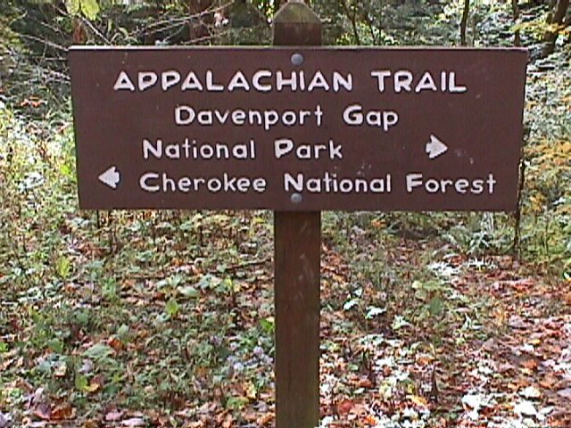
Wed 6/13 Pecks Corner à Davenport
Gap 20.0 2875
Thur 6/14 Davenport
Gap à Roaring Fork 17.9 5034
Fri 6/15 Roaring Fork à Hot Springs 18.8
2906
Sat 6/16 Hot
Springs à
Little Laurel 19.6
3315
Sun 6/17 Little Laurel à Hogback Ridge 21.5
3790
Mon 6/18 Hogback Ridge à No Business Knob 20.6
3316
Tues 6/19 No Business Knob à Cherry Gap 22.7
4558
Wed 6/20 Cherry Gap à Roan High Knob 14.5
4025
 In June of 2007 I hiked my
final section of the trail, from Fontana Dam at the southeastern end of the Smoky Mountains
to Roan Mountain. After Tatiana and I hiked Roan Mountain
two years earlier, we decided it would be a fitting spot for finishing the
trail. We managed to hike all of the
missing miles in central Virginia
earlier in 2007, which set me up to hike this final section in the summer. We drove down on Saturday the 9th,
and stayed at a hiker-oriented hotel called The Hike Inn – located just a
few miles from Fontana. We had dinner at a local restaurant in Bryson City,
a gateway town for the Smokies located west of Cherokee. The next morning we followed the
recommendation of our host at the inn and had breakfast in Robbinsville. While at the inn we made the acquaintance of
an overly friendly cat named “Catzilla”.
This cat reminded us of our cat Keesha – just larger and masculine. He came right into our room and jumped up
onto the bed in the morning.
In June of 2007 I hiked my
final section of the trail, from Fontana Dam at the southeastern end of the Smoky Mountains
to Roan Mountain. After Tatiana and I hiked Roan Mountain
two years earlier, we decided it would be a fitting spot for finishing the
trail. We managed to hike all of the
missing miles in central Virginia
earlier in 2007, which set me up to hike this final section in the summer. We drove down on Saturday the 9th,
and stayed at a hiker-oriented hotel called The Hike Inn – located just a
few miles from Fontana. We had dinner at a local restaurant in Bryson City,
a gateway town for the Smokies located west of Cherokee. The next morning we followed the
recommendation of our host at the inn and had breakfast in Robbinsville. While at the inn we made the acquaintance of
an overly friendly cat named “Catzilla”.
This cat reminded us of our cat Keesha – just larger and masculine. He came right into our room and jumped up
onto the bed in the morning.
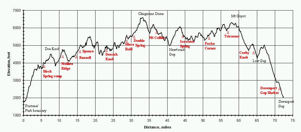
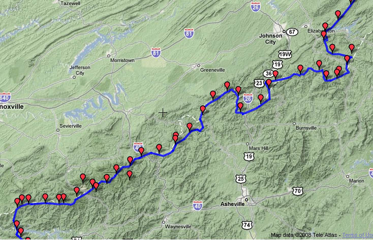
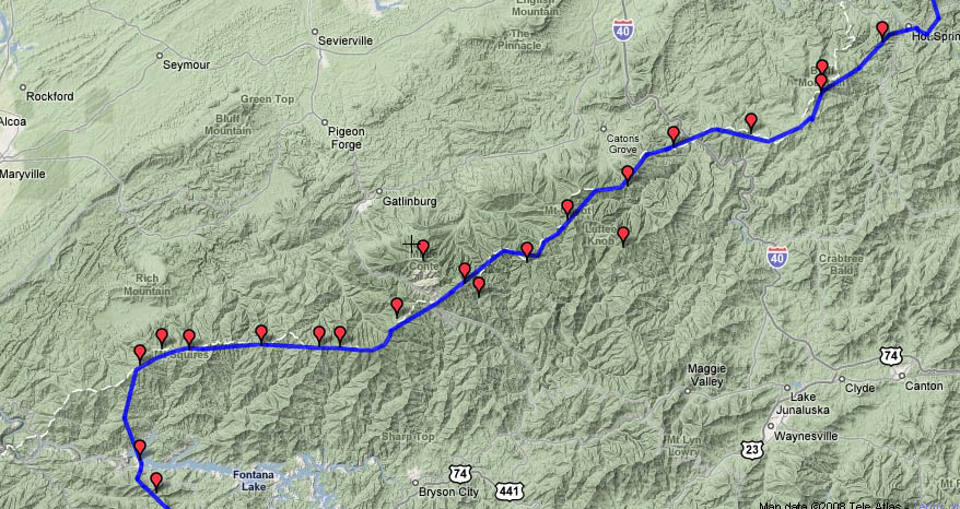
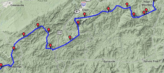
Check out a map of the elevation profile through the Smokies
and terrain maps of the entire
route | detail of Smokies to
Hot Springs and Hot Springs to
Roan Mountain. | Interactive
Great Smokies map | Overall
elevation profile of the trip
Sun 6/10 Fontana
à Russell Field 13.1
Elevation
Profile
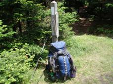
After breakfast on Sunday, we drove to Fontana Dam. I had earlier obtained reservations for the
four shelters I indeed to stay in while covering the 71 miles through the National Park, and before starting off I
filled out a permit and left a copy at the drop box near the dam. We walked across the dam together before
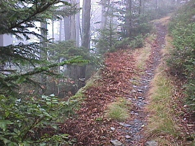
saying our goodbyes. The trail was easy
at first, following an old paved road to a small parking area. Then in led into
the woods and climbed steadily for several miles. Once reaching the main mountain chain in the
park, the trail does not drop much below 4500 feet – in fact it stays above
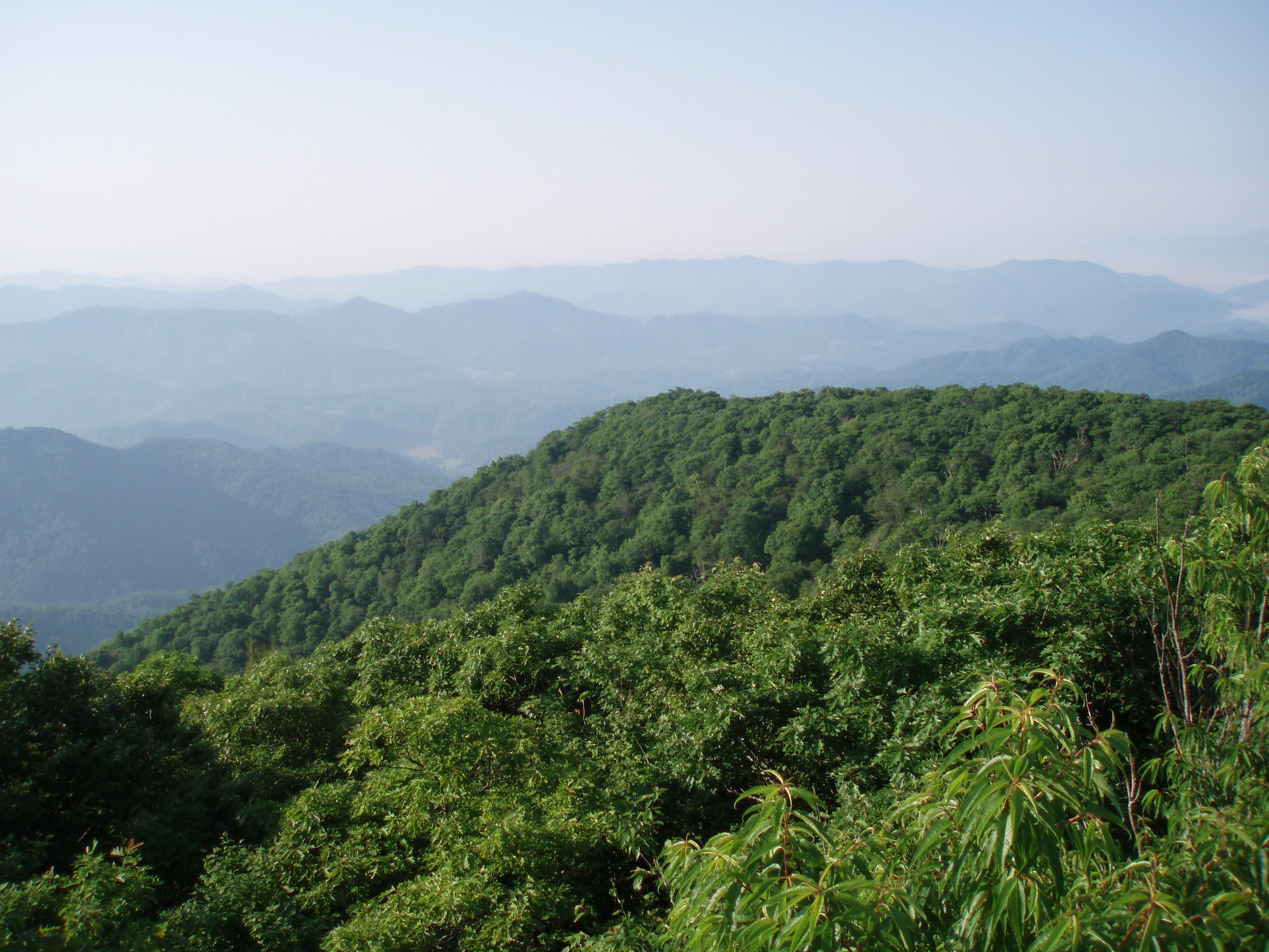
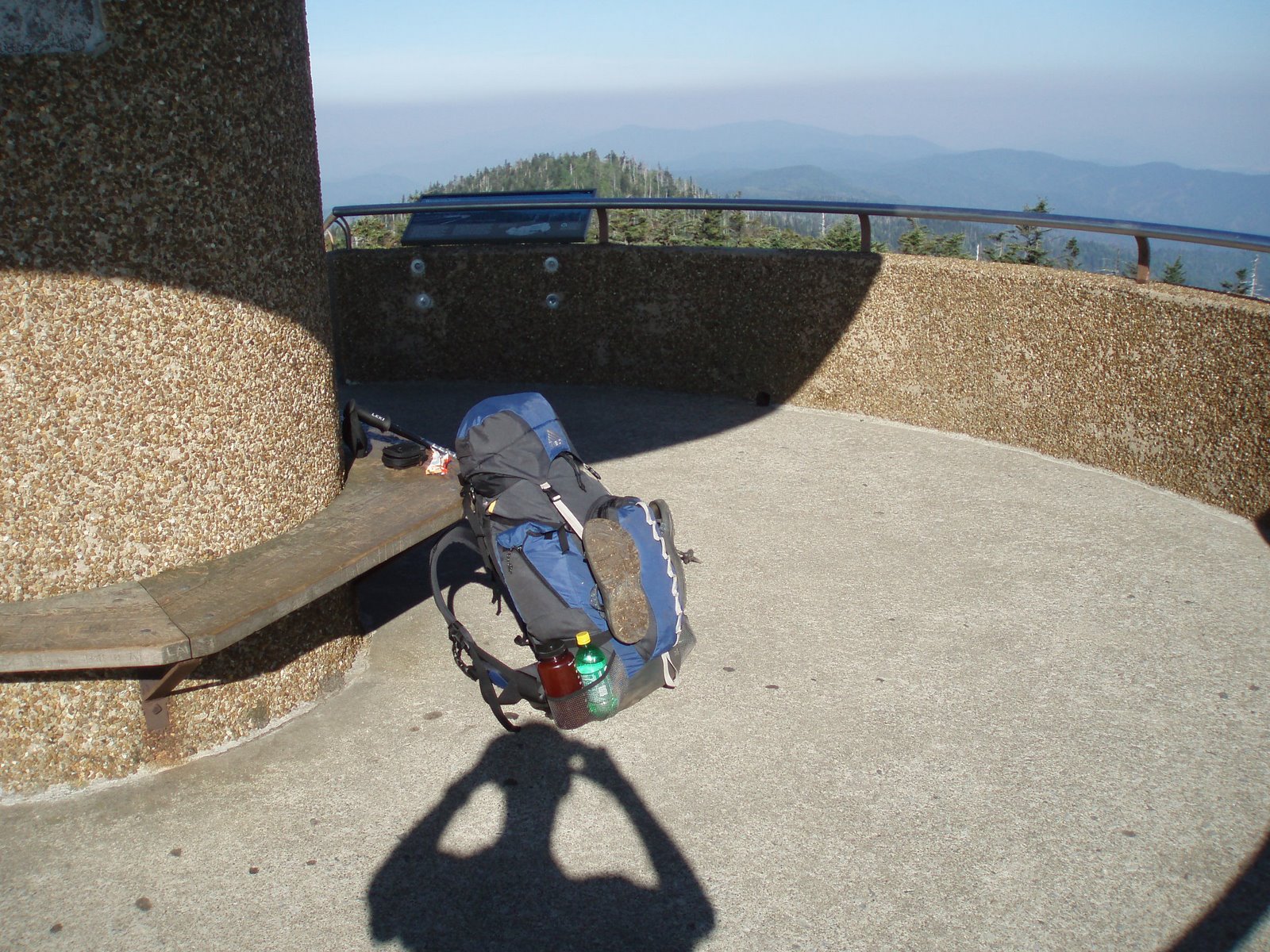
5000 for more than 30 miles – so the initial climb was significant. After gaining 2300’ I paused to climb the Shuckstack fire tower,
which provides an excellent
view of the southeastern Smokies, Fontana Dam, and the Nantahala mountains
to the south. Several other hikers were
checking out the view when I stopped there, and I stayed at the same shelter
with three of them on my second night. A
few miles further on, I took a break at the Mollies Ridge Shelter. The three thru-hikers I had met at the tower
were also there, and we were gazing across the open grassy field in front of
the shelter when an unusual-looking hiker entered the clearing. His pack was made of Tyvek and duct tape, and
he was not wearing any shoes. He
explained to us that he had hiked the northern half of the trail last year,
stopping near Crabtree Falls,
VA because of an injury. He was
completing his hike this year. The
reason for his choice of pack and footwear was partly derived from the cause
for which he was hiking – to raise awareness for veterans’ issues. In particular, he wanted to convince the
government to provide more extensive counseling and psychological care for
returning solders than they are currently offering. He was an interesting guy to talk to. I hiked several more miles before staying the
night at Russell
Field Shelter. Although many of the
shelters along the trail in the Smokies have been remodeled in recent years,
this one still bore the cramped quarters and chain link fence typical of the
older shelters. There was a small grassy
clearing in front of the shelter – a nice place to read in the sun – but not
what I would call a field. Probably
there had been a larger cleared area in the past – in the 1800s many settlers grazed
cattle and other livestock in cleared areas on the mountaintops during the
summer. One large group of hikers showed
up later. They told me they had arrived
at their previous shelter near midnight the previous night, to the great
consternation of the other campers there.
I was glad they were more punctual today.
Mon 6/11 Russell Field à Double Spring Gap 16.4
Elevation
profile
 The weather yesterday had
been warm and sunny, but it cooled down nicely over night at 4360’ above sea
level. I awoke to moderately cloudy
skies and cool temperatures. On the map
it looked like the day would provide a moderately challenging hike, but less
strenuous than the big climb the previous day.
Maps can be deceiving. As it
turned out, the route involved many small ups and downs, as well as some
relatively rugged sections. It took only
a few easy miles to reach the next shelter, at Spence Field. The thru-hikers I had met the previous day
had gone on to this shelter, and I could see it would have been an appealing
place to stay. The large grassy field
surrounding the shelter is beginning to shrink as trees advance across it, but
there is still a large open space. The
shelter has also been remodeled, with a higher roof and a covered porch
area. The rugged section followed Spence
Field, starting by ascending to Rocky Top.
The route lost fairly significant elevation before cresting again at Thunderhead Mountain, the highest point in the
western end of the park. The views were
quite good, but it was difficult to make out distant landmarks with any clarity
because of the partial cloud cover. Cades Cove was
visible in the distance, and I imagined the hundreds of cars and tourists
slowly making their way along the scenic drive past the restored settlers
cabins and barns. Towards mid-afternoon
I came upon a trail crew who were doing basic trail maintenance. I had seen evidence of clearing and water bar
work for the past several miles. The
leader noted the rude hikers who had come into camp after midnight a few days
earlier – that would be the guys I had met last night. I soon came upon Silers Bald Shelter, where
they were camped. A half dozen tents
were set up in the grassy clearing near the shelter, and a large female turkey
was boldly foraging in the grass. She
came quite close to me – probably hoping for a handout. Silers Bald itself was a short distance up
the trail; this bald is also closing in with tree growth. Two miles further I came to Double
Spring Gap Shelter. This shelter,
also with a chain link fence across the front and no remodeling, was
appropriately named – two springs were within yards of the clearing. Both were, however, dismally low. There was just enough water flowing to pump
for use with dinner. Water had been
somewhat scarce along this section of trail: the spring at Mollies Ridge was
dry, and the one at Russell Field was slow.
I looked at the park website when writing this text, approximately a
month after my hike, and discovered the situation had gotten worse. Park officials were cautioning against
backpacking the western end of the park along the AT – the stretch I had done
in these past two days – because of a lack of water. I am glad I hiked when I did. The three thru-hikers I met earlier stayed at
the shelter. I did not get many details
from them regarding why they were still this far south – the tail end of the
thru-hiker crowd was probably at least a week ahead. This group would probably need to flip-flop –
going to Maine after hiking through Virginia – if they hoped
to complete the trail this year. Around
dusk, we had a surprising sight: into the clearing strode a young guy with a
National Park Service hat, backpack, black t-shirt and camouflage pants,
holding a large black rifle with a scope on it.
I eventually realized he was one of the sharpshooters hired by the park
to hunt non-native
pigs, which are causing
all sorts of problems
in the park. I had seen quite a bit
of evidence of their rooting that day.
The weather yesterday had
been warm and sunny, but it cooled down nicely over night at 4360’ above sea
level. I awoke to moderately cloudy
skies and cool temperatures. On the map
it looked like the day would provide a moderately challenging hike, but less
strenuous than the big climb the previous day.
Maps can be deceiving. As it
turned out, the route involved many small ups and downs, as well as some
relatively rugged sections. It took only
a few easy miles to reach the next shelter, at Spence Field. The thru-hikers I had met the previous day
had gone on to this shelter, and I could see it would have been an appealing
place to stay. The large grassy field
surrounding the shelter is beginning to shrink as trees advance across it, but
there is still a large open space. The
shelter has also been remodeled, with a higher roof and a covered porch
area. The rugged section followed Spence
Field, starting by ascending to Rocky Top.
The route lost fairly significant elevation before cresting again at Thunderhead Mountain, the highest point in the
western end of the park. The views were
quite good, but it was difficult to make out distant landmarks with any clarity
because of the partial cloud cover. Cades Cove was
visible in the distance, and I imagined the hundreds of cars and tourists
slowly making their way along the scenic drive past the restored settlers
cabins and barns. Towards mid-afternoon
I came upon a trail crew who were doing basic trail maintenance. I had seen evidence of clearing and water bar
work for the past several miles. The
leader noted the rude hikers who had come into camp after midnight a few days
earlier – that would be the guys I had met last night. I soon came upon Silers Bald Shelter, where
they were camped. A half dozen tents
were set up in the grassy clearing near the shelter, and a large female turkey
was boldly foraging in the grass. She
came quite close to me – probably hoping for a handout. Silers Bald itself was a short distance up
the trail; this bald is also closing in with tree growth. Two miles further I came to Double
Spring Gap Shelter. This shelter,
also with a chain link fence across the front and no remodeling, was
appropriately named – two springs were within yards of the clearing. Both were, however, dismally low. There was just enough water flowing to pump
for use with dinner. Water had been
somewhat scarce along this section of trail: the spring at Mollies Ridge was
dry, and the one at Russell Field was slow.
I looked at the park website when writing this text, approximately a
month after my hike, and discovered the situation had gotten worse. Park officials were cautioning against
backpacking the western end of the park along the AT – the stretch I had done
in these past two days – because of a lack of water. I am glad I hiked when I did. The three thru-hikers I met earlier stayed at
the shelter. I did not get many details
from them regarding why they were still this far south – the tail end of the
thru-hiker crowd was probably at least a week ahead. This group would probably need to flip-flop –
going to Maine after hiking through Virginia – if they hoped
to complete the trail this year. Around
dusk, we had a surprising sight: into the clearing strode a young guy with a
National Park Service hat, backpack, black t-shirt and camouflage pants,
holding a large black rifle with a scope on it.
I eventually realized he was one of the sharpshooters hired by the park
to hunt non-native
pigs, which are causing
all sorts of problems
in the park. I had seen quite a bit
of evidence of their rooting that day.
Tues 6/12 Double Spring à Pecks Corner 21.2
Elevation
profile
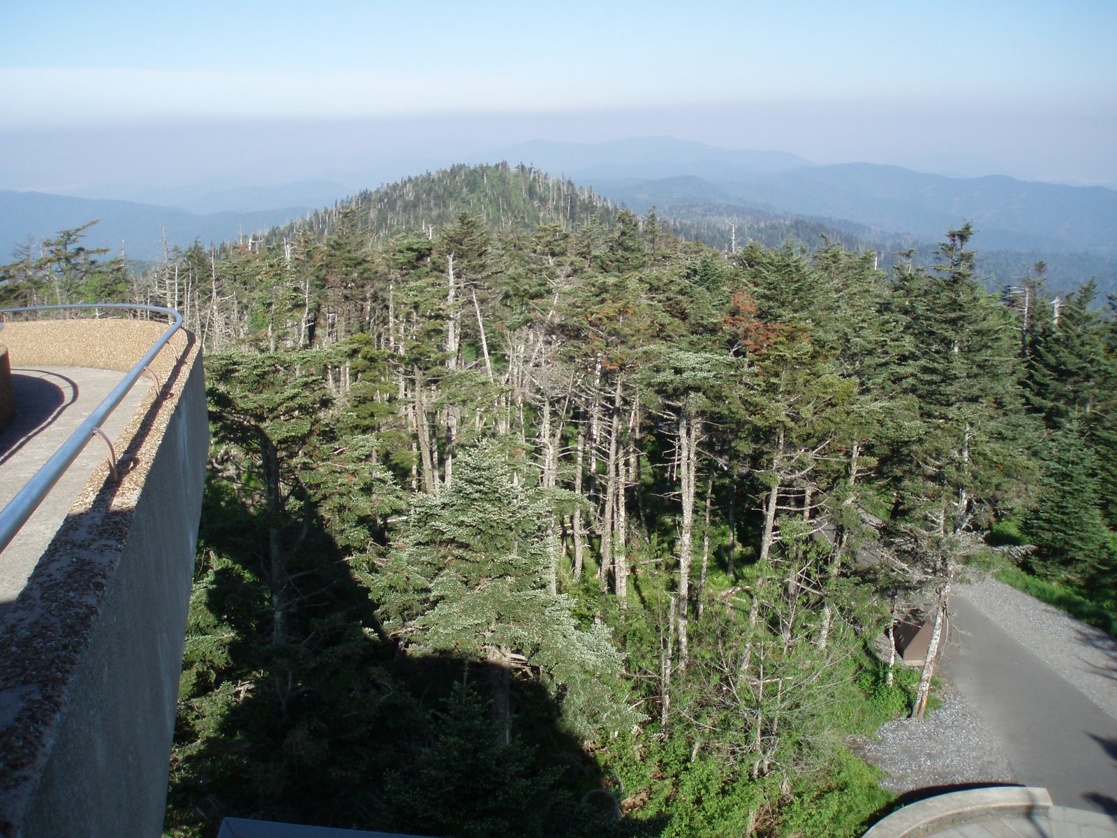
I got a reasonably early start on Tuesday, and started the
steady climb towards Clingman’s Dome
– at 6643’ the highest point in the
Smokies, in the state of Tennessee, and
along the entire Appalachian Trail. The trail gradually rose toward several
intermediate peaks, dropping in elevation a little between each before rising
again. As I started off, I was already
surrounded by a dramatic change in forest cover: the higher elevations in the Smokies are
dominated by spruce and fir trees, a forest type more typical of New England. When
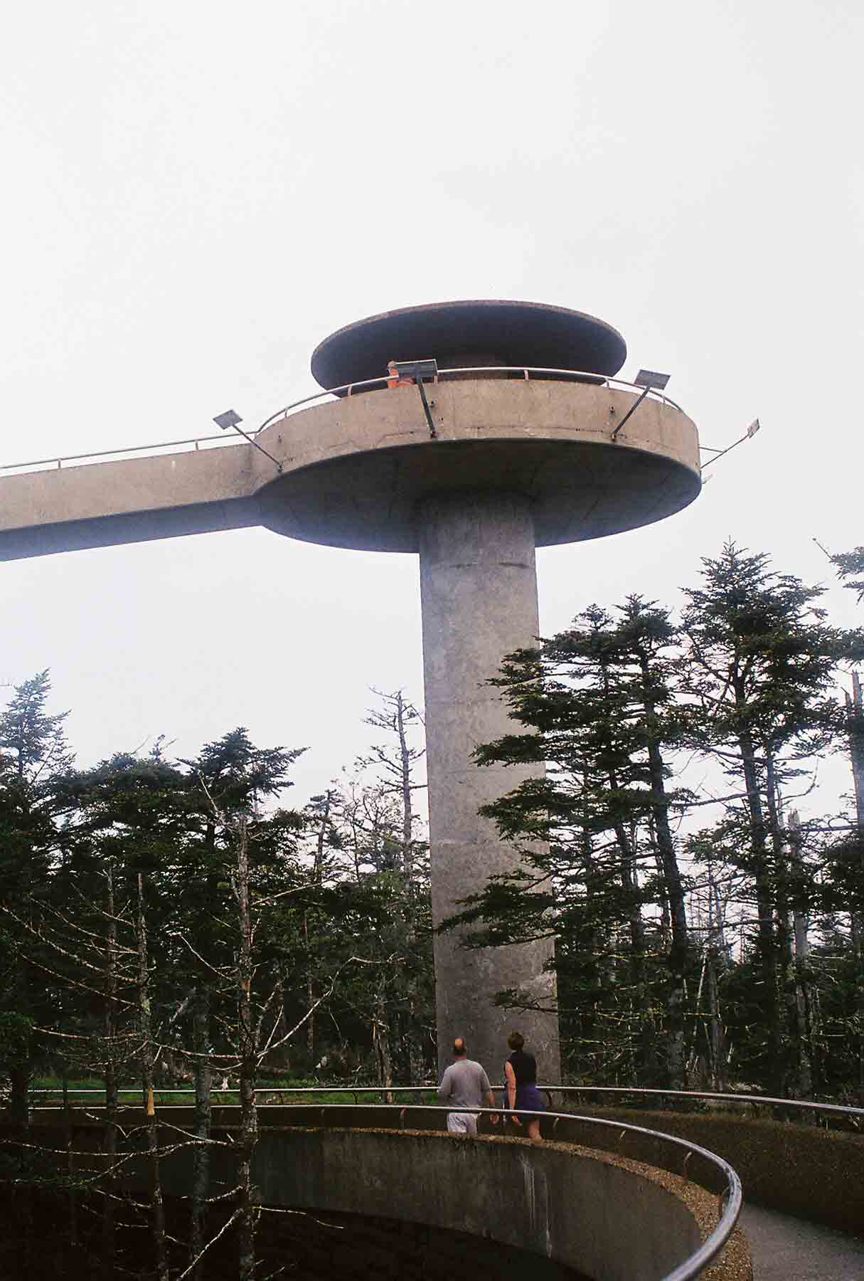
I arrived at Clingman’s Dome, I was the
only person there. This was quite a
treat, given that the paved road that ends at a parking lot ½ mile from the
observation tower provides easy access to tourists, many of whom arrive by
bus. In fact, when Tatiana and I had
stopped here a few years ago, the place was overrun with kids on a spring break
trip. I 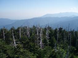
 enjoyed the view from the tower, which was outstanding. The next 8 miles of trail followed a fairly level ridge, always
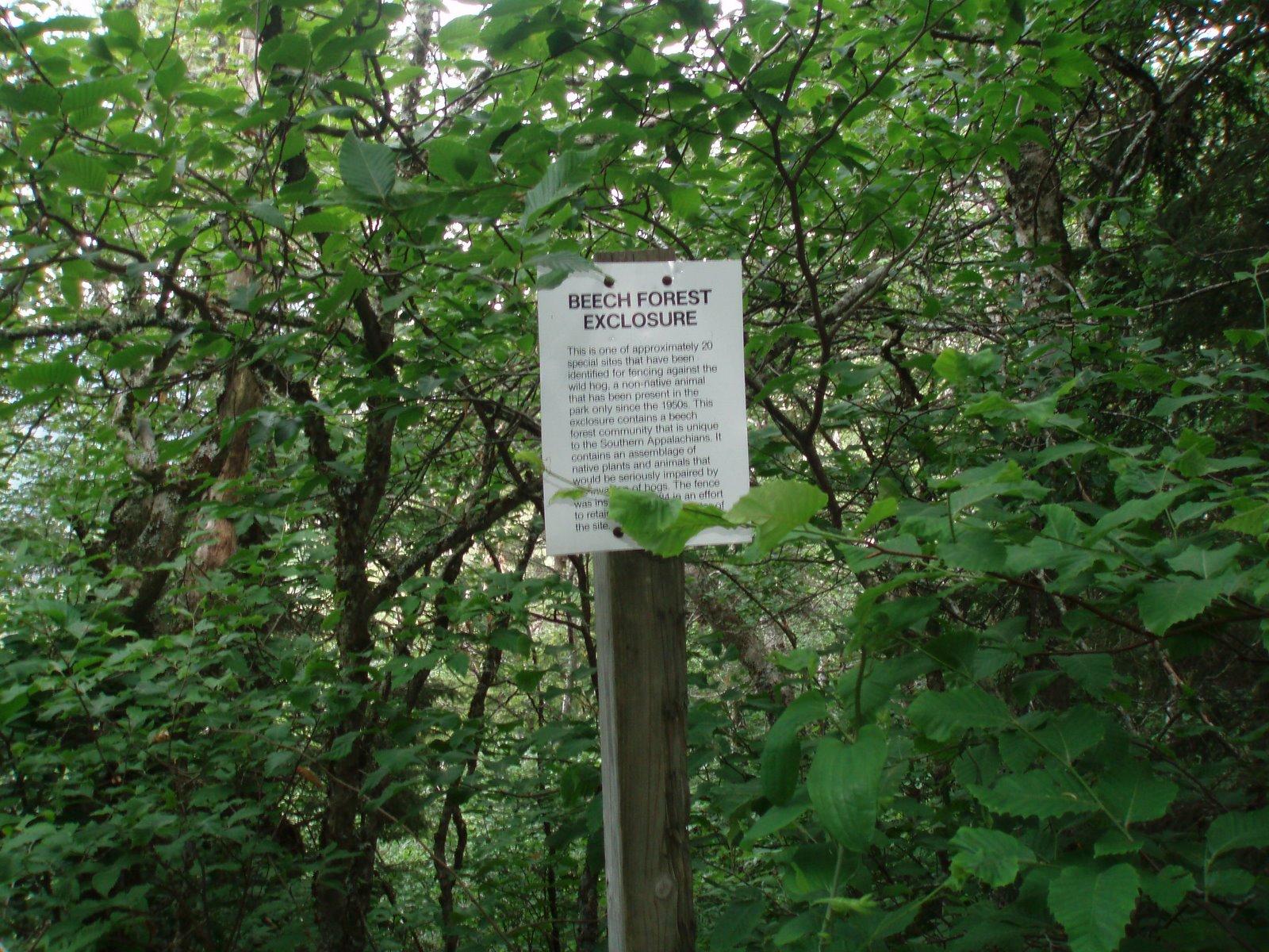
moving gradually down, and paralleling the road to the peak. Along the way I crossed a fence that was erected
to keep the pigs away from a rare
stand of beech trees. Eventually I
reached Newfound Gap, where the trail crosses the main highway that ferries
tourists between Gatlinburg and Cherokee.
The parking lot at the gap provides and excellent view, and the place
was crowded with families and retirees.
I stopped to wash out my cooking pot and refill water bottles, but moved
on as quickly as I could to get away from the crowds. The next 4 miles of trail were relatively
easy and well-worn, since many people day-hike starting at Newfound Gap. After three miles I passed the Boulevard
Trail, which leads to Mt. LeConte. I had used that trail when hiking with my
brother Mike several years ago, as we looped from Mt. LeConte
onto the AT. Shortly afterward I came to
Icewater Spring Shetler, where I took a longer break. A few hikers were already settling down for
the night, and I sensed the evening would be a crowded one there. I continued hiking through the fragrant
forest, soon reaching Charlie’s Bunion. This location, honoring one of the early
explorers of these mountains, provides an outstanding view, which was made
possible by a landslide; heavy rains triggered the landslide, but the ground
had been made unstable by logging operations.
I hiked another 7 miles through the spruce trees, leaving behind the
more crowded section of trail, to arrive at Pecks
Corner Shelter. Mike and I had
stayed here in 2001, and it was very busy then, as the spring break crowds
combined with the thru-hikers. This time
the shelter was only half full, the other hikers being a father-son team who
were hiking the AT through the park in a southbound direction, and a couple who
were on a loop hike. That evening we saw
two or three bears in the area near the shelter. It was quite cold at night also – which
perhaps should not be surprising since the elevation was 5280’.
enjoyed the view from the tower, which was outstanding. The next 8 miles of trail followed a fairly level ridge, always
moving gradually down, and paralleling the road to the peak. Along the way I crossed a fence that was erected
to keep the pigs away from a rare
stand of beech trees. Eventually I
reached Newfound Gap, where the trail crosses the main highway that ferries
tourists between Gatlinburg and Cherokee.
The parking lot at the gap provides and excellent view, and the place
was crowded with families and retirees.
I stopped to wash out my cooking pot and refill water bottles, but moved
on as quickly as I could to get away from the crowds. The next 4 miles of trail were relatively
easy and well-worn, since many people day-hike starting at Newfound Gap. After three miles I passed the Boulevard
Trail, which leads to Mt. LeConte. I had used that trail when hiking with my
brother Mike several years ago, as we looped from Mt. LeConte
onto the AT. Shortly afterward I came to
Icewater Spring Shetler, where I took a longer break. A few hikers were already settling down for
the night, and I sensed the evening would be a crowded one there. I continued hiking through the fragrant
forest, soon reaching Charlie’s Bunion. This location, honoring one of the early
explorers of these mountains, provides an outstanding view, which was made
possible by a landslide; heavy rains triggered the landslide, but the ground
had been made unstable by logging operations.
I hiked another 7 miles through the spruce trees, leaving behind the
more crowded section of trail, to arrive at Pecks
Corner Shelter. Mike and I had
stayed here in 2001, and it was very busy then, as the spring break crowds
combined with the thru-hikers. This time
the shelter was only half full, the other hikers being a father-son team who
were hiking the AT through the park in a southbound direction, and a couple who
were on a loop hike. That evening we saw
two or three bears in the area near the shelter. It was quite cold at night also – which
perhaps should not be surprising since the elevation was 5280’.
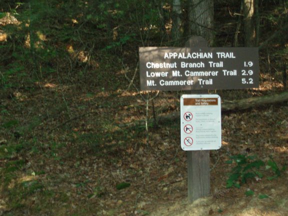
Wed 6/13 Pecks Corner à Davenport
Gap 20.0 Elevation
profile
 I warmed up quickly in the
morning, climbing along the side trail back to the AT. The trail was empty in the morning, and I saw
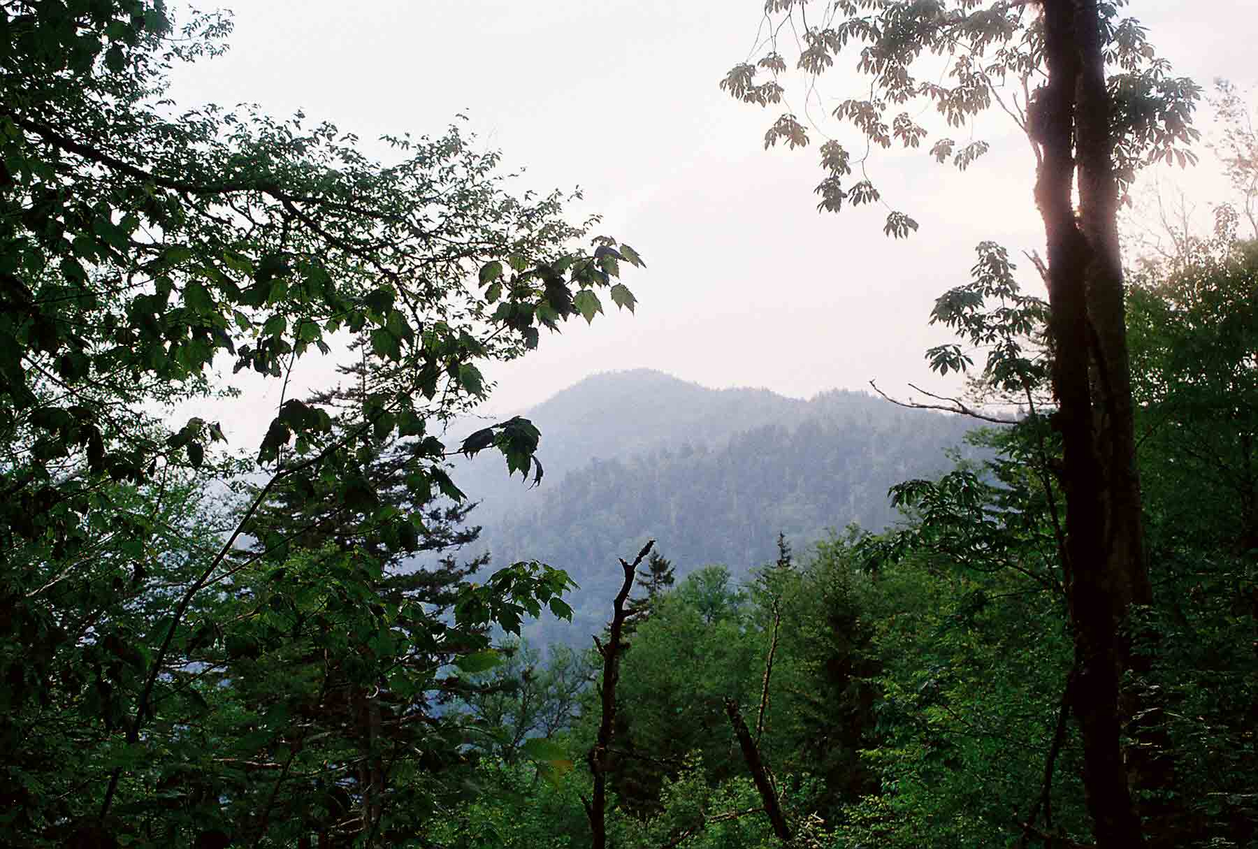
only one small group and a solo hiker until mid-afternoon. It was a very pleasant walk, continuing along
the spruce-fir ridge with occasional
views of the surrounding mountain ridges.
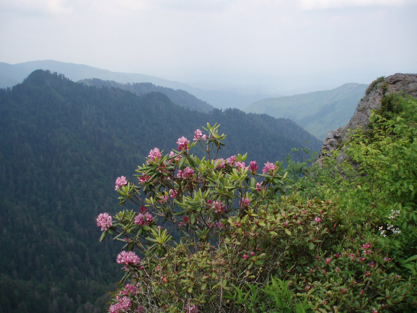
Occasional blooming rhododendron
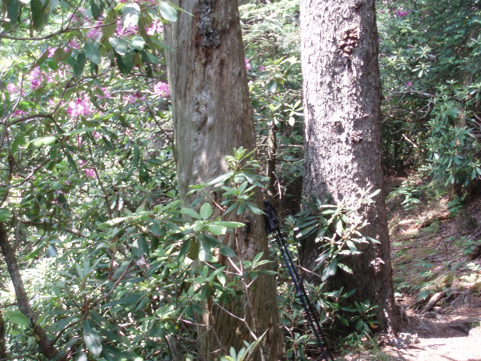
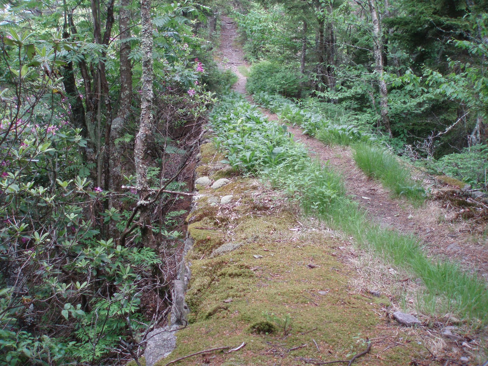
framed the view next to large trees along the trail. The CCC build this section of trail in the
1930s, and they leveled
out some of the sharp elevation changes and added retaining walls (another
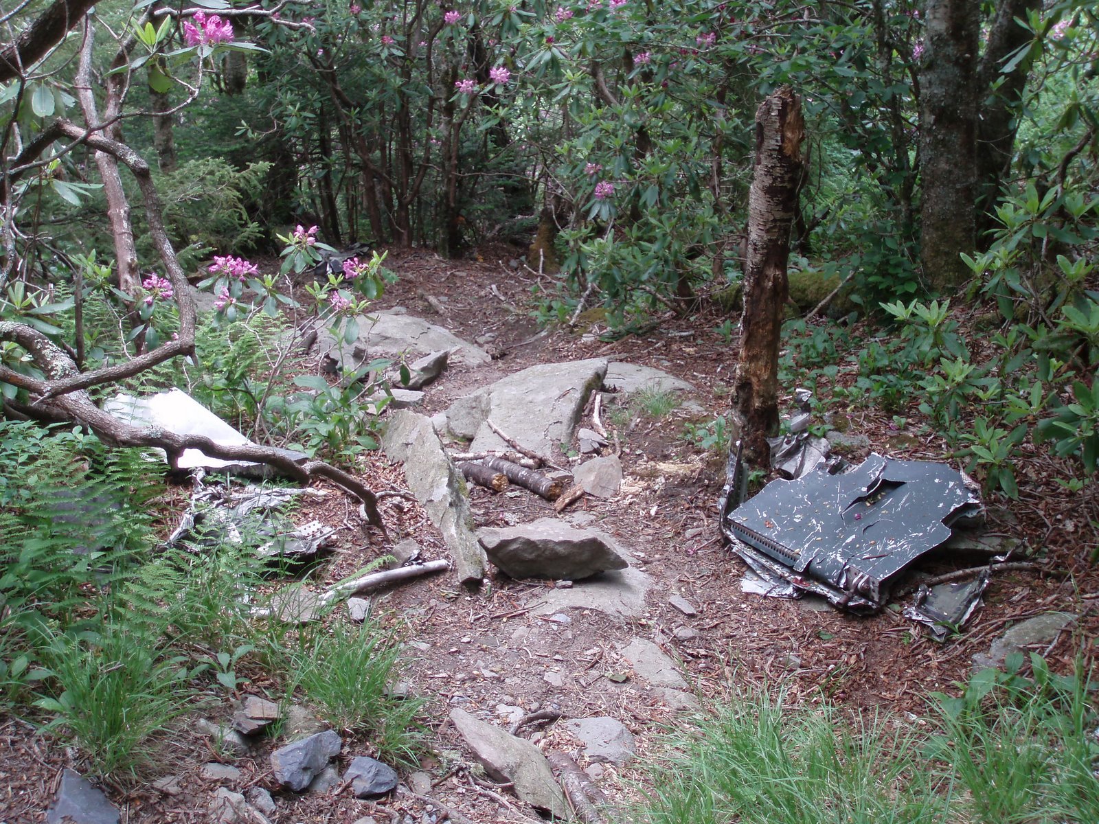
pic) – in a fashion similar to the way roads are often constructed. At one point I passed the wreckage of a plane that crashed into
the mountains back in the 70s. I took a
break in the afternoon at Cosby Knob Shelter, anther spot where Mike and I
stayed in 2001. That year we woke to
several inches of snow on the ground – something that was unthinkable now. The shelter had been remodeled since then,
and looked quite nice. A few miles
further I arrived at a side trail to the Mt. Cammerer
lookout, which I took the time to explore.
The lookout is a wooded structure built to watch for fires (it’s
technically not a tower since it sits right on the ground rather than on tall
iron or wooden legs – its position on the edge of a cliff provides and
excellent viewpoint). There were several
day hikers at the lookout, and they must have hiked quite a distance to get
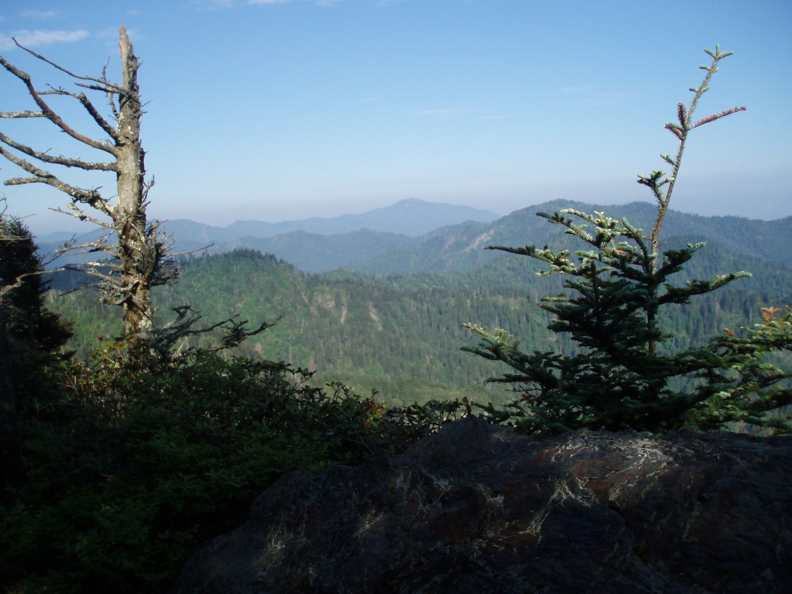
there. The view was spectacular, taking in much of
the eastern end of the park, the impressive elevation drop to the Pigeon River
and gorge where I-40 travels, and the high mountains beyond. After returning to the trail I continued the
descent to Davenport
Gap Shelter – at 2600’ more than 3700 feet lower than the highest point I
had crossed that morning. The shelter
was unoccupied, and remained so throughout the night. It was in a glade of huge maple and basswood trees – probably
an area that had never been logged. It
rained a little that night, but nothing significant.
I warmed up quickly in the
morning, climbing along the side trail back to the AT. The trail was empty in the morning, and I saw
only one small group and a solo hiker until mid-afternoon. It was a very pleasant walk, continuing along
the spruce-fir ridge with occasional
views of the surrounding mountain ridges.
Occasional blooming rhododendron
framed the view next to large trees along the trail. The CCC build this section of trail in the
1930s, and they leveled
out some of the sharp elevation changes and added retaining walls (another
pic) – in a fashion similar to the way roads are often constructed. At one point I passed the wreckage of a plane that crashed into
the mountains back in the 70s. I took a
break in the afternoon at Cosby Knob Shelter, anther spot where Mike and I
stayed in 2001. That year we woke to
several inches of snow on the ground – something that was unthinkable now. The shelter had been remodeled since then,
and looked quite nice. A few miles
further I arrived at a side trail to the Mt. Cammerer
lookout, which I took the time to explore.
The lookout is a wooded structure built to watch for fires (it’s
technically not a tower since it sits right on the ground rather than on tall
iron or wooden legs – its position on the edge of a cliff provides and
excellent viewpoint). There were several
day hikers at the lookout, and they must have hiked quite a distance to get
there. The view was spectacular, taking in much of
the eastern end of the park, the impressive elevation drop to the Pigeon River
and gorge where I-40 travels, and the high mountains beyond. After returning to the trail I continued the
descent to Davenport
Gap Shelter – at 2600’ more than 3700 feet lower than the highest point I
had crossed that morning. The shelter
was unoccupied, and remained so throughout the night. It was in a glade of huge maple and basswood trees – probably
an area that had never been logged. It
rained a little that night, but nothing significant.
Thur 6/14 Davenport
Gap à Roaring Fork 17.9
Elevation
profile
 It was a short hike to the park
border at Davenport Gap in the
morning, along a scenic stretch of trail that passed through deep woods filled
with giant trees. Another mile past the
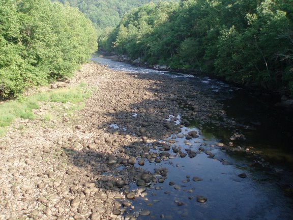
border brought me to a crossing of I-40 and a bridge over the Pigeon River. I was soon
It was a short hike to the park
border at Davenport Gap in the
morning, along a scenic stretch of trail that passed through deep woods filled
with giant trees. Another mile past the
border brought me to a crossing of I-40 and a bridge over the Pigeon River. I was soon 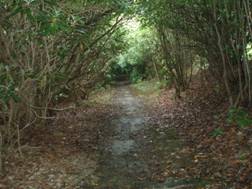 climbing again, having
crossed one of the lowest points on my intended route. I made a stop at Standing Bear Farm, a hostel
located a short distance from the trail.
The rustic spot, located on a gravel road that felt like the middle of
nowhere (or at least the middle of the woods) provided a bunkhouse, supplies,
laundry, and computer and phone access.
I did a quick check of my email before heading back out onto the
trail. The next high
point was at Snowbird
Mountain, which had a wide,
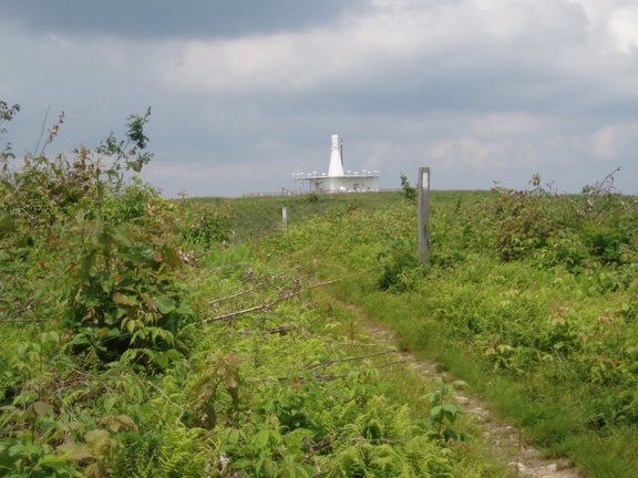
flat, grassy summit. The area was
cleared partly to provide access to an aviation control building operated by
the FAA, which was surrounded by fencing and dire warnings against
trespassing. The peak afforded an excellent
view of the surrounding green-cloaked mountains, and dark clouds foretold
the possibility of a thunderstorm. After
a few more miles in the woods the trail again rose above the trees, this time
to climb the grass-covered peak known as
Max Patch. Although this peak
provided an even better 360
degree view than Snowbird, I was not able to enjoy it because thunder was
ominously threatening overhead, rain was lightly falling, and I was at least a
half mile from the nearest shelter in the forest. I had considered camping on top of the peak,
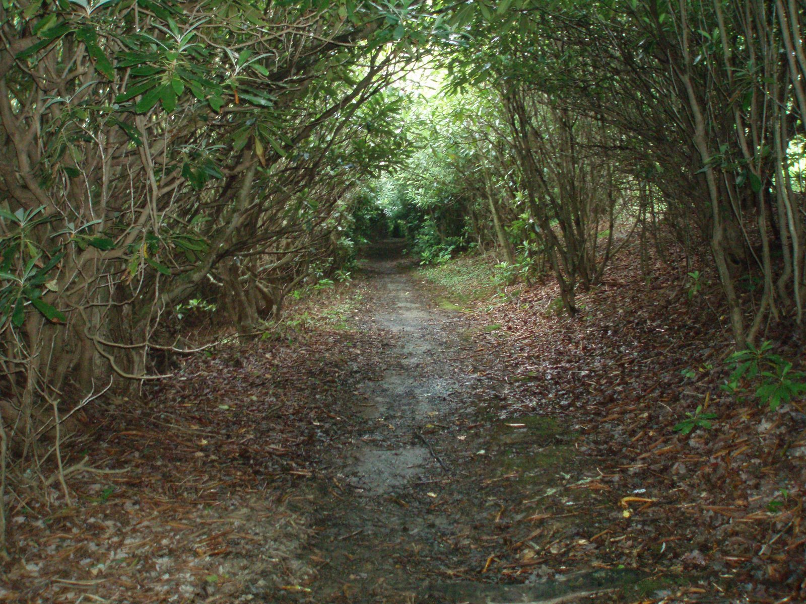
but sticking around for the coming storm did not seem wise. Instead I continued on to the next shelter,
passing through an impressive tunnel of
rhododendrons along the way. The
trail crossed the first major stream, other than the Pigeon River,
since starting the hike, and I was able to easily fill up for the evening. I stayed at Roaring
Fork Shelter, a standard wooden structure near the trail. The shelter was relatively crowded: a
thru-hiker who had been delayed by injury was hiking with his mother and dog;
and two guys were just out for a couple of days. There was also a small group of teenage boys
from an area camp. In the evening the
rain settled in with a heavier rhythm, and I was glad for the shelter of the
small wooded structure where I slept.
climbing again, having
crossed one of the lowest points on my intended route. I made a stop at Standing Bear Farm, a hostel
located a short distance from the trail.
The rustic spot, located on a gravel road that felt like the middle of
nowhere (or at least the middle of the woods) provided a bunkhouse, supplies,
laundry, and computer and phone access.
I did a quick check of my email before heading back out onto the
trail. The next high
point was at Snowbird
Mountain, which had a wide,
flat, grassy summit. The area was
cleared partly to provide access to an aviation control building operated by
the FAA, which was surrounded by fencing and dire warnings against
trespassing. The peak afforded an excellent
view of the surrounding green-cloaked mountains, and dark clouds foretold
the possibility of a thunderstorm. After
a few more miles in the woods the trail again rose above the trees, this time
to climb the grass-covered peak known as
Max Patch. Although this peak
provided an even better 360
degree view than Snowbird, I was not able to enjoy it because thunder was
ominously threatening overhead, rain was lightly falling, and I was at least a
half mile from the nearest shelter in the forest. I had considered camping on top of the peak,
but sticking around for the coming storm did not seem wise. Instead I continued on to the next shelter,
passing through an impressive tunnel of
rhododendrons along the way. The
trail crossed the first major stream, other than the Pigeon River,
since starting the hike, and I was able to easily fill up for the evening. I stayed at Roaring
Fork Shelter, a standard wooden structure near the trail. The shelter was relatively crowded: a
thru-hiker who had been delayed by injury was hiking with his mother and dog;
and two guys were just out for a couple of days. There was also a small group of teenage boys
from an area camp. In the evening the
rain settled in with a heavier rhythm, and I was glad for the shelter of the
small wooded structure where I slept.
Fri 6/15 Roaring Fork à Hot Springs 18.8
Elevation
profile
 I rose early on Friday,
knowing that I needed to hike to the town of Hot Springs before the post office closed at
4:00. Thankfully the route was
relatively easy, and I made good time cruising through the moist woods. The rain had stopped, but the air was warm
and humid. Before long I was taking a
lunch break at Deer Park Mountain Shelter, only about three miles from
town. I cruised into Hot
Springs around 1:30, and soon found myself at Elmer’s
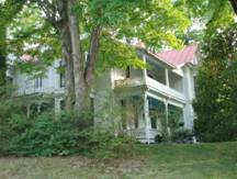
Sunnybank Inn. Elmer’s is a hiker-oriented hostel/B&B,
housed in an old Victorian structure that has served as a boarding house for
decades. The establishment attempts to
reconnect people with the natural world and get them away from technology, and
bans cell phones and computers. Since I
was there after the thru-hiker rush, many of the guests were not hikers, but
had been drawn to the Inn by their interest in
the vegetarian meals served there. There
was one fascinating hiker who I discovered had visited Washington
DC several years ago and managed to camp
(illegally) in the National Arboretum as well as along the Paint Branch Trail
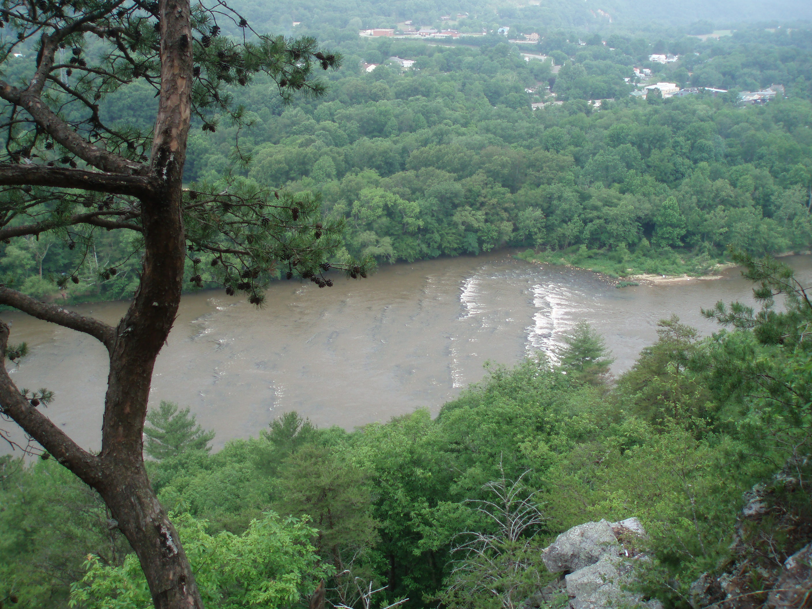
in College Park. The town of Hot Springs
was a nice place to spend the afternoon, and I picked up my box of food,
wandered around the town and along the French Broad River,
and enjoyed a buffalo burger for dinner at a local pub. Hot
Springs has embraced it’s status as a “trail town”,
and the official AT blazes are prominently
engraved in the sidewalk through the middle of town.
I rose early on Friday,
knowing that I needed to hike to the town of Hot Springs before the post office closed at
4:00. Thankfully the route was
relatively easy, and I made good time cruising through the moist woods. The rain had stopped, but the air was warm
and humid. Before long I was taking a
lunch break at Deer Park Mountain Shelter, only about three miles from
town. I cruised into Hot
Springs around 1:30, and soon found myself at Elmer’s
Sunnybank Inn. Elmer’s is a hiker-oriented hostel/B&B,
housed in an old Victorian structure that has served as a boarding house for
decades. The establishment attempts to
reconnect people with the natural world and get them away from technology, and
bans cell phones and computers. Since I
was there after the thru-hiker rush, many of the guests were not hikers, but
had been drawn to the Inn by their interest in
the vegetarian meals served there. There
was one fascinating hiker who I discovered had visited Washington
DC several years ago and managed to camp
(illegally) in the National Arboretum as well as along the Paint Branch Trail
in College Park. The town of Hot Springs
was a nice place to spend the afternoon, and I picked up my box of food,
wandered around the town and along the French Broad River,
and enjoyed a buffalo burger for dinner at a local pub. Hot
Springs has embraced it’s status as a “trail town”,
and the official AT blazes are prominently
engraved in the sidewalk through the middle of town.
Sat 6/16 Hot Springs à Little Laurel 19.6
Elevation
profile
In the morning I had breakfast at Elmer’s before heading
back onto the trail. I was not really
craving vegetarian fare, but thought I should try one of the meals at the Inn, which seem to get rave reviews. The meal centered around waffles and granola,
with fresh fruit preserves and other plant products on the side. It was actually quite good, and the
conversation with other guests was interesting.
It was mid-morning by the time I hit the trail, and I hurried 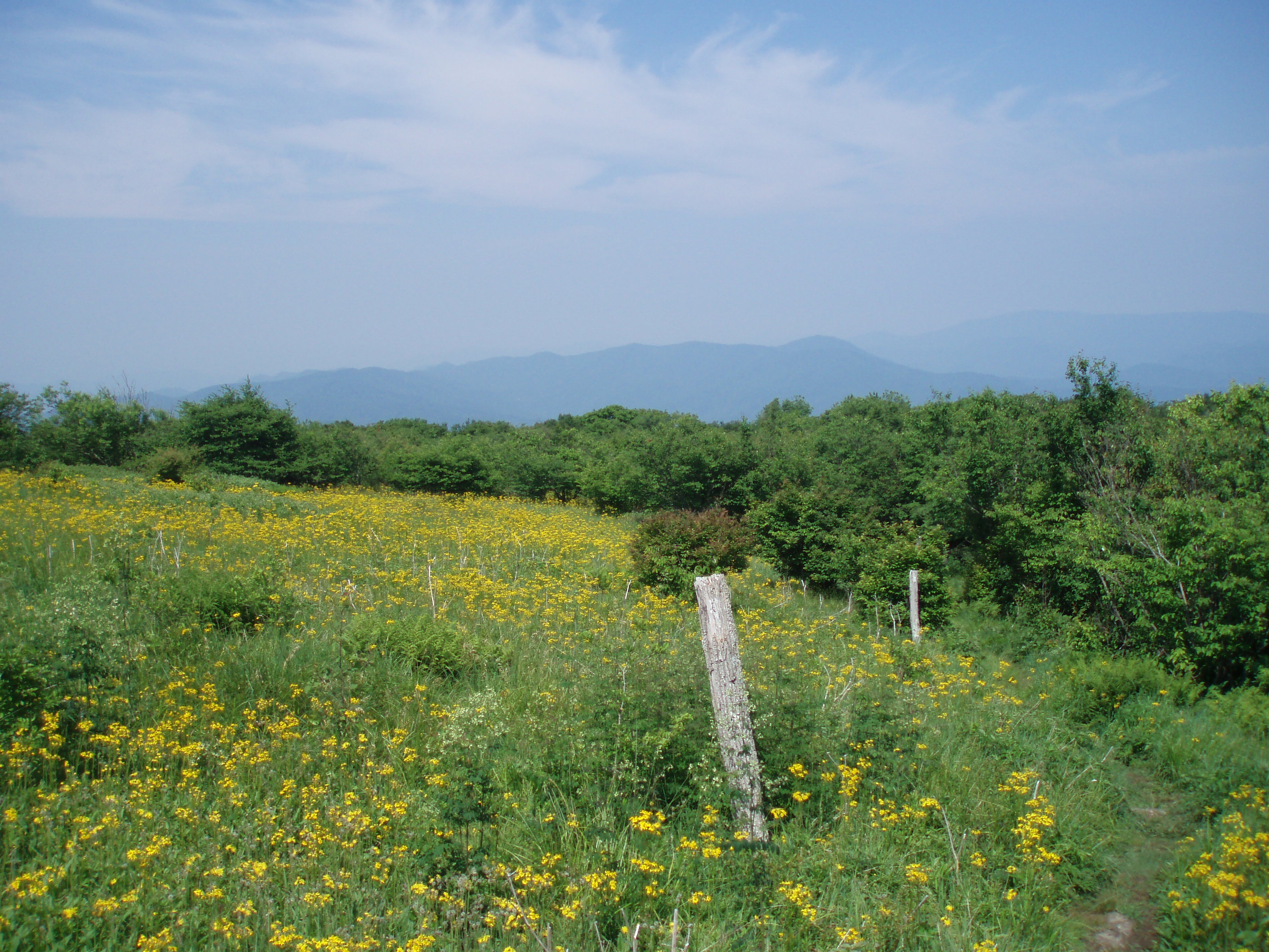 off because I had many miles
to cover. The trail
ran along the river, which is popular for rafting trips, for a ways before climbing
steeply past a viewpoint called Lover’s Leap (how many of these are
there??) back into the mountains. Near the
top of the first climb I took a side trail to the Rich Mountain Fire
Tower. The old wooden tower provided a
good vantage point for taking in the surrounding mountains, but clouds and haze
mostly obscured the view. Other than the
tower, the route for today was not particularly distinctive, with no high
peaks, views, or scenic streamside walks to attract day-hikers, so in spite of
the fact that it was a weekend I did not see many other people. I crossed two major 2-lane paved roads, one
of which was bridged by a pedestrian overpass.
Neither road was carrying much traffic when I passed over them
though. I was enjoying a solitary hike
through deep forest, later in the afternoon, when I suddenly crested a hill and
came upon a clearing that seemed to have been taken over by a large group. Tents were set up in every available space,
the picnic table was crowded with people, and the shelter appeared full. It turned out nearly the entire group, more
than 20 of them, were from a church in Indianapolis
and were traveling together. They made
room for me in the
shelter, and I wandered down to wait in a rather long line to get
water. It was very strange to be dealing
with such crowds in the backcountry, especially on a day when I had not seen
many hikers. I woke up in the middle of
the night, and when I stepped out of the shelter I noticed some movement above
me in the trees. It took me a moment to
realize that several flying squirrels were flitting around, trying to get at
the large food bag that members of the group had hung from one of the
trees. I had never seen flying squirrels
in the wild, although I know they are quite common, so I watched them for a few
minutes before returning to my sleeping bag.
off because I had many miles
to cover. The trail
ran along the river, which is popular for rafting trips, for a ways before climbing
steeply past a viewpoint called Lover’s Leap (how many of these are
there??) back into the mountains. Near the
top of the first climb I took a side trail to the Rich Mountain Fire
Tower. The old wooden tower provided a
good vantage point for taking in the surrounding mountains, but clouds and haze
mostly obscured the view. Other than the
tower, the route for today was not particularly distinctive, with no high
peaks, views, or scenic streamside walks to attract day-hikers, so in spite of
the fact that it was a weekend I did not see many other people. I crossed two major 2-lane paved roads, one
of which was bridged by a pedestrian overpass.
Neither road was carrying much traffic when I passed over them
though. I was enjoying a solitary hike
through deep forest, later in the afternoon, when I suddenly crested a hill and
came upon a clearing that seemed to have been taken over by a large group. Tents were set up in every available space,
the picnic table was crowded with people, and the shelter appeared full. It turned out nearly the entire group, more
than 20 of them, were from a church in Indianapolis
and were traveling together. They made
room for me in the
shelter, and I wandered down to wait in a rather long line to get
water. It was very strange to be dealing
with such crowds in the backcountry, especially on a day when I had not seen
many hikers. I woke up in the middle of
the night, and when I stepped out of the shelter I noticed some movement above
me in the trees. It took me a moment to
realize that several flying squirrels were flitting around, trying to get at
the large food bag that members of the group had hung from one of the
trees. I had never seen flying squirrels
in the wild, although I know they are quite common, so I watched them for a few
minutes before returning to my sleeping bag.
Sun 6/17 Little Laurel à Hogback Ridge 21.5 Elevation
profile
 In the morning I left before
the big group had much momentum. I knew
I would not see them again, since they were planning on taking 3-4 days to hike
the distance I planned to cover by tomorrow morning. The shelter had been at a relatively high
elevation, and within 1.5 miles I found another side trail to an observation
tower. This time the peak, called Camp
Creek Bald, was marred by industrial infrastructure of some sort, which was
a noisy visual intrusion. The view was
better than yesterday, however, as the weather was clearer. The next 5-6 miles were rather rugged, and
progress was slowed on the rocky trail.
Occasional views gave me a good overall sense of the local
topography. One of the rocky peaks along
the ridge was called Big Butt. I was
hoping to see an official sign declaring the name of that location, but
unfortunately there was none. Eventually
the trail dropped down to cross two roads in a farmed valley, then crossed
several streams before climbing again toward another ridge. The trail was now circling the valley where
I-26 runs from Erwin, TN
– where I would be in two days – to Ashville
NC. I soon came upon a clearing where there was a
view of the ridge opposite the highway.
I could pick out the high point on the next ridge, known as Big Bald –
it was, as the name suggests, clear of trees.
After a few more miles I reached the Hogback
Ridge Shelter, which was situated along a pleasantly wooded ridge. Two section hikers were already in
residence. Brewmaster, a retired
chemistry professor from Pennsylvania,
had some fascinating stories. True to
his trail name, he was an expert on beer and had actually taught a course in
the subject of making beer.
In the morning I left before
the big group had much momentum. I knew
I would not see them again, since they were planning on taking 3-4 days to hike
the distance I planned to cover by tomorrow morning. The shelter had been at a relatively high
elevation, and within 1.5 miles I found another side trail to an observation
tower. This time the peak, called Camp
Creek Bald, was marred by industrial infrastructure of some sort, which was
a noisy visual intrusion. The view was
better than yesterday, however, as the weather was clearer. The next 5-6 miles were rather rugged, and
progress was slowed on the rocky trail.
Occasional views gave me a good overall sense of the local
topography. One of the rocky peaks along
the ridge was called Big Butt. I was
hoping to see an official sign declaring the name of that location, but
unfortunately there was none. Eventually
the trail dropped down to cross two roads in a farmed valley, then crossed
several streams before climbing again toward another ridge. The trail was now circling the valley where
I-26 runs from Erwin, TN
– where I would be in two days – to Ashville
NC. I soon came upon a clearing where there was a
view of the ridge opposite the highway.
I could pick out the high point on the next ridge, known as Big Bald –
it was, as the name suggests, clear of trees.
After a few more miles I reached the Hogback
Ridge Shelter, which was situated along a pleasantly wooded ridge. Two section hikers were already in
residence. Brewmaster, a retired
chemistry professor from Pennsylvania,
had some fascinating stories. True to
his trail name, he was an expert on beer and had actually taught a course in
the subject of making beer.
Mon 6/18 Hogback Ridge à No Business Knob 20.6
Elevation
profile
 The following day dawned
clear and bright. I had been looking
forward to the next section of hiking, knowing that it passed over Big
Bald. Since I missed out on the
opportunity to enjoy the view from Max Patch, I viewed this as the replacement
mountain. After a few miles of easy
hiking I emerged at the top of the mountain pass (a low spot known as Sams Gap,
from the perspective of the trail) where I-26 crossed the mountains. I crossed under the highway and quickly
climbed back into the woods. The next 6
miles leading to Big Bald were an interesting mix of deep woods and grassy
meadows. One stretch of meadow reminded
me very strongly of the old fields near my parents house where my brother Mike
and I used to explore when we were kids.
I had to remind myself that I was actually above 4000’ elevation instead
of the perhaps 800’ in Grant Michigan. I
passed a group of retiree day hikers who had left a car at a gravel road a few
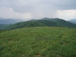
miles after the highway, and met a family group of backpackers who had likely
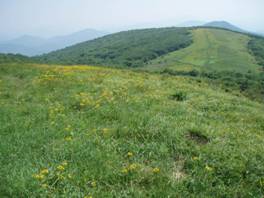
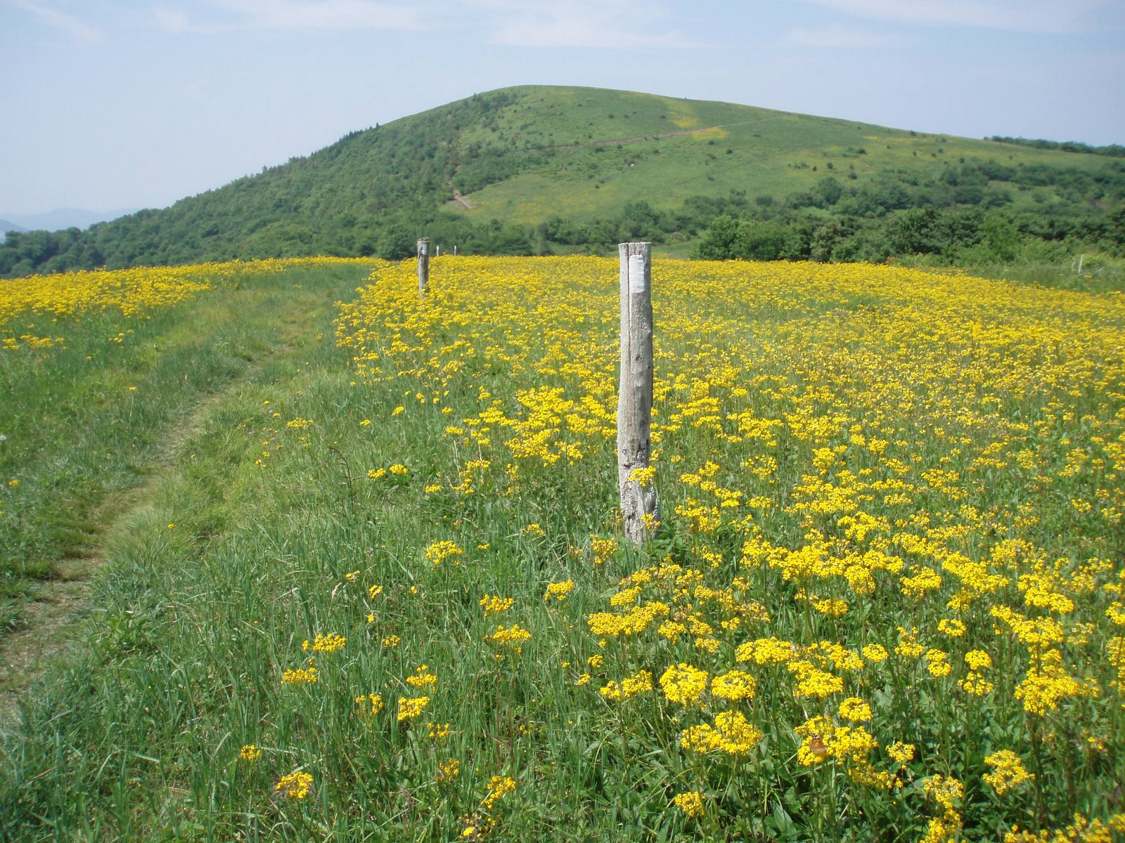
stayed at the shelter the other side of Big Bald. Soon I reached the top. The grassy
slopes approaching the peak were covered in yellow-flowered plants waving
gently in the breeze. The view on top
took in some developed area to the south – a ski resort occupies that side of
the mountain – but mostly looked out on green, forested mountains. I was fairly certain I could pick out Roan Mountain,
where I expected to end my hike in a few days.
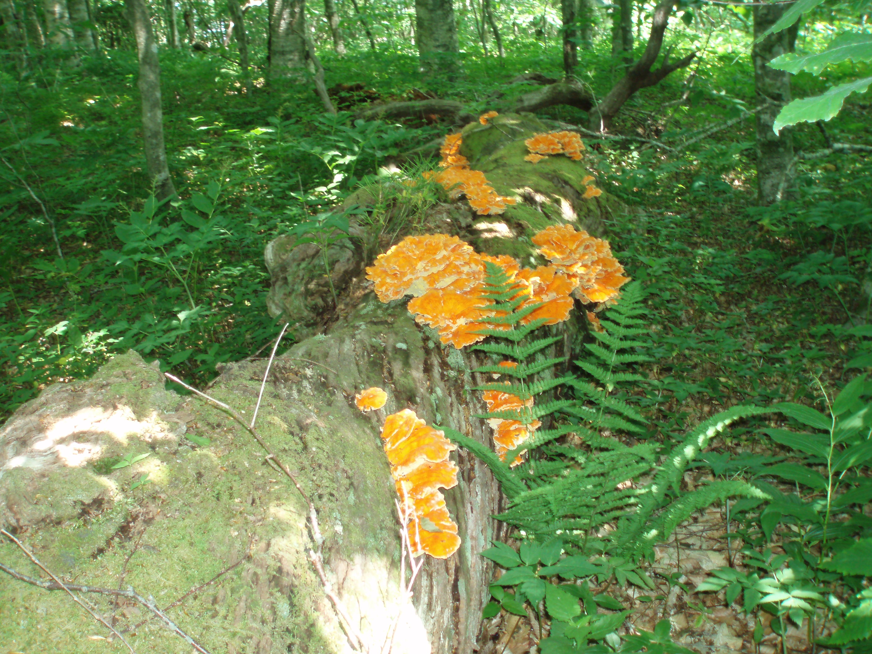
After descended from the peak, the trail followed a grassy
ridge for a ways and then entered an ancient forest in a sag between Big
and Little Balds. The forest had the
feel of Franconia Ridge in the White Mountains,
and was marked by medium-size spruce trees and mossy fallen logs, some of which
sported a brilliant orange fungus. I
took a brief break at the shelter, which was nested in this intriguing forest –
it would have been a fun place to spend the night. Soon I crossed over the wooded summit of
Little Bald and then gradually descended the ridge to cross Spivey Gap. The remaining 5 miles of hiking, leading up
to No
Business Knob Shelter, was very interesting. The trail followed the contours of the
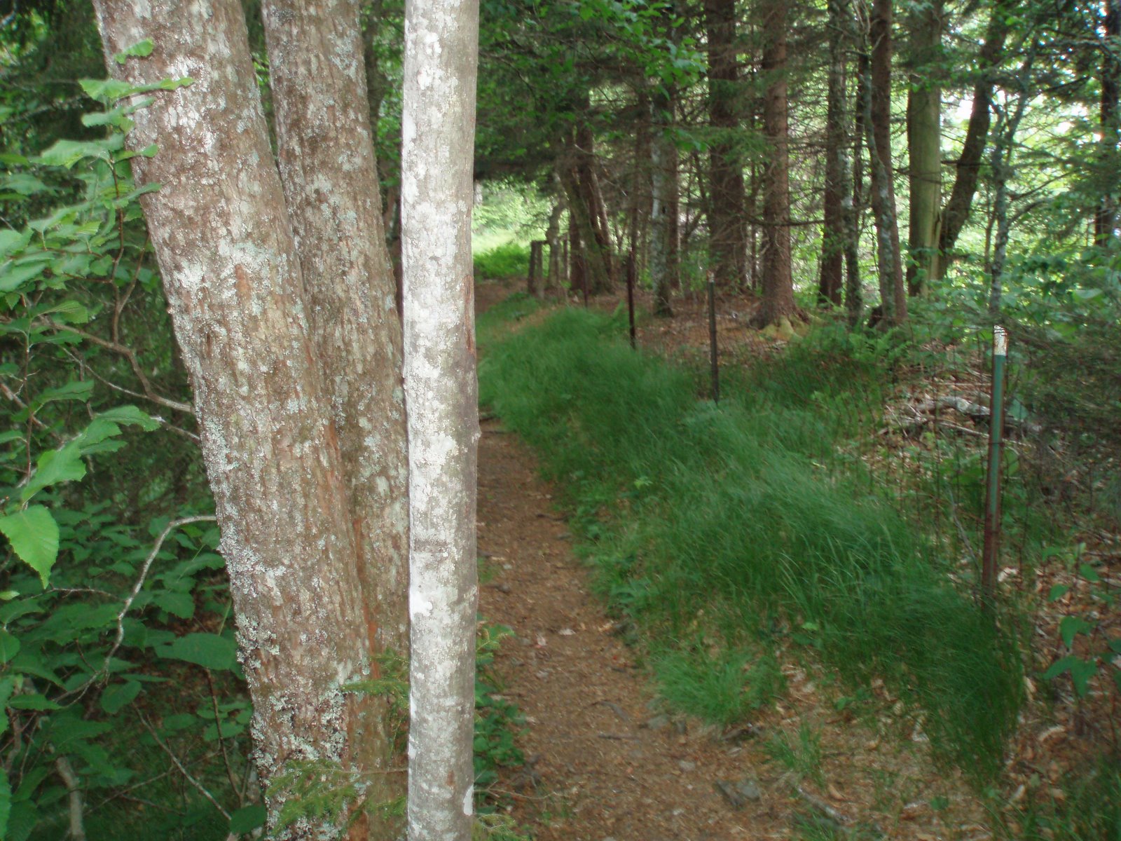
mountain as it skirted the outside edge, rather than climbing over top. The route passed through heavy rhododendron
thickets, crossing several streams, as it wound in and out along the edge of
the mountain. The register at No
Business Knob Shelter contained several recent accounts of bear sightings, so I
was careful to select a good food-hanging tree that evening. After making dinner, my post-meal musing was
disturbed by a tremendous crashing sound coming from the woods behind the
shelter. I did some exploring and soon
discovered that a large maple tree had fallen down. There was only the slightest hint of a
breeze, so it was hard to say what had triggered the fall. I could see that one side of the tree’s base
had begun to rot, which probably weakened it enough to make it fall. The maple had taken out several smaller trees
as it fell. I was glad I did not have a
tent set up beneath it.
The following day dawned
clear and bright. I had been looking
forward to the next section of hiking, knowing that it passed over Big
Bald. Since I missed out on the
opportunity to enjoy the view from Max Patch, I viewed this as the replacement
mountain. After a few miles of easy
hiking I emerged at the top of the mountain pass (a low spot known as Sams Gap,
from the perspective of the trail) where I-26 crossed the mountains. I crossed under the highway and quickly
climbed back into the woods. The next 6
miles leading to Big Bald were an interesting mix of deep woods and grassy
meadows. One stretch of meadow reminded
me very strongly of the old fields near my parents house where my brother Mike
and I used to explore when we were kids.
I had to remind myself that I was actually above 4000’ elevation instead
of the perhaps 800’ in Grant Michigan. I
passed a group of retiree day hikers who had left a car at a gravel road a few
miles after the highway, and met a family group of backpackers who had likely
stayed at the shelter the other side of Big Bald. Soon I reached the top. The grassy
slopes approaching the peak were covered in yellow-flowered plants waving
gently in the breeze. The view on top
took in some developed area to the south – a ski resort occupies that side of
the mountain – but mostly looked out on green, forested mountains. I was fairly certain I could pick out Roan Mountain,
where I expected to end my hike in a few days.
After descended from the peak, the trail followed a grassy
ridge for a ways and then entered an ancient forest in a sag between Big
and Little Balds. The forest had the
feel of Franconia Ridge in the White Mountains,
and was marked by medium-size spruce trees and mossy fallen logs, some of which
sported a brilliant orange fungus. I
took a brief break at the shelter, which was nested in this intriguing forest –
it would have been a fun place to spend the night. Soon I crossed over the wooded summit of
Little Bald and then gradually descended the ridge to cross Spivey Gap. The remaining 5 miles of hiking, leading up
to No
Business Knob Shelter, was very interesting. The trail followed the contours of the
mountain as it skirted the outside edge, rather than climbing over top. The route passed through heavy rhododendron
thickets, crossing several streams, as it wound in and out along the edge of
the mountain. The register at No
Business Knob Shelter contained several recent accounts of bear sightings, so I
was careful to select a good food-hanging tree that evening. After making dinner, my post-meal musing was
disturbed by a tremendous crashing sound coming from the woods behind the
shelter. I did some exploring and soon
discovered that a large maple tree had fallen down. There was only the slightest hint of a
breeze, so it was hard to say what had triggered the fall. I could see that one side of the tree’s base
had begun to rot, which probably weakened it enough to make it fall. The maple had taken out several smaller trees
as it fell. I was glad I did not have a
tent set up beneath it.
Tues 6/19 No Business Knob à Cherry Gap 22.7
Elevation
profile
 For this penultimate day of
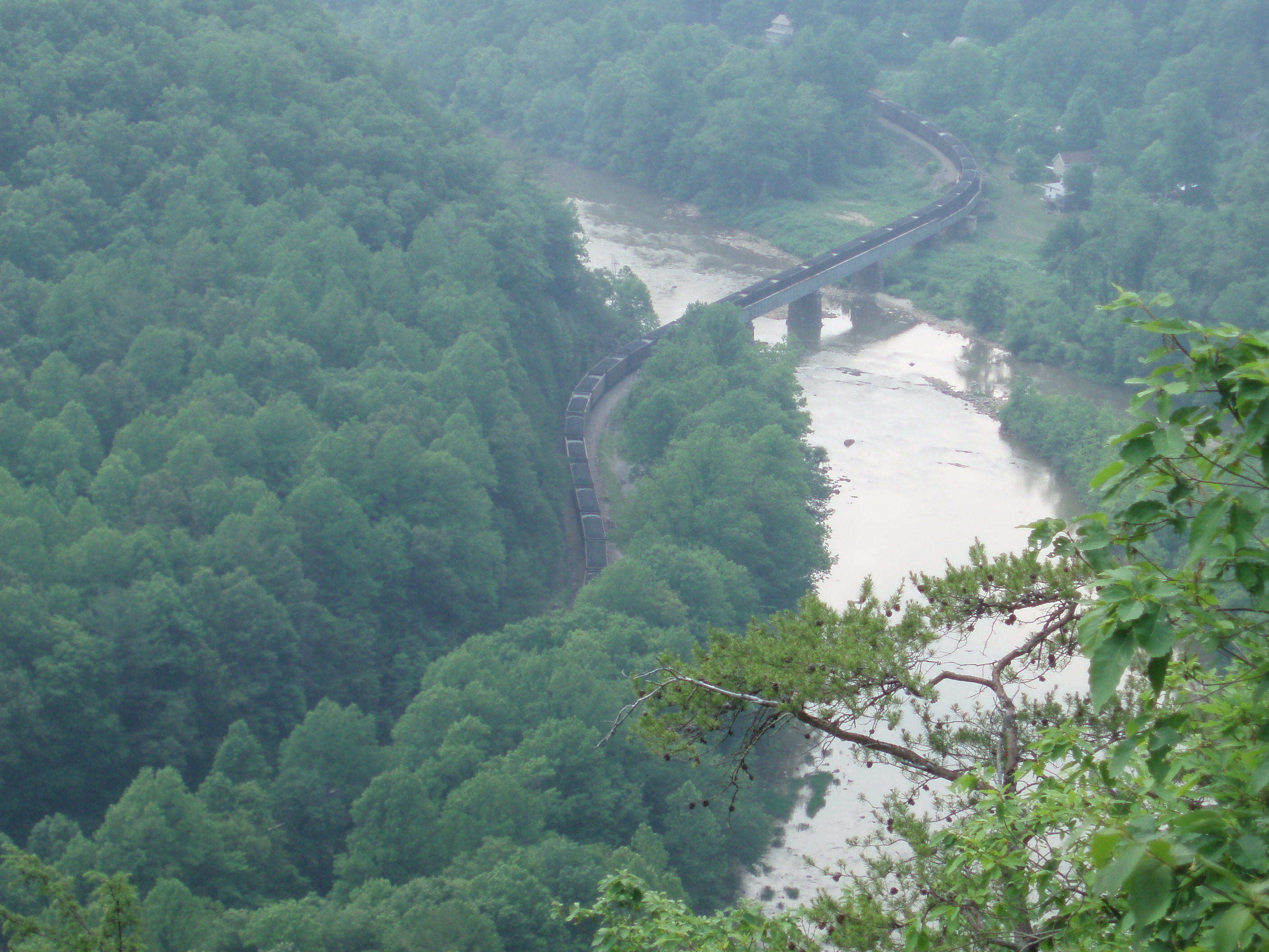
hiking I had planned my longest hike of the trip. I got an early start, and was soon striding
down a dry, pine-covered ridge with occasional views to the Nolichucky River
valley, toward which I was descending. I
heard a train whistle in the distance, and watched as an engine pulling dozens
– probably hundreds – of cars full of coal snaked along the edge of the
river. On reaching the river I took a
break at Uncle
Johnny’s Hostel, which sits right next to the trail. The hostel had several small bunkhouses, an
outfitter shop for re-supply, and provided free loaner bikes for trips to the
town of Erwin,
which lay three miles away along the river.
It would have been a nice place to stay – and in fact, a hiker I met
later that day told me he had been there for a week! The guy’s trail name was “Lazy Bones”, and it
seemed a fitting name given what he had told me. The trail crossed the wide Nolichucky,
another popular rafting river, on a road bridge, and then followed the river
for a mile or so, passing another hostel/campground before ascending into the
woods. After a long climb I reached
“Beauty Spot”, an open grassy
clearing with views of the surrounding mountains. I could hear and see a storm brewing, but the
rain was not imminent and I took advantage of the opportunity to rest and enjoy
the view. The trail re-entered the
woods for perhaps a mile, and then crossed another grassing opening. By this time the thunder had grown very
close, and rain was beginning to fall as I hurried across the open ground to
find shelter in the trees. I put the
rain cover on my pack and continued to hike – I usually don’t bother with a
rain jacket while hiking, except in colder weather – and soon began climbing Unaka Mountain. The heavens opened up, and heavy rain began
to fall – I was soon soaking wet. I
passed several other hikers on the way up, and by the time I reached the top
the rain had stopped. The 5180’ peak was
covered
with spruce trees, and it felt like I had been transported north to Maine. At the bottom of the descent I reached Cherry
Gap, where a shelter awaited. I had
time to get into dry clothes and get water for the evening before the rain
started again – it would continue for much of the night.
For this penultimate day of
hiking I had planned my longest hike of the trip. I got an early start, and was soon striding
down a dry, pine-covered ridge with occasional views to the Nolichucky River
valley, toward which I was descending. I
heard a train whistle in the distance, and watched as an engine pulling dozens
– probably hundreds – of cars full of coal snaked along the edge of the
river. On reaching the river I took a
break at Uncle
Johnny’s Hostel, which sits right next to the trail. The hostel had several small bunkhouses, an
outfitter shop for re-supply, and provided free loaner bikes for trips to the
town of Erwin,
which lay three miles away along the river.
It would have been a nice place to stay – and in fact, a hiker I met
later that day told me he had been there for a week! The guy’s trail name was “Lazy Bones”, and it
seemed a fitting name given what he had told me. The trail crossed the wide Nolichucky,
another popular rafting river, on a road bridge, and then followed the river
for a mile or so, passing another hostel/campground before ascending into the
woods. After a long climb I reached
“Beauty Spot”, an open grassy
clearing with views of the surrounding mountains. I could hear and see a storm brewing, but the
rain was not imminent and I took advantage of the opportunity to rest and enjoy
the view. The trail re-entered the
woods for perhaps a mile, and then crossed another grassing opening. By this time the thunder had grown very
close, and rain was beginning to fall as I hurried across the open ground to
find shelter in the trees. I put the
rain cover on my pack and continued to hike – I usually don’t bother with a
rain jacket while hiking, except in colder weather – and soon began climbing Unaka Mountain. The heavens opened up, and heavy rain began
to fall – I was soon soaking wet. I
passed several other hikers on the way up, and by the time I reached the top
the rain had stopped. The 5180’ peak was
covered
with spruce trees, and it felt like I had been transported north to Maine. At the bottom of the descent I reached Cherry
Gap, where a shelter awaited. I had
time to get into dry clothes and get water for the evening before the rain
started again – it would continue for much of the night.
Wed 6/20 Cherry Gap à Roan High Knob 14.5
Elevation Profile

 I awoke today with
excitement, knowing that I was about to reach my goal. I set off through wet woods that were slowly
drying out in the sun. I had been
carrying a tiny I-pod shuffle with me, but had not used it yet. I decided to listen to a lecture series that
was hosted by Church of the Servant earlier that year. A philosophy professor and a biology
professor were addressing arguments raised by Richard Dawkins in a recent book
that attacks religious belief. It was
very interesting. I also listed to music
for a while, but when I began the ascent of Roan Mountain
I shut off the music, wanting to fully enjoy the natural sounds around me as I
hiked. The climb was long and relatively
steep, although not rocky. From the low
spot at Hughes Gap, the trail ascended 2245’ in about three miles. As I neared the top, the fragrant smell of
fir trees wafted through the air, and signs of the northern forest soon again
surrounded me. The final ½ mile of trail
passes over a few rocky stretches – just to add some extra challenge, it seemed
– but I soon found myself standing at a trail sign where I had ended a section
hike two years earlier. I had completed
the entire trail! It was a great feeling
to be finished, but I had plans for the rest of the afternoon so I did not
dwell on it much. Tatiana had originally
planned to pick me up today, but she had to remain in Greenbelt to attend a meeting where the
Architectural Review Committee would examine plans for our addition. So I decided to stay in the shelter at Roan Mountain
that night, and she would arrive by noon the next day. After getting water at the nearby parking
lot, I hiked the ½ mile to the Roan
High Knob Shelter, which is the highest such structure on the entire trail
at 6285’. The shelter is an enclosed
4-sided
I awoke today with
excitement, knowing that I was about to reach my goal. I set off through wet woods that were slowly
drying out in the sun. I had been
carrying a tiny I-pod shuffle with me, but had not used it yet. I decided to listen to a lecture series that
was hosted by Church of the Servant earlier that year. A philosophy professor and a biology
professor were addressing arguments raised by Richard Dawkins in a recent book
that attacks religious belief. It was
very interesting. I also listed to music
for a while, but when I began the ascent of Roan Mountain
I shut off the music, wanting to fully enjoy the natural sounds around me as I
hiked. The climb was long and relatively
steep, although not rocky. From the low
spot at Hughes Gap, the trail ascended 2245’ in about three miles. As I neared the top, the fragrant smell of
fir trees wafted through the air, and signs of the northern forest soon again
surrounded me. The final ½ mile of trail
passes over a few rocky stretches – just to add some extra challenge, it seemed
– but I soon found myself standing at a trail sign where I had ended a section
hike two years earlier. I had completed
the entire trail! It was a great feeling
to be finished, but I had plans for the rest of the afternoon so I did not
dwell on it much. Tatiana had originally
planned to pick me up today, but she had to remain in Greenbelt to attend a meeting where the
Architectural Review Committee would examine plans for our addition. So I decided to stay in the shelter at Roan Mountain
that night, and she would arrive by noon the next day. After getting water at the nearby parking
lot, I hiked the ½ mile to the Roan
High Knob Shelter, which is the highest such structure on the entire trail
at 6285’. The shelter is an enclosed
4-sided 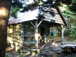 historic building that
originally served as a fire warden’s cabin.
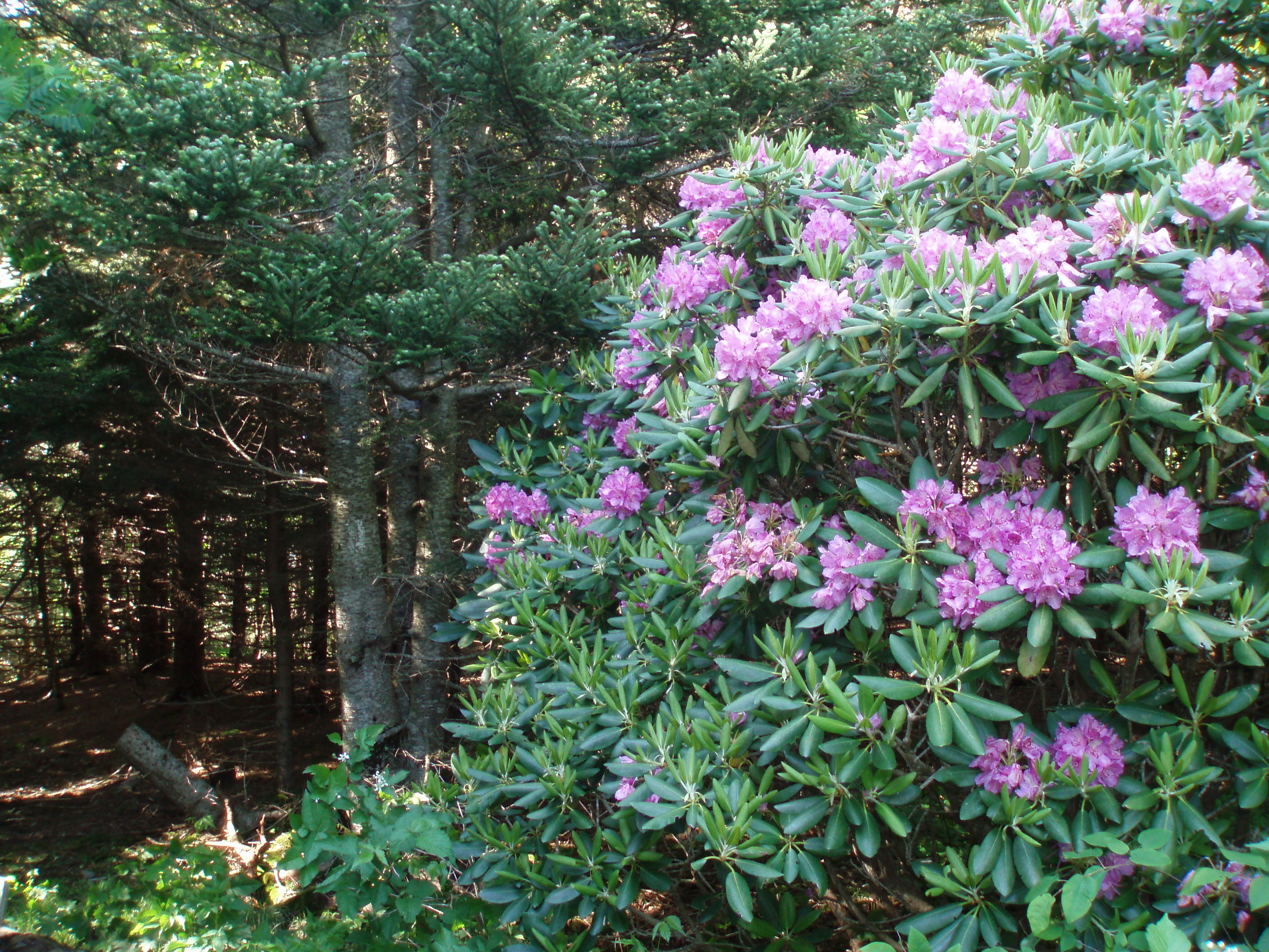
Fragrant fir and spruce, as well as a
historic building that
originally served as a fire warden’s cabin.
Fragrant fir and spruce, as well as a 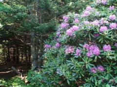 few blooming Catwaba
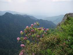
rhododendrons surrounded it. Having
plenty of time left in the day, I stashed most of my things at the shelter and
continued north on the trail, through a section that had been one of my
favorites when we hiked it in 2005. The
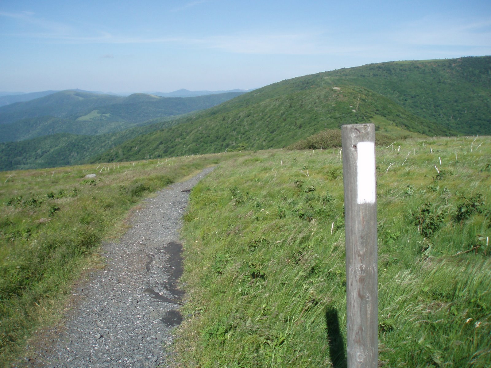
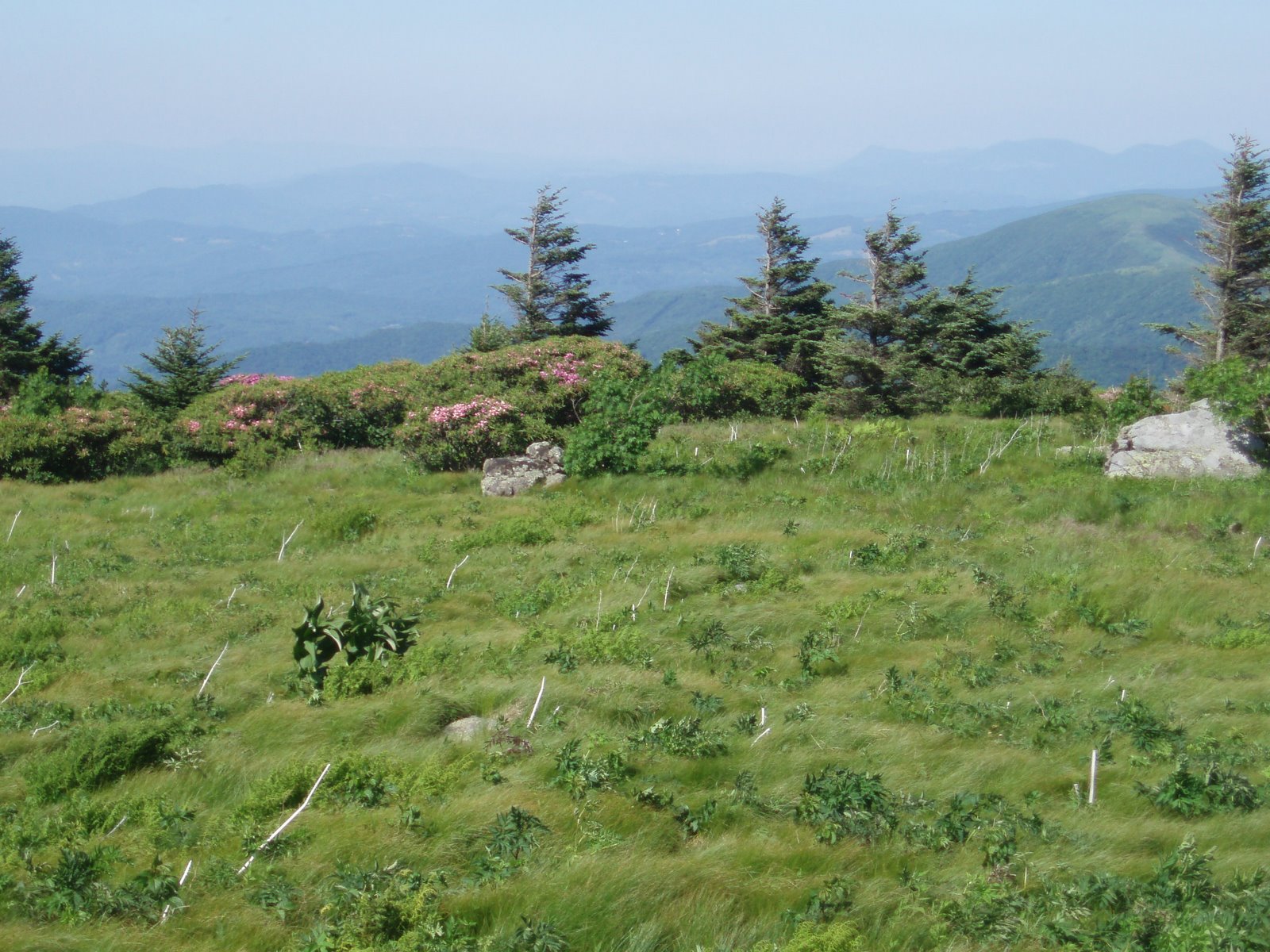
trail descends through spruce-fir forest to Carver’s Gap, then climbs along a grassy, open ridge top for several
miles. I spotted some rare
Gray’s Lily’s in bloom, and enjoyed superior vistas along the entire
route. I hiked 4 miles to grassy ridge,
a short distance off the AT, which is considered the highest natural 360-degree view near the
trail. The word “natural” eliminates
both Mount Washington (covered with numerous
buildings) and Clingman’s Dome (which has the observation tower and otherwise
would not offer a view at all, because of the trees). I could pick out many high peaks in the
distance, including Grandfather
Mountain. There were also flame azaleas in bloom.
few blooming Catwaba
rhododendrons surrounded it. Having
plenty of time left in the day, I stashed most of my things at the shelter and
continued north on the trail, through a section that had been one of my
favorites when we hiked it in 2005. The
trail descends through spruce-fir forest to Carver’s Gap, then climbs along a grassy, open ridge top for several
miles. I spotted some rare
Gray’s Lily’s in bloom, and enjoyed superior vistas along the entire
route. I hiked 4 miles to grassy ridge,
a short distance off the AT, which is considered the highest natural 360-degree view near the
trail. The word “natural” eliminates
both Mount Washington (covered with numerous
buildings) and Clingman’s Dome (which has the observation tower and otherwise
would not offer a view at all, because of the trees). I could pick out many high peaks in the
distance, including Grandfather
Mountain. There were also flame azaleas in bloom.
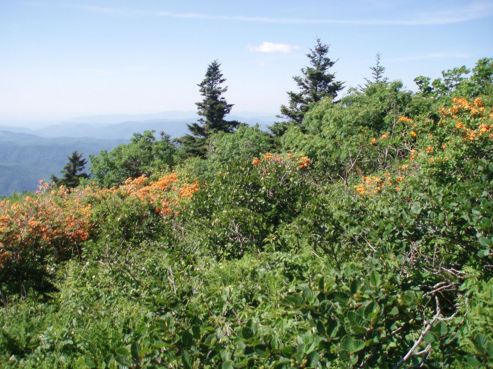
The next morning I packed up my stuff and returned to the
parking area, then hiked through the developed trail system exploring the
Catawba rhododendron gardens. The gardens
are a popular attraction, particularly at this time of year, which is the peak
time for blooming. I also followed a
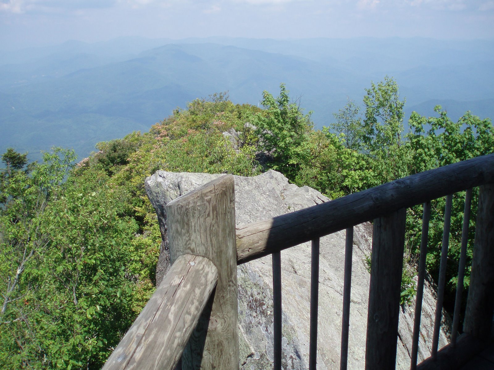
trail out to Roan High Bluff, which
offered an excellent view from the precipitous west face of the mountain.