 US 2/Gorham, NH to Katahdin 2006
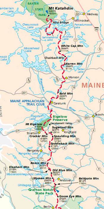
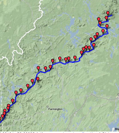
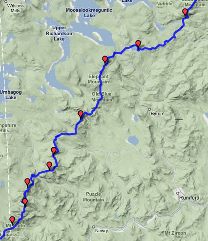
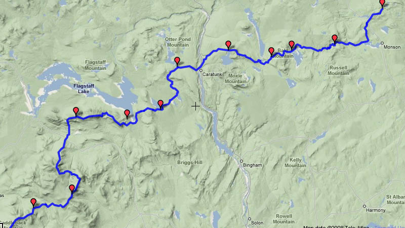
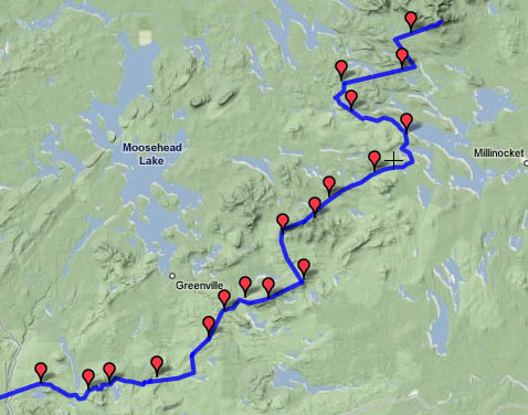
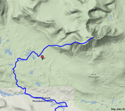
Detail maps: Maine | south
| Bigelow and Saddleback | 100 mile wilderness | Katahdin | Maine
elevation profile
Date Campsite Mileage feet climbed
Sat. 7/22 Gentian
Pond 11.8 3475
Sun 7/23 Speck
Pond 14.7 4499
Mon 7/24 Andover (Pine Ellis
B&B) 17.5 3794
Tues 7/25 Bemis Mountain
18.8 5192
Wed 7/26 Piazza
Rock 19.5 2365
Thurs 7/27 Spaulding Mountain 16.9 4085
Fri 7/28 Horns
Pond 18.6 4838
Sat 7/29 Pierce
Pond 27.5 3003
Sun 7/30 Moxie
Bald 22.8 3719
Mon 7/31 Monson
(Shaw’s) 17.9 1060
Tues 8/1 Wilson Valley
10.4 770
Wed 8/2 Chairback
Gap 15.6 3198
Thurs 8/3 Tappan
campsite (+ 5 miles Gulf Hagas) 11.7 2279
Fri 8/4 Cooper
Brook Falls 17.1 2156
Sat 8/5 Wadleigh
Stream 21.5
400
Sun 8/6 Hurd
Brook 19.6 1690
Mon 8/7 The
Birches (Baxter SP) 13.4 605
Tues 8/8 Katahdin
10 4177
The summer of 2006 was crowded with activity. We had expected to have an opportunity to
spend some time in California,
and I had made reservations to hike the John Muir Trail in
July. But then Tatiana’s job situation
changed, with a permanent position becoming available in late summer. We also took our opportunity to fly to Ukraine and travel with Mark across Russia by
train. After we returned, I flew to Colorado to see Dan and Mike and their families, and then
back to Connecticut
for Kim and Dave’s wedding. I had been
home for less than a week of total time when Tatiana dropped me off at the
Washington DC Greyhound station at 3:00am on the 21st of July. I boarded a bus bound for New York, and arrived at the giant Port
Authority Bus Terminal around 8:00am. I
had a 3 hour layover, and spent some time wandering mid-town Manhattan and visiting Grand Central
Station. Then I boarded another bus
headed for Boston. After a shorter layover at Boston’s
north station, I climbed onto the third bus of the day, headed for Gorham, New
Hampshire. My
arrival was delayed by traffic, and late that night I checked into the Hiker’s
Paradise hostel.
 I
slept in a bit to recover from the long travel time, and enjoyed a hearty
breakfast at the restaurant associated with the hostel, then got a ride from
the proprietor to the trailhead. I
headed off into the woods, and was immediately re-acquainted with the rocks and
roots of the White
Mountains. The skies were cloudy,
threatening rain. I made the initial
climb without incident, and passed a couple of view spots, looking back at the
lake created by the dam across the Androscoggin
River and the
Carter/Moriah range where I had finished my hike the previous year. A few miles later, the rain started. By the time I reached the Gentian
Pond shelter, things were quite wet.
There was still plenty of time to hike to another shelter, but I had
determined to take it easy the first day out, and the rain was not encouraging
for further travel. Within the next
hour, two pairs of thru-hikers stopped by the shelter and then pressed on. I would end up seeing all of them later as
well – two guys named Sven and Tailwind, and two women, one named Low-key and
the other whose name I don’t recall.
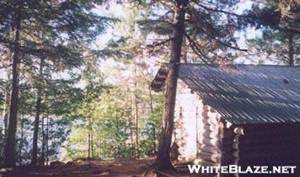
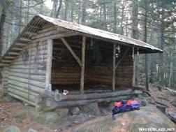
There were a couple of older guys staying in the shelter, which was in a
picturesque setting near Gentian Pond.
The pond was difficult to appreciate because of the rain, however. Around 10:00 I was awaked by the sounds of
two hikers settling into the shelter.
They had gotten a late start, and had come up one of the numerous side
trails that climbs to the main ridge followed by the AT. The side trails are difficult to access with
a vehicle, most of them starting from a poorly maintained gravel road. The hikers proceeded to get settled and cook
their dinner, so sleep was a challenge for a while. It was hard to feel too resentful of these
guys, knowing that they had hiked over rough terrain in the dark and rain, but
I was still not happy they had arrived in this late fashion.
I
slept in a bit to recover from the long travel time, and enjoyed a hearty
breakfast at the restaurant associated with the hostel, then got a ride from
the proprietor to the trailhead. I
headed off into the woods, and was immediately re-acquainted with the rocks and
roots of the White
Mountains. The skies were cloudy,
threatening rain. I made the initial
climb without incident, and passed a couple of view spots, looking back at the
lake created by the dam across the Androscoggin
River and the
Carter/Moriah range where I had finished my hike the previous year. A few miles later, the rain started. By the time I reached the Gentian
Pond shelter, things were quite wet.
There was still plenty of time to hike to another shelter, but I had
determined to take it easy the first day out, and the rain was not encouraging
for further travel. Within the next
hour, two pairs of thru-hikers stopped by the shelter and then pressed on. I would end up seeing all of them later as
well – two guys named Sven and Tailwind, and two women, one named Low-key and
the other whose name I don’t recall.
There were a couple of older guys staying in the shelter, which was in a
picturesque setting near Gentian Pond.
The pond was difficult to appreciate because of the rain, however. Around 10:00 I was awaked by the sounds of
two hikers settling into the shelter.
They had gotten a late start, and had come up one of the numerous side
trails that climbs to the main ridge followed by the AT. The side trails are difficult to access with
a vehicle, most of them starting from a poorly maintained gravel road. The hikers proceeded to get settled and cook
their dinner, so sleep was a challenge for a while. It was hard to feel too resentful of these
guys, knowing that they had hiked over rough terrain in the dark and rain, but
I was still not happy they had arrived in this late fashion.
 Conditions
were still wet and drippy when I awoke the next day. It was not raining hard, but the rocks and
roots bore the signs of wet weather. I
was hiking through the Mahoosuc
Range, with has a
reputation as one of the most challenging sections of the entire trail. The range spans 32 miles from US 2 near
Gorham to Grafton Notch in Maine. Today I crossed several high spots that were
above tree line, and probably would have offered views in better weather. I could see nothing because of the clouds,
however. After several miles of rugged
climbing, I came to a battered blue sign announcing the border crossing. The sign read “Maine – the way things out to be”. The trail continued over several more rugged
peaks, which remain indistinctive in my
Conditions
were still wet and drippy when I awoke the next day. It was not raining hard, but the rocks and
roots bore the signs of wet weather. I
was hiking through the Mahoosuc
Range, with has a
reputation as one of the most challenging sections of the entire trail. The range spans 32 miles from US 2 near
Gorham to Grafton Notch in Maine. Today I crossed several high spots that were
above tree line, and probably would have offered views in better weather. I could see nothing because of the clouds,
however. After several miles of rugged
climbing, I came to a battered blue sign announcing the border crossing. The sign read “Maine – the way things out to be”. The trail continued over several more rugged
peaks, which remain indistinctive in my 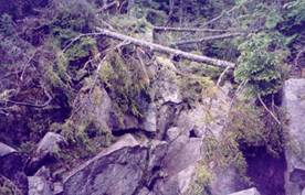 memory
because of the rainy conditions. Around
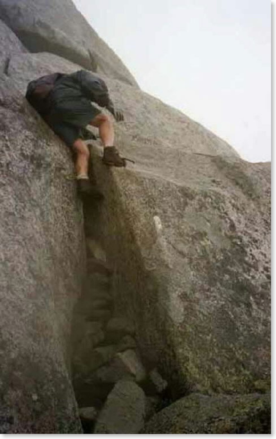
mid-day I took a break at Full Goose shelter, before descending into Mahoosuc
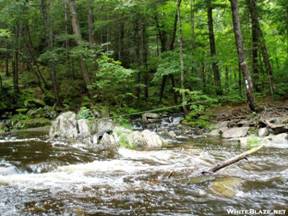
Notch. The notch is a narrow valley or
canyon between two mountains, filled with jumbled piles of large boulders. The sun rarely reaches the bottom of the
notch, and patches of ice could be seen in many crevices. The trail follows the notch for about a mile,
winding
its way over and under boulders, sometimes passing through narrow areas
that required the removal of my pack. I
think it took well over an hour to travel this mile of trail – perhaps closer
to two hours. I was thankful that the
rain had stopped and the rocks were not slippery. After completing passage of the notch, the
trail immediately ascended one of the steepest
climbs on the entire route, going up Mahoosuc Arm. The rain returned partway up the climb, and
by the time I reached the shelter at Speck
Pond things were again quite wet.
Visibility was so poor that I am not sure I even saw the pond, which is
the highest in Maine. The shelter was crowded with hikers trying to
stay dry. I spent a cold night, but was
happy to be out of the rain.
memory
because of the rainy conditions. Around
mid-day I took a break at Full Goose shelter, before descending into Mahoosuc
Notch. The notch is a narrow valley or
canyon between two mountains, filled with jumbled piles of large boulders. The sun rarely reaches the bottom of the
notch, and patches of ice could be seen in many crevices. The trail follows the notch for about a mile,
winding
its way over and under boulders, sometimes passing through narrow areas
that required the removal of my pack. I
think it took well over an hour to travel this mile of trail – perhaps closer
to two hours. I was thankful that the
rain had stopped and the rocks were not slippery. After completing passage of the notch, the
trail immediately ascended one of the steepest
climbs on the entire route, going up Mahoosuc Arm. The rain returned partway up the climb, and
by the time I reached the shelter at Speck
Pond things were again quite wet.
Visibility was so poor that I am not sure I even saw the pond, which is
the highest in Maine. The shelter was crowded with hikers trying to
stay dry. I spent a cold night, but was
happy to be out of the rain.
Mon 7/24 Andover (Pine Ellis
B&B) 17.5 Elevation
profile
 The rain cleared out overnight, but
clouds and fog still shrouded the mountains when I started out the next
day. I soon passed a side trail which
led to Old Speck, the 3rd-highest peak in Maine at 4180’. I elected to pass on the trip to the top,
figuring I would not be able to see anything.
As I began the steep descent toward Grafton Notch, the weather began to
clear. Partway down, I took in a view of
Baldpate Mountain on the other side of the
notch. Clear blue skies were in evidence
by the time I reached the bottom.
Grafton Notch is a state park, and there was a large
parking lot with a number of cars. I
took a break to dry things out a bit, but pushed on before too long. I had made arrangements to be picked up at the
trailhead near Andover
at 3:00, so I wanted to make sure I got there in time. The climb to Baldpate Mountain
was moderately challenging, and ended with a significant amount of time above
treeline. For the first time on the
trip, I could enjoy the view. After descending the mountain I crossed a
stream with a scenic cascading waterfall, Dunn Notch Falls, nearby. I arrived at the next paved road just as my
ride was arriving to pick me up. Several
miles of driving on a paved mountain road brought me to the small town of Andover, where we had
stayed after finishing last year’s hike.
I had hoped to make it to Grafton Notch the previous year, which
explains the choice of lodging locations.
The Pine Ellis B&B is really a hiker hostel, situated in an old
home. I enjoyed a relaxing afternoon of
doing laundry and relaxing. There was
only one place to eat in town, and I ended up having dinner and breakfast
there. I also picked up my next supply
of food, which would keep me going for a week.
I had started out with a 3-day supply in order to minimize the load
while hiking the rugged Mahoosuc
Range.
The rain cleared out overnight, but
clouds and fog still shrouded the mountains when I started out the next
day. I soon passed a side trail which
led to Old Speck, the 3rd-highest peak in Maine at 4180’. I elected to pass on the trip to the top,
figuring I would not be able to see anything.
As I began the steep descent toward Grafton Notch, the weather began to
clear. Partway down, I took in a view of
Baldpate Mountain on the other side of the
notch. Clear blue skies were in evidence
by the time I reached the bottom.
Grafton Notch is a state park, and there was a large
parking lot with a number of cars. I
took a break to dry things out a bit, but pushed on before too long. I had made arrangements to be picked up at the
trailhead near Andover
at 3:00, so I wanted to make sure I got there in time. The climb to Baldpate Mountain
was moderately challenging, and ended with a significant amount of time above
treeline. For the first time on the
trip, I could enjoy the view. After descending the mountain I crossed a
stream with a scenic cascading waterfall, Dunn Notch Falls, nearby. I arrived at the next paved road just as my
ride was arriving to pick me up. Several
miles of driving on a paved mountain road brought me to the small town of Andover, where we had
stayed after finishing last year’s hike.
I had hoped to make it to Grafton Notch the previous year, which
explains the choice of lodging locations.
The Pine Ellis B&B is really a hiker hostel, situated in an old
home. I enjoyed a relaxing afternoon of
doing laundry and relaxing. There was
only one place to eat in town, and I ended up having dinner and breakfast
there. I also picked up my next supply
of food, which would keep me going for a week.
I had started out with a 3-day supply in order to minimize the load
while hiking the rugged Mahoosuc
Range.
Today’s hike ended up being one of the most challenging of
the entire trip. I covered more mileage
than I had on previous days through rugged terrain, with a much heavier load of
food. The route did not look overly
challenging at first glance, since none of the climbs were up major
mountains. But there were a series of
steep ascents followed by precipitous drops, making for a difficult hike. The initial part of the hike involved a
relatively modest climb through a forest of northern hardwoods. I took a break at the Hall Mountain Shelter,
which was followed by a steep drop into Sawyer Notch where I forded a stream,
and an even steeper climb to Moody
Mountain. The elevation gain was short-lived, as the
trail soon plunged down to South
Arm Road, which also leads to Andover.
Hikers frequently stay a couple of nights in town and “slackpack”
through this section. The trail returned
to near vertical after crossing the road, ascending toward a mountain called
“Old Blue”. I was worn out when I
reached the top, but a break and a Snickers bar revived me enough to move
on. The trail passed through a section
of old growth as it skirted Elephant Mountain, then crossed several peaks of Bemis Mountain
before arriving at Bemis
Mountain Shelter. There was a guy
camping with his dog at the shelter, a local who had hiked in from the next
road and was planning to go out the same way the following day. Later in the afternoon two thru-hikers,
Fortune Cookie and Bloody Mess, arrived.
They had been staying in another hostel in Andover.
I would end up staying in the same shelter with them for several more
nights throughout the rest of my trip.
The weather was still pleasant, and we enjoyed the evening at the
campsite.
Blue skies and mild temperatures continued as I strode down
the trail the next morning. This would
be probably the least rugged section of western Maine, and I enjoyed the relatively easy
hiking. The morning involved scrambling
over several bumpy peaks of Bemis Mountain, then
a descent to a ford of Bemis Stream, followed by a climb to ME route 17.
The 2-lane paved road, like all of the roads crossed in Maine, was remote and
carried little traffic. No more passing
through interchange communities while crossing under a busy interstate highway,
or waiting for a clear spot at some of the multi-lane road crossings in the
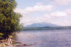
mid-Atlantic. The road afforded a view
of nearby Mooselookmeguntic
Lake. The next section of trail was a pleasant walk
past several “ponds”, which are bodies of water that would be called lakes
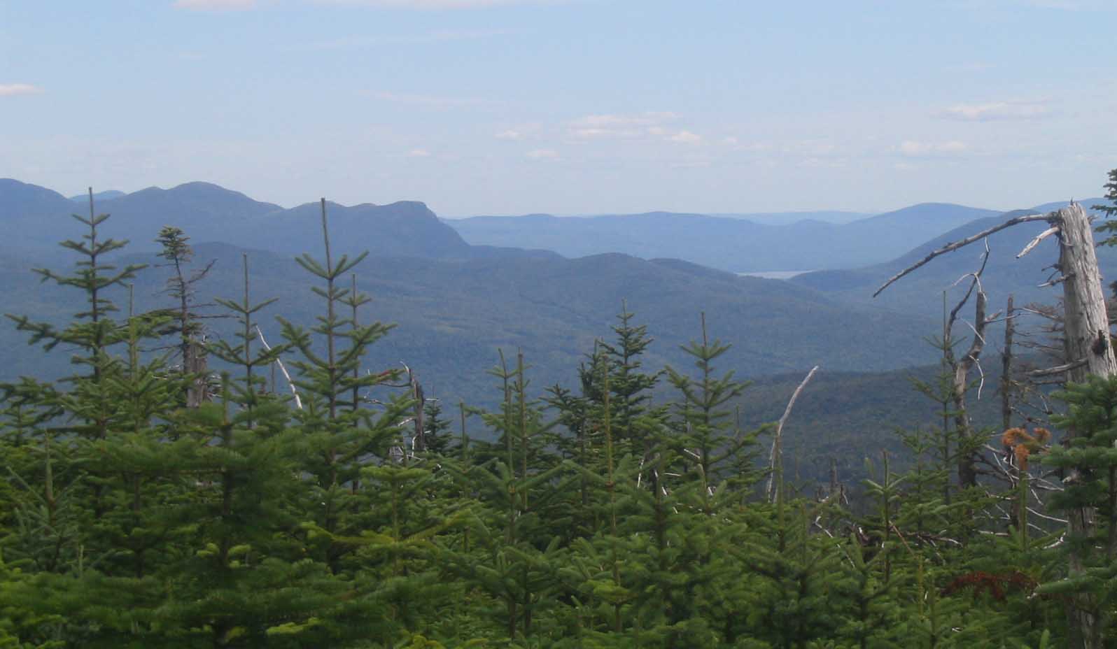
elsewhere. I went for a 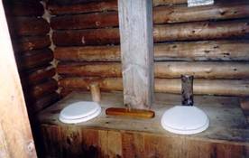 swim at Long Pond. Towards the end of the afternoon I paused at
an overlook to rest and take a photo.
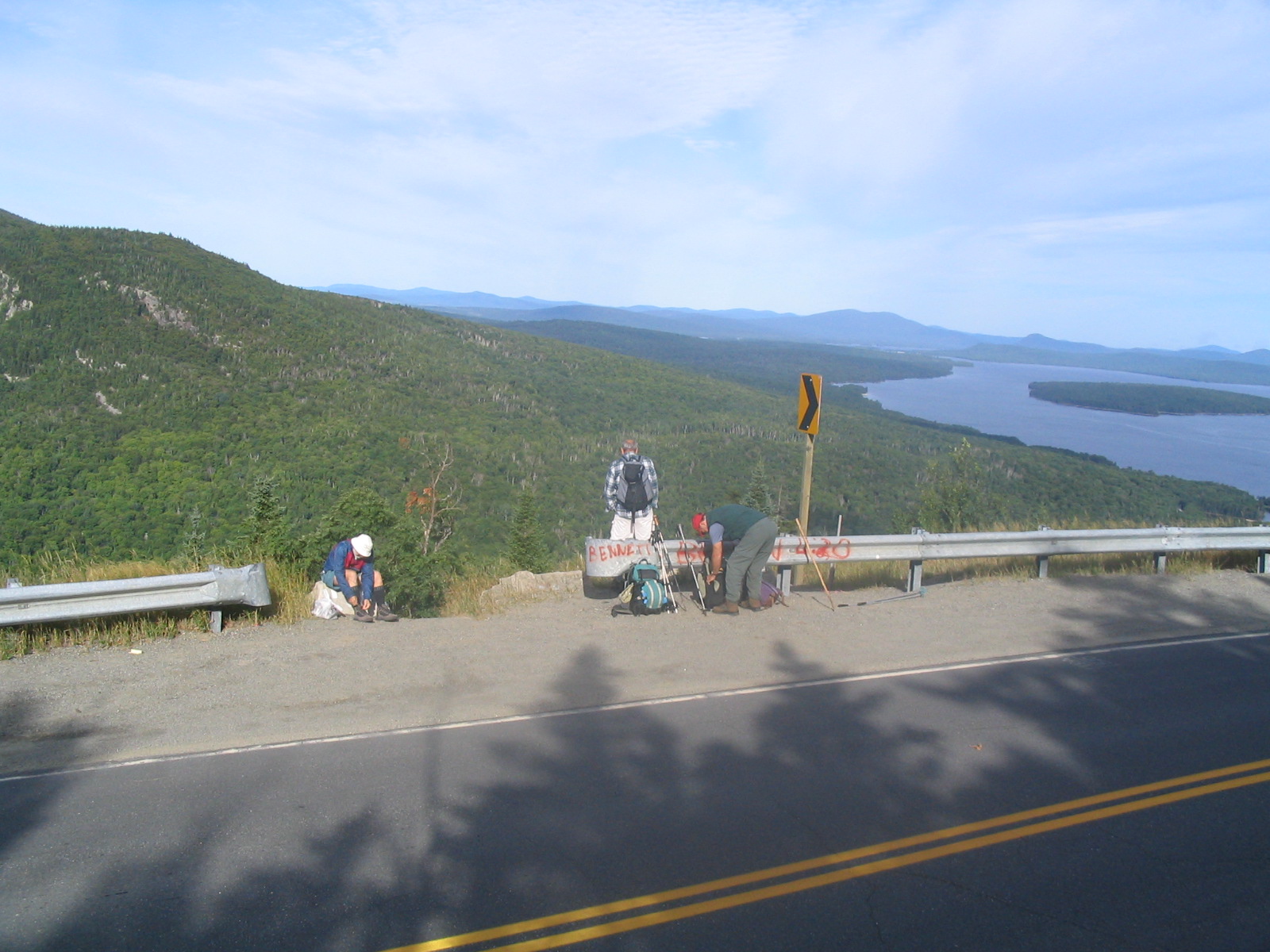
The trail continued downhill for a mile before crossing ME Route 4,
which leads to Rangley – a common re-supply town for many hikers. I paused at a stream shortly after the road
crossing to get water, when I discovered that my camera was missing. I realized almost immediately that I had
probably left it at the top of the hill, at the overlook. I left my pack and jogged back up the trail –
and found my camera sitting on a rock. I
was relieved, but also frustrated.
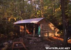
Fortunately it was a relatively easy hike the rest of the way to Piazza
Rock Shelter. The shelter was in an
interesting area. The woods had the
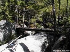
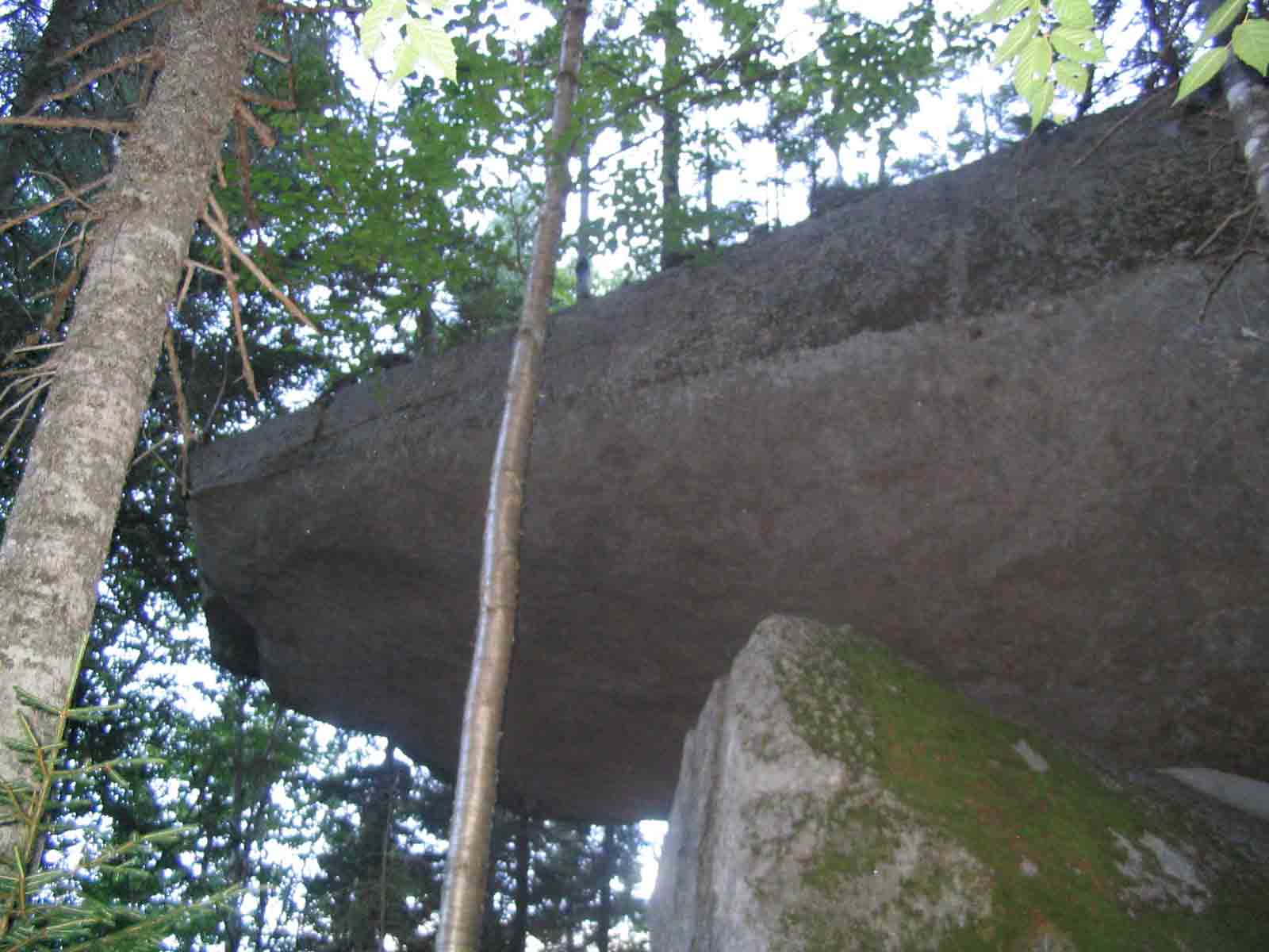
classic “North Woods” feel, with large maple and birch trees. Nearby I found a rock formation that was the
namesake for the shelter. It was a huge slab of rock cantilevered out in almost
impossible fashion from the adjacent rocky hillside. The other interesting feature was the privy,
which had two seats with a cribbage board between. Above the door was inscribed the words “Your
Move”. A group of teenage boys were
tenting near the shelter – I think they were from Quebec; the thru-hikers I had met the
previous day showed up later, but I don’t recall if anyone else stayed in the
shelter. Heavy rain moved in later in
the evening, which would become a theme for the next few days. I was glad I had rescued my camera from an
untimely end in the rain.
swim at Long Pond. Towards the end of the afternoon I paused at
an overlook to rest and take a photo.
The trail continued downhill for a mile before crossing ME Route 4,
which leads to Rangley – a common re-supply town for many hikers. I paused at a stream shortly after the road
crossing to get water, when I discovered that my camera was missing. I realized almost immediately that I had
probably left it at the top of the hill, at the overlook. I left my pack and jogged back up the trail –
and found my camera sitting on a rock. I
was relieved, but also frustrated.
Fortunately it was a relatively easy hike the rest of the way to Piazza
Rock Shelter. The shelter was in an
interesting area. The woods had the
classic “North Woods” feel, with large maple and birch trees. Nearby I found a rock formation that was the
namesake for the shelter. It was a huge slab of rock cantilevered out in almost
impossible fashion from the adjacent rocky hillside. The other interesting feature was the privy,
which had two seats with a cribbage board between. Above the door was inscribed the words “Your
Move”. A group of teenage boys were
tenting near the shelter – I think they were from Quebec; the thru-hikers I had met the
previous day showed up later, but I don’t recall if anyone else stayed in the
shelter. Heavy rain moved in later in
the evening, which would become a theme for the next few days. I was glad I had rescued my camera from an
untimely end in the rain.
Thurs 7/27 Spaulding
Mountain 16.9 Elevation
profile
 The rain cleared by morning, and hiking
conditions were good as I set off for another challenging day of hiking. The route through western Maine
vies with the White Mountains for title of
most rugged on the trail – a point that would be permanently drilled into my
head by the end of the next three days.
The immediate goal for today was Saddleback
Mountain, which is really a chain of high points that jut up above treeline
for several miles. The way up passed
Ethel Pond,
The rain cleared by morning, and hiking
conditions were good as I set off for another challenging day of hiking. The route through western Maine
vies with the White Mountains for title of
most rugged on the trail – a point that would be permanently drilled into my
head by the end of the next three days.
The immediate goal for today was Saddleback
Mountain, which is really a chain of high points that jut up above treeline
for several miles. The way up passed
Ethel Pond, 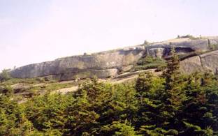 and the navigated an extremely rough and
steep stretch to the top. Bloody Mess
and Fortune were right behind me, and we took a break together at the top. I walked through the alpine zone across
uneven terrain to the Horn, which is the eastern peak on Saddleback, then
dipped down into stunted trees and back up to Saddleback Junior. By this time the skies were beginning to
cloud over. The route dropped several
thousand feet to ford Orbeton Stream, and then climbed again to reach Spaulding
Mountain Shelter. During the climb
the skies opened up and I walked the last mile or two through pouring
rain. I had been hoping to hike 2 more
miles to a side trail leading to Sugarloaf Mountain,
where hikers are permitted to stay in the unoccupied Summit House – but the
rain changed my plans. The weather also
caused me to pass on a side trail to Mt.
Abraham, which is reputed
to have good views. The shelter was
full, with a number of section hikers and southbound thru-hikers, plus a dog.
and the navigated an extremely rough and
steep stretch to the top. Bloody Mess
and Fortune were right behind me, and we took a break together at the top. I walked through the alpine zone across
uneven terrain to the Horn, which is the eastern peak on Saddleback, then
dipped down into stunted trees and back up to Saddleback Junior. By this time the skies were beginning to
cloud over. The route dropped several
thousand feet to ford Orbeton Stream, and then climbed again to reach Spaulding
Mountain Shelter. During the climb
the skies opened up and I walked the last mile or two through pouring
rain. I had been hoping to hike 2 more
miles to a side trail leading to Sugarloaf Mountain,
where hikers are permitted to stay in the unoccupied Summit House – but the
rain changed my plans. The weather also
caused me to pass on a side trail to Mt.
Abraham, which is reputed
to have good views. The shelter was
full, with a number of section hikers and southbound thru-hikers, plus a dog.
 Conditions
were still drippy and damp when I set off in the morning. It took more than an hour to climb the
rugged, rocky trail over Spaulding
Mountain and past the
trail to Sugarloaf. The skies cleared a
bit as I descended to a minor road crossed, then proceed to an assault of the very steep Crocker peaks – north and south. Another major descent ended at ME 27, which
leads to Stratton. Bloody Mess and
Fortune had hurried ahead so that they could catch a ride to town and pick up a
package. I pushed on, beginning the
ascent of the Bigelow
Range. The Bigelows
are similar to Saddleback – a mountain chain with several miles of above
timberline route along the top. The area
is protected as a state preserve. I
ascended to a viewpoint
overlooking Horns Pond, then dropped down to the shelters and campsite at Horns
Pond. This was a popular area with
multiple tent sites and three shelters.
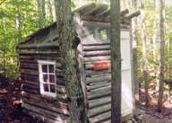
One shelter was a small historic structure adjacent to the trail; the
others were large identical shelters facing the mountain. I settled down in one of them before another
evening rainstorm hit. This time the
rain was so hard that I could barely hear the people next to me. The site had a caretaker, and he hung out and
talked to us for a while. I also
wandered over to the pond for which the site is named – a small body of water
nested into the spruce-fir forest.
Conditions
were still drippy and damp when I set off in the morning. It took more than an hour to climb the
rugged, rocky trail over Spaulding
Mountain and past the
trail to Sugarloaf. The skies cleared a
bit as I descended to a minor road crossed, then proceed to an assault of the very steep Crocker peaks – north and south. Another major descent ended at ME 27, which
leads to Stratton. Bloody Mess and
Fortune had hurried ahead so that they could catch a ride to town and pick up a
package. I pushed on, beginning the
ascent of the Bigelow
Range. The Bigelows
are similar to Saddleback – a mountain chain with several miles of above
timberline route along the top. The area
is protected as a state preserve. I
ascended to a viewpoint
overlooking Horns Pond, then dropped down to the shelters and campsite at Horns
Pond. This was a popular area with
multiple tent sites and three shelters.
One shelter was a small historic structure adjacent to the trail; the
others were large identical shelters facing the mountain. I settled down in one of them before another
evening rainstorm hit. This time the
rain was so hard that I could barely hear the people next to me. The site had a caretaker, and he hung out and
talked to us for a while. I also
wandered over to the pond for which the site is named – a small body of water
nested into the spruce-fir forest.
 I
got an early start today, knowing that I had a long hike ahead of me. I wanted to get as far as Pierce Pond, where
the next morning I could walk to the nearby Harrison Camps for breakfast. The first part of the day was challenging, as
I scrambled up another rough section of trail towards Bigelow Peak. When I reached treeline, the wind was so
fierce that I was afraid my pack cover would blow off. I was walking through a cloud and could not
see more than a few dozen feet when I passed over the west peak of Bigelow. The trail descended into the trees and
crossed a flat sag where a campsite and monument to Myron Avery were
situation. Avery, for who the east
Bigelow peak is named, was a driving force behind establishing the route of the
trail in the 1920s and 30s, and was president of the Appalachian Trail
Conference through the 50s. The wind was
still strong when I crossed Avery
Peak, but the cloud
appeared to be lifting a little. As I
descended from the top, the clouds below
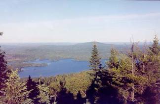
suddenly lifted and I was treated to an amazing view of the surrounding wooded
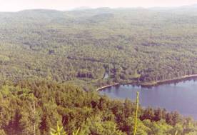
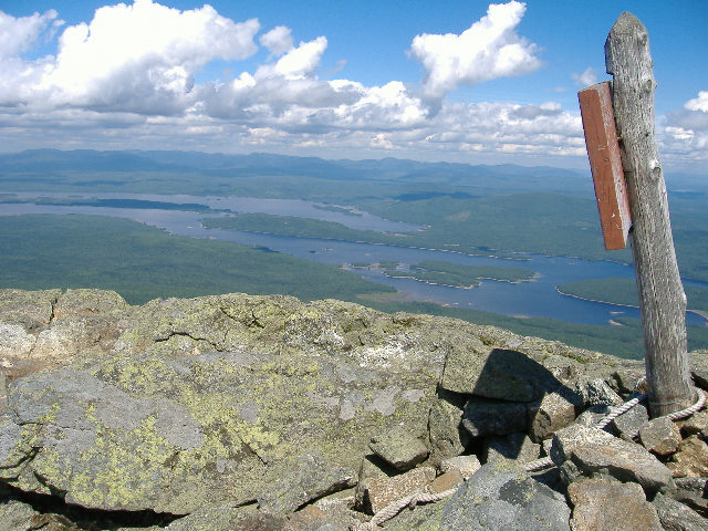
countryside, including the large, blue Flagstaff Lake. I took a break at a side trail to admire the
view, then continued a long descent, with a brief “up” again to cross Little
Bigelow, down toward Flagstaff
Lake. The next section of trail is rather easy, at
least compared to the hiking I had done for the past week, and I was able to
move along quite quickly. The route passed
several ponds, including West Carry Pond
where I took a break, and East Carry Pond where I went for a swim. Vicious mosquitoes bedeviled one short
section of trail, but otherwise the hiking was pleasant. I crossed one remote, barren paved road on
which someone had spray painted “2000 miles” – the approximate place at which
this milestone is reached for a northbound hiker starting in Georgia. In the afternoon I hiked with a guy named
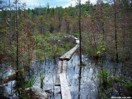
“Maine Train”, and we pushed each other to reach the shelter. We also encountered a detour around a boggy
section of trail. In the Smokies the
next year I met a guy who had ignored those detour signs and nearly got stuck
in the mud – I was glad I did not do the same.
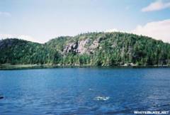
We finally reached the Pierce
Pond Shelter around 7:00pm. The
shelter was in a beautiful spot with a view
of Pierce Pond. A large group of
hikers was there, including the four I had met on my first afternoon on the
trail. The bugs were out, so I set up my
tent, and slept well that night.
I
got an early start today, knowing that I had a long hike ahead of me. I wanted to get as far as Pierce Pond, where
the next morning I could walk to the nearby Harrison Camps for breakfast. The first part of the day was challenging, as
I scrambled up another rough section of trail towards Bigelow Peak. When I reached treeline, the wind was so
fierce that I was afraid my pack cover would blow off. I was walking through a cloud and could not
see more than a few dozen feet when I passed over the west peak of Bigelow. The trail descended into the trees and
crossed a flat sag where a campsite and monument to Myron Avery were
situation. Avery, for who the east
Bigelow peak is named, was a driving force behind establishing the route of the
trail in the 1920s and 30s, and was president of the Appalachian Trail
Conference through the 50s. The wind was
still strong when I crossed Avery
Peak, but the cloud
appeared to be lifting a little. As I
descended from the top, the clouds below
suddenly lifted and I was treated to an amazing view of the surrounding wooded
countryside, including the large, blue Flagstaff Lake. I took a break at a side trail to admire the
view, then continued a long descent, with a brief “up” again to cross Little
Bigelow, down toward Flagstaff
Lake. The next section of trail is rather easy, at
least compared to the hiking I had done for the past week, and I was able to
move along quite quickly. The route passed
several ponds, including West Carry Pond
where I took a break, and East Carry Pond where I went for a swim. Vicious mosquitoes bedeviled one short
section of trail, but otherwise the hiking was pleasant. I crossed one remote, barren paved road on
which someone had spray painted “2000 miles” – the approximate place at which
this milestone is reached for a northbound hiker starting in Georgia. In the afternoon I hiked with a guy named
“Maine Train”, and we pushed each other to reach the shelter. We also encountered a detour around a boggy
section of trail. In the Smokies the
next year I met a guy who had ignored those detour signs and nearly got stuck
in the mud – I was glad I did not do the same.
We finally reached the Pierce
Pond Shelter around 7:00pm. The
shelter was in a beautiful spot with a view
of Pierce Pond. A large group of
hikers was there, including the four I had met on my first afternoon on the
trail. The bugs were out, so I set up my
tent, and slept well that night.
 Sunny, blue skies greeted the morning as
I hastened up the trail to Harrison Camps, arriving a bit late because I slept
longer than I intended to. The camp is a
rustic set of buildings with sleeping areas and a common area for relaxation
and dining. The cook served a breakfast
of blueberry pancakes with wild Maine
blueberries, which I ate gratefully.
After breakfast I set out along a scenic stretch of trail following
Pierce Pond Stream, which was marked by several cascades and rapids. The trail eventually led to the swift, wide Kennebec River, which has no
bridge. Thankfully, a local outfitter
provides shuttle services. I had to wait
as some hikers ahead of me were shuttle across, then received my ride. On the other side of the river, the trail followed
the river for a short distance, crossed US
route 201 near the tiny town of Caratunk,
then continued into the woods. The route
continued to be relatively easy, and around noon I stopped at Pleasant Pond
Leanto. A short side trail led to a lake
(Pleasant Pond), which was mostly lined by trees but also a view vacation
homes. A boat was out pulling water
skiers. I let my feet dangle in the
water from a dock for a while before moving on.
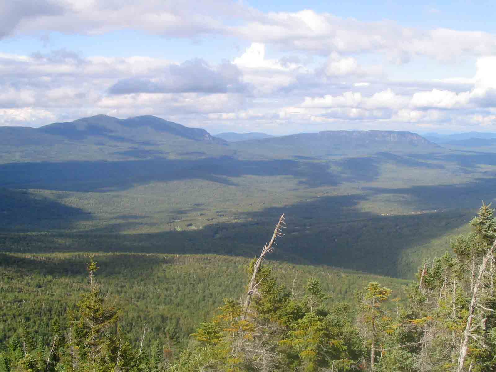
The trail next climbed Pleasant Pond Mountain, which provided a superb
view of the mountain ranges I had been climbing the past few days. After another low-lying, easy section the
trail ascended another mountain, Moxie Bald. On the way up a hiker named Fast Lane passed
me. When I reached the top, I discovered
another awesome
view, and found Fast Lane and another hiker picking ripe fruits from the
abundant blueberry bushes that topped the mountain. I decided this was an excellent idea, and
filled a Ziploc back with berries for desert.
The Moxie
Bald shelter was at the bottom of the mountain, in a scenic spot along
another lake.
Sunny, blue skies greeted the morning as
I hastened up the trail to Harrison Camps, arriving a bit late because I slept
longer than I intended to. The camp is a
rustic set of buildings with sleeping areas and a common area for relaxation
and dining. The cook served a breakfast
of blueberry pancakes with wild Maine
blueberries, which I ate gratefully.
After breakfast I set out along a scenic stretch of trail following
Pierce Pond Stream, which was marked by several cascades and rapids. The trail eventually led to the swift, wide Kennebec River, which has no
bridge. Thankfully, a local outfitter
provides shuttle services. I had to wait
as some hikers ahead of me were shuttle across, then received my ride. On the other side of the river, the trail followed
the river for a short distance, crossed US
route 201 near the tiny town of Caratunk,
then continued into the woods. The route
continued to be relatively easy, and around noon I stopped at Pleasant Pond
Leanto. A short side trail led to a lake
(Pleasant Pond), which was mostly lined by trees but also a view vacation
homes. A boat was out pulling water
skiers. I let my feet dangle in the
water from a dock for a while before moving on.
The trail next climbed Pleasant Pond Mountain, which provided a superb
view of the mountain ranges I had been climbing the past few days. After another low-lying, easy section the
trail ascended another mountain, Moxie Bald. On the way up a hiker named Fast Lane passed
me. When I reached the top, I discovered
another awesome
view, and found Fast Lane and another hiker picking ripe fruits from the
abundant blueberry bushes that topped the mountain. I decided this was an excellent idea, and
filled a Ziploc back with berries for desert.
The Moxie
Bald shelter was at the bottom of the mountain, in a scenic spot along
another lake.
I awoke to another beautiful day, and strode off into the
woods at a quick pace. I knew that this
would be an easy section of trail, and hoped to arrive in Monson by mid
afternoon so that I would have some time to enjoy the town. The route included fording two streams, one
of which was a mid-thigh level. For
several miles the trail followed the Piscatquis
River through Horseshoe
Canyon. Eventually I reached a
turnoff where an old sign, nearly grown into the tree it was fastened to,
pointed the direction to Shaw’s Boarding House.
I continued past the side trail, which was a shortcut to Monson,
deciding that I would rather hike a few more miles to the road and then be able
to start there the next day. I did not
need to wait long for a ride, and soon was in Monson,
where I got a bunk at the famous Shaw’s. I discovered it was not a good time of the
week to be in Monson, since most of the restaurants were closed on Mondays –
but I did find a place to eat. I also
called Tatiana and discovered that I would need to delay my finishing date by a
day, because she needed to attend a special orientation session for her new
job. So I re-worked my itinerary and
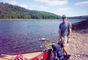
planned to take 6 days to hike the 100 mile wilderness instead of 5.
 The
breakfast
at Shaw’s was memorable. The cook
serves eggs, sausage, bacon, and pancakes, and the diners order by number: a 3,
for example, gets you three of everything.
I ordered a four, and even managed to eat some leftovers. Since there was plenty of time, I checked
email in the library and caught a ride to the trail around 11:00. The prospect of hiking
100 miles without access to re-supply points, which is daunting for many
hikers, did not concern me much. I had
hiked 142 miles between Andover
and Monson. The 10 miles to Wilson
Valley were more rugged than the past few days, but still nothing compared
to western Maine
– mostly a number of small ups and downs.
The only notable landmark was Little
Wilson Falls, an impressive 60’ cascade on a small stream. There was also a ford
of Big Wilson Stream,
and a railroad track. A few middle-aged
section hikers were at the shelter, but other than that things were pretty
quiet. Another evening rainfall began
after I had settled in, and I was once again glad to be out of the rain.
The
breakfast
at Shaw’s was memorable. The cook
serves eggs, sausage, bacon, and pancakes, and the diners order by number: a 3,
for example, gets you three of everything.
I ordered a four, and even managed to eat some leftovers. Since there was plenty of time, I checked
email in the library and caught a ride to the trail around 11:00. The prospect of hiking
100 miles without access to re-supply points, which is daunting for many
hikers, did not concern me much. I had
hiked 142 miles between Andover
and Monson. The 10 miles to Wilson
Valley were more rugged than the past few days, but still nothing compared
to western Maine
– mostly a number of small ups and downs.
The only notable landmark was Little
Wilson Falls, an impressive 60’ cascade on a small stream. There was also a ford
of Big Wilson Stream,
and a railroad track. A few middle-aged
section hikers were at the shelter, but other than that things were pretty
quiet. Another evening rainfall began
after I had settled in, and I was once again glad to be out of the rain.
 The Barren/Chairback
mountain range presents the most challenging obstacle to hikers in the 100
mile wilderness. Hiking this 12-mile
long range was like getting a little taste of the more rugged sections further
south. Although not particularly high in
elevation, the trail was very rugged, so much so that one group of scouts that
I encountered today spend the entire day traveling 7 miles between two
shelters. The route did not challenge me
to that extent, but I was tired after a 15 mile day. Toward the beginning of the range is an
excellent viewpoint at
Barren Slide, where an avalanche cleared the vegetation some years
ago. I took a lunch break at Cloud Pond,
a scenic spot surrounded by spruce trees.
Further along the ridge, numerous rocky peaks protruded from the trees,
creating a challenging route. Eventually
I reached Chairback
Gap shelter, where three other hikers had already settled in. One was a guy hiking with his dog, and the
other two were novice hikers who had driven up from Florida.
They were both college students studying to be musicians, and one had
actually brought a trumpet – he played “taps” for us in the evening. A heavy rain had started by the time the
scout group from Pennsylvania
arrived. Most of them set up tents, but
we were able to make space for a mother/wife traveling with the group and her 7
or 8 year old daughter.
The Barren/Chairback
mountain range presents the most challenging obstacle to hikers in the 100
mile wilderness. Hiking this 12-mile
long range was like getting a little taste of the more rugged sections further
south. Although not particularly high in
elevation, the trail was very rugged, so much so that one group of scouts that
I encountered today spend the entire day traveling 7 miles between two
shelters. The route did not challenge me
to that extent, but I was tired after a 15 mile day. Toward the beginning of the range is an
excellent viewpoint at
Barren Slide, where an avalanche cleared the vegetation some years
ago. I took a lunch break at Cloud Pond,
a scenic spot surrounded by spruce trees.
Further along the ridge, numerous rocky peaks protruded from the trees,
creating a challenging route. Eventually
I reached Chairback
Gap shelter, where three other hikers had already settled in. One was a guy hiking with his dog, and the
other two were novice hikers who had driven up from Florida.
They were both college students studying to be musicians, and one had
actually brought a trumpet – he played “taps” for us in the evening. A heavy rain had started by the time the
scout group from Pennsylvania
arrived. Most of them set up tents, but
we were able to make space for a mother/wife traveling with the group and her 7
or 8 year old daughter.
Thurs 8/3 Tappan campsite (+ 5 miles Gulf Hagas) 11.7
Elevation
profile
 The
next morning the rain had again cleared, and I set off through wet vegetation
and air warming in the sun. The first
part of the day included a rather steep descent from Chairback
Mountain, followed by a ford at the Pleasant River and a pleasant section of trail
owned by the Nature Conservancy called The
Hermitage. This area is fairly
easily accessible to day hikers, who simply need to pay a user fee to the
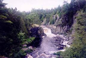
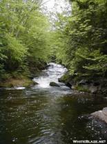
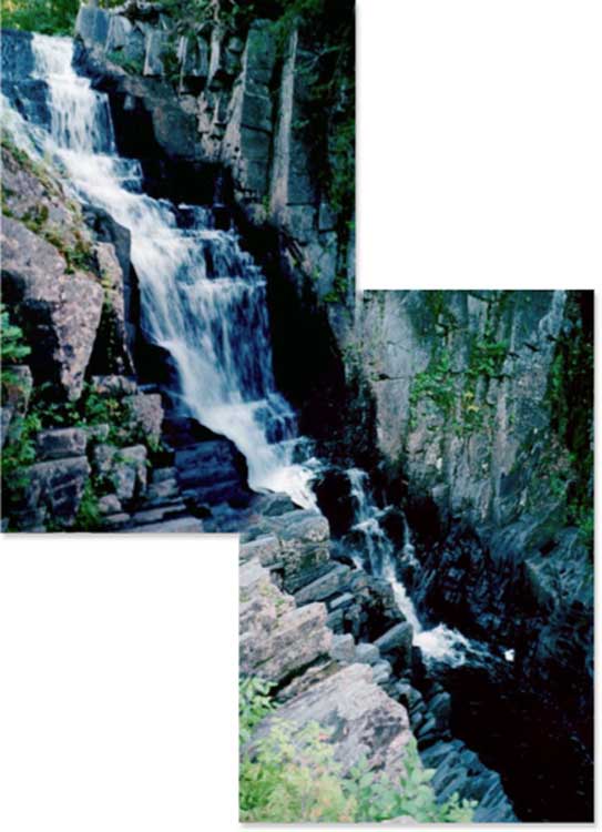
private company that owns the gravel road along the river. Soon I came to a side trail that led to the Gulf Hagas area,
where I took a 5 mile side trip. The
trail followed a rushing river that forms multiple waterfalls
as it courses over the rocky terrain.
The setting was reminiscent of the waterfalls along the North Shore of
Lake Superior in Minnesota and on the western
edge of the Porcupine Mountains in Michigan. Upon returning to the AT, I hiked up a
gradual hill to Carl Newhall Leanto. I
got water from the nearby stream, but because the weather was nice and there was
plenty of daylight left I hiked a bit further to the Tappan
campsite. The next section of trail
began ascending the Whitecap Mountain range, and I climbed Gulf Hagas Mountain before reaching the
campsite. Along the way a brief view
opened up, from which I caught a glimpse of far-off Katahdin. The campsite included a nice grassy area next
to the trail, which unfortunately was taken up by a group from a camp; I was
able to find a suitable site in the trees, however, and enjoyed a night away
from a shelter.
The
next morning the rain had again cleared, and I set off through wet vegetation
and air warming in the sun. The first
part of the day included a rather steep descent from Chairback
Mountain, followed by a ford at the Pleasant River and a pleasant section of trail
owned by the Nature Conservancy called The
Hermitage. This area is fairly
easily accessible to day hikers, who simply need to pay a user fee to the
private company that owns the gravel road along the river. Soon I came to a side trail that led to the Gulf Hagas area,
where I took a 5 mile side trip. The
trail followed a rushing river that forms multiple waterfalls
as it courses over the rocky terrain.
The setting was reminiscent of the waterfalls along the North Shore of
Lake Superior in Minnesota and on the western
edge of the Porcupine Mountains in Michigan. Upon returning to the AT, I hiked up a
gradual hill to Carl Newhall Leanto. I
got water from the nearby stream, but because the weather was nice and there was
plenty of daylight left I hiked a bit further to the Tappan
campsite. The next section of trail
began ascending the Whitecap Mountain range, and I climbed Gulf Hagas Mountain before reaching the
campsite. Along the way a brief view
opened up, from which I caught a glimpse of far-off Katahdin. The campsite included a nice grassy area next
to the trail, which unfortunately was taken up by a group from a camp; I was
able to find a suitable site in the trees, however, and enjoyed a night away
from a shelter.
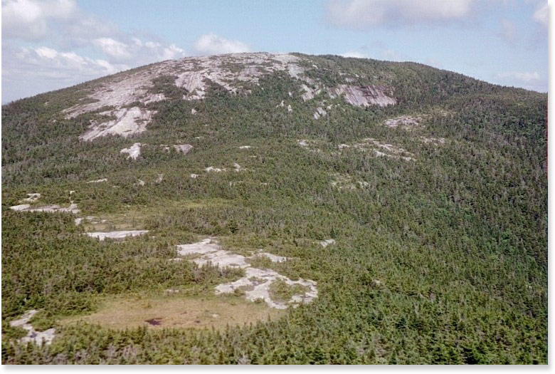
Today was another clear, sunny day – at least for most of
the time. I started by climbing over the
rest of the Whitecap range, summated 2 minor peaks before reaching Whitecap
Mountain – at 3654’ the highest point in the 100 mile wilderness. The rest of the route was relatively easy,
passing several streams and ponds. I had
hoped to go for a swim at Crawford Pond, but when I arrived around 2:00pm the
skies were darkening in the west and thunder rumbled in the distance. I made it to Cooper
Brook Falls Leanto before the rain started, and it did not last long. I still had a chance to swim – in the natural
swimming hole below the falls on Cooper Brook.
Bloody Mess and Fortune Cookie caught up to me here – I had not seen
them since my 28 mile day over Bigelow – and stayed at the shelter. There was a group from a camp tenting nearby
as well.
 I
think this was one of the best hiking days I have ever experienced. The weather was perfect, the terrain moderate
to easy, and the woods were beautiful.
After starting from the scenic campsite along Cooper Brook, after a few
hours I came to the Antlers Campsite, which is located on a peninsula in a beautiful blue lake surrounded by forest. It was a great place to enjoy a break and the
view. On returning to the trail I
discovered a privy that was designed to look like a small rustic building –
with a window, curtains, and a (non-working) sink inside. The sign labeled it as “Fort
Relief”. Later in the morning there
was a side trail to a lake with a clear view of Katahdin, and several miles of
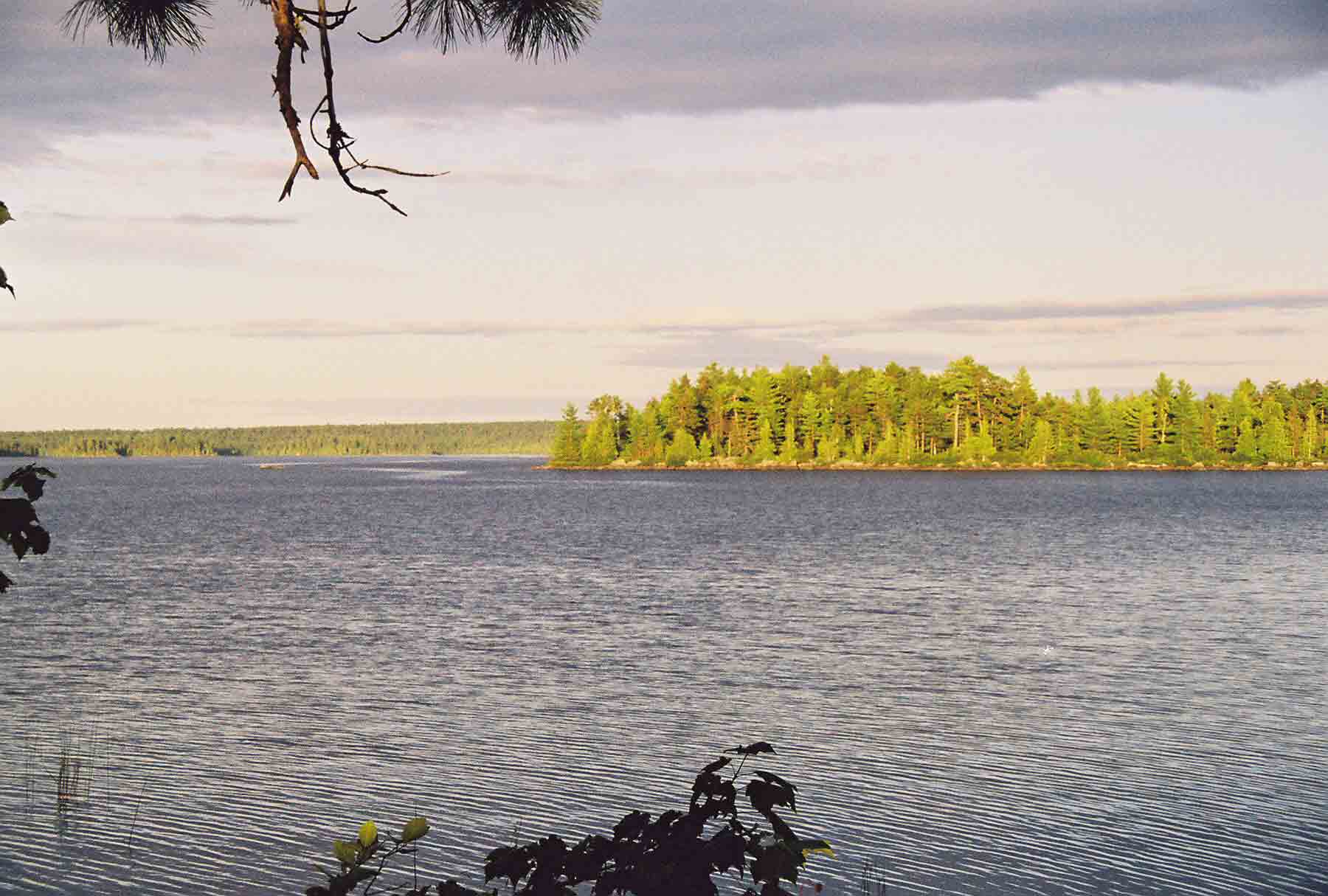
walking along the scenic, tumbling Nahmekanta Stream. In the afternoon I reached Nahmekanta Lake,
a large wilderness lake with a small drive-in campground on one end. A private camp was out of view on the far
side, several miles away. I stayed for
the night at Wadleigh
Stream Shelter, which is located in a
I
think this was one of the best hiking days I have ever experienced. The weather was perfect, the terrain moderate
to easy, and the woods were beautiful.
After starting from the scenic campsite along Cooper Brook, after a few
hours I came to the Antlers Campsite, which is located on a peninsula in a beautiful blue lake surrounded by forest. It was a great place to enjoy a break and the
view. On returning to the trail I
discovered a privy that was designed to look like a small rustic building –
with a window, curtains, and a (non-working) sink inside. The sign labeled it as “Fort
Relief”. Later in the morning there
was a side trail to a lake with a clear view of Katahdin, and several miles of
walking along the scenic, tumbling Nahmekanta Stream. In the afternoon I reached Nahmekanta Lake,
a large wilderness lake with a small drive-in campground on one end. A private camp was out of view on the far
side, several miles away. I stayed for
the night at Wadleigh
Stream Shelter, which is located in a 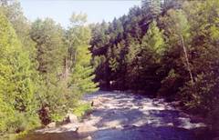 scenic wooded area along a small
stream. Fast Lane, Bloody Mess, and
Fortune Cookie were there, as well as a father-son duo I had met in Monson, and
several section hikers. The wilderness
was actually crawling with hikers, especially camp groups and section hikers
out to do just the piece from Monson to Baxter – and I now understood why: that
section of trail is very accessible to the moderately experienced
backpacker.
scenic wooded area along a small
stream. Fast Lane, Bloody Mess, and
Fortune Cookie were there, as well as a father-son duo I had met in Monson, and
several section hikers. The wilderness
was actually crawling with hikers, especially camp groups and section hikers
out to do just the piece from Monson to Baxter – and I now understood why: that
section of trail is very accessible to the moderately experienced
backpacker.
 The
hike today ranks highly on the scenic beauty scale, just like yesterday’s
ramble. The terrain and scenery were
similar, with long stretches of trail next to deep blue lakes and rushing
streams. The morning started with a
climb to a lookout
point above Nahmekanta Lake, then proceeded for several miles along Polywog
Stream, and then Rainbow
Stream, where a shelter was tucked into a neat spot next to the water. The trail then followed Rainbow Lake
for several miles before climbing to Rainbow
Ledges. The Ledges were covered with
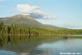
blueberries, and I took time to collect some to eat with dinner. Katahdin was also clearly in view, looming
over the scene. After a while I
reluctantly moved on, eventually crossing the boulder-strewn
Hurd Brook and arriving at the shelter with the same name. This is the northernmost
official shelter on the trail (not counting the campsites in Baxter State
Park), and many through-hikers write sentimental
final entries in the journal there. The
book was full, so I did not write anything.
I was surprised, however, to read a brief note from Bloody Mess,
scrawled onto the back of the notebook.
She and Fortune Cookie had started hiking around 5:00, and the note
indicated they intended to climb Katahdin tomorrow – which meant they were
probably hiking into Baxter yet today. I
guess they just wanted to finish the hike.
My other companions from the previous night all showed up in due course,
and we enjoyed a relaxing and beautiful evening.
The
hike today ranks highly on the scenic beauty scale, just like yesterday’s
ramble. The terrain and scenery were
similar, with long stretches of trail next to deep blue lakes and rushing
streams. The morning started with a
climb to a lookout
point above Nahmekanta Lake, then proceeded for several miles along Polywog
Stream, and then Rainbow
Stream, where a shelter was tucked into a neat spot next to the water. The trail then followed Rainbow Lake
for several miles before climbing to Rainbow
Ledges. The Ledges were covered with
blueberries, and I took time to collect some to eat with dinner. Katahdin was also clearly in view, looming
over the scene. After a while I
reluctantly moved on, eventually crossing the boulder-strewn
Hurd Brook and arriving at the shelter with the same name. This is the northernmost
official shelter on the trail (not counting the campsites in Baxter State
Park), and many through-hikers write sentimental
final entries in the journal there. The
book was full, so I did not write anything.
I was surprised, however, to read a brief note from Bloody Mess,
scrawled onto the back of the notebook.
She and Fortune Cookie had started hiking around 5:00, and the note
indicated they intended to climb Katahdin tomorrow – which meant they were
probably hiking into Baxter yet today. I
guess they just wanted to finish the hike.
My other companions from the previous night all showed up in due course,
and we enjoyed a relaxing and beautiful evening.
Mon 8/7 The Birches (Baxter SP) 13.4 Elevation
profile
I took my time getting going as I left Hurd Brook, knowing
that the day ahead would present an easy hike.
I strolled the remaining 4 miles to the northern boundary of the 100
mile wilderness, which ends at a paved road primarily used by logging
trucks. A pedestrian zone on the road
bridge provided a way to cross the swift, wide Penobscot
River. I stopped at the small
camp store associated with Abol
Bridge campground, and
got a breakfast sandwich and a few other snacks, to tide me over until tomorrow
afternoon. The trail took a sharp left
beyond the store, and followed a straight corridor along the river, soon
reaching an information
board where hikers can sign up for a site at the Birches campground in Baxter State Park. I was the first northbound hiker to sign up
for the day, so now I could take my time getting to the campground. After a few more miles, the trail turned
right to follow Nesowadnehunk Stream, which tumbles down out of the park. Along the route are two waterfalls, named Big
and Little Niagara. Tatiana and I had
hiked to here from Daicy Pond on our honeymoon.
I short time later I arrived at Daicy Pond, which was a recreational camp
before being incorporated into the state park.
Rustic cabins provide accommodations near the pond, which is a typical Maine lake surrounded by
forest. In the center of the camp, on
the water, is another rustic building that serves as the library – housing lots
of old books on natural historic as well as general fiction, and board games
and other rainy-weather activities. I
found a comfortable chair on the porch, with a view toward the lake and
Katahdin, and found a book to read.
While the weather was still clear, the mountain was wreathed in
clouds. I spent a couple of hours
reading. Eventually Fast Lane showed up,
and I decided to hike with him to the Birches campsite. The campsite is located a few hundred yards
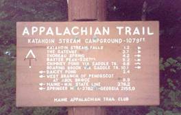
from the Katahdin Stream Campground, which is open to the general public. I checked
in with a ranger and set up camp in one of the 2-person
shelters at the site. There were two
other guys there – southbounders who planned to start hiking the next day, and
had received permission to camp there because there were not many northbound
hikers around yet. Fast Lane got picked
up at the park by his sister, and planned to return the next day for the climb;
the guys from Boston
had a reserved site in the regular campground.
An older guy from West
Virginia named Huff, who I had seen off and on for
the past week, showed up at the Birches later in the afternoon.
I was eager to start my climb today, although the mountain
was still clouded over in the morning. I
delayed a little, but eventually got on the trail around 8:00, hoping that the
weather would eventually clear. I had
climbed Katahdin with Tatiana in 2003 on our honeymoon, but we climbed from the
other side, using the Cathedral Trail.
The AT follows a route known as the Hunt Trail up the south side of the
mountain. The first part of the trail
was moderately steep, passing through spruce and northern hardwood forest. After a mile I reached Katahdin
Stream Falls, and impressive waterfall that serves as a destination for
some less ambitious hikers. After
crossing the stream (which was a bit tricky because trail crew workers were
installing a new bridge), the trail ascended more steeply through forest that
rapidly turned to pure spruce. The trees
got shorter, and eventually stopped altogether as I came to a rugged pitch that resembled a boulder field on a
vertical slope. The climbing
was difficult, but I did not have a good sense of the surrounding landscape
because I was 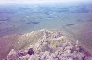 climbing
through a cloud. I did not see anyone
else as I hiked. After hoisting myself
up many
steep and high rocks, I eventually reached The Gateway, a pair of large
rocks that mark the transition to more level ground approaching the
summit. Above that point is a vast
“table land” of rock, with scattered rare alpine plants and many temporary
ponds or puddles formed by the rains.
About a mile from the summit I passed the Thoreau Spring, named for the
famous author who journeyed here in the 1840s.
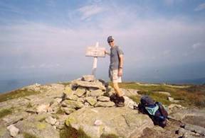
Eventually I found myself standing at the top. Two other hikers were there, day hikers who
had come up a different trail. They soon
moved on, and I hung around for a couple of hours, enjoying being on top of the
world. For at least 30 minutes I was
alone on top of Katahdin. The peak was
still covered in a cloud, but I could see that things were beginning to break
up, as views of the land below or the knife edge ridgeline to the northeast
would briefly come into view, only to be swallowed up again in white foggy
moisture. Other hikers started arriving,
including Sven and Tailwind, two of the hikers I met on my first day of the
trip. It felt good to know that I had
kept pace, over the course of several weeks, with hikers who were conditioned
from being on the trail since Georgia. Finally, I decided it was time to return
down. As I made my way across the
tableland and down the steep, rocky descent, I encountered several of the other
hikers I had seen over the course of the past few days, including Fastlane and
his sister, and the faster and son from Boston. As I climbed down the exposed ridgeline the
clouds cleared completely, and I enjoyed a suburb view of the lake and stream
filled countryside I had hiked through during the past week. Seeing how exposed the ridge was made me
somewhat glad it had been cloudy on the way up!
When I reached the bottom, I hung out in one of the small
picnic shelters while waiting for Tatiana.
Because of the work schedule change, she had starting driving from DC
early that morning, so it was quite a feat to make it all the way to
Baxter. We stayed at a B&B an hour
or two south, after a hearty dinner at Friendly’s, and drove the rest of the
way home the next day.
climbing
through a cloud. I did not see anyone
else as I hiked. After hoisting myself
up many
steep and high rocks, I eventually reached The Gateway, a pair of large
rocks that mark the transition to more level ground approaching the
summit. Above that point is a vast
“table land” of rock, with scattered rare alpine plants and many temporary
ponds or puddles formed by the rains.
About a mile from the summit I passed the Thoreau Spring, named for the
famous author who journeyed here in the 1840s.
Eventually I found myself standing at the top. Two other hikers were there, day hikers who
had come up a different trail. They soon
moved on, and I hung around for a couple of hours, enjoying being on top of the
world. For at least 30 minutes I was
alone on top of Katahdin. The peak was
still covered in a cloud, but I could see that things were beginning to break
up, as views of the land below or the knife edge ridgeline to the northeast
would briefly come into view, only to be swallowed up again in white foggy
moisture. Other hikers started arriving,
including Sven and Tailwind, two of the hikers I met on my first day of the
trip. It felt good to know that I had
kept pace, over the course of several weeks, with hikers who were conditioned
from being on the trail since Georgia. Finally, I decided it was time to return
down. As I made my way across the
tableland and down the steep, rocky descent, I encountered several of the other
hikers I had seen over the course of the past few days, including Fastlane and
his sister, and the faster and son from Boston. As I climbed down the exposed ridgeline the
clouds cleared completely, and I enjoyed a suburb view of the lake and stream
filled countryside I had hiked through during the past week. Seeing how exposed the ridge was made me
somewhat glad it had been cloudy on the way up!
When I reached the bottom, I hung out in one of the small
picnic shelters while waiting for Tatiana.
Because of the work schedule change, she had starting driving from DC
early that morning, so it was quite a feat to make it all the way to
Baxter. We stayed at a B&B an hour
or two south, after a hearty dinner at Friendly’s, and drove the rest of the
way home the next day.