 Harriman State Park
to Manchester,
VT 2004
Harriman State Park
to Manchester,
VT 2004
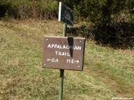
Starting point: Arden
Valley Rd, near route 17, Harriman State Park
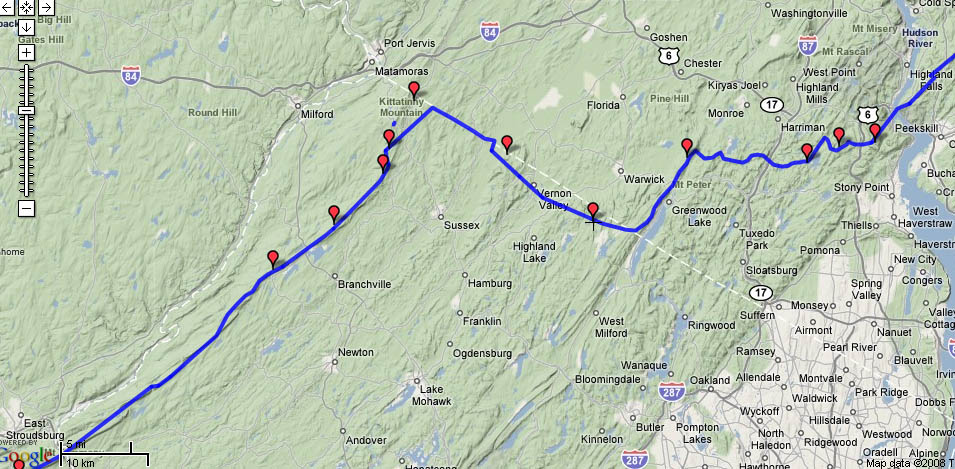
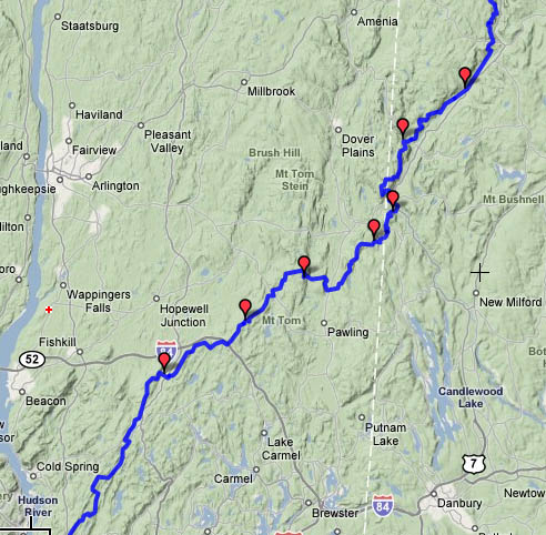
Maps of route: Harriman State Park | New York and Connecticut | Massachusetts | Elevation
profile
Date Campsite Mileage feet climbed
Sat. 7/10 West
Mt. Shelter 13.4 2121
Sun 7/11 Graymoor
Friary (campsite) 12.5 1731
Mon 7/12 RPH
Shelter 18.9 1682
Tues 7/13 Telephone
Pioneers shelter 16.6 1604
Wed 7/14 Mt. Algo shelter
21.4 2095
Thurs 7/15 Pine
Swamp Brook shelter 17.3 2510
Fri 7/16 Riga Shelter 20.2 2693
Sat 7/17 Tom
Leonard Shelter 24.1 3718
Sun 7/18 Upper
Goose Pond Cabin 21.6 2080
Mon 7/19 Kay
Wood Shelter 17.6 1535
Tues 7/20 Mt. Greylock
hostel 20.0 3371
Wed 7/21 Congdon
Shelter 20.4 3040
Thurs 7/22 Kid
Gore Shelter 18.7 3093
Fri 7/23 Stratton
Pond Shelter 15.1 1641
Sat 7/24 Route
30 10.4 235
 This was my first
backpacking trip of longer than 5 days.
I had done several 4-5 day trips in the Rockies
before we were married. I was nervous
about how the trip would go, because of my aborted trip the previous summer and
several recent trips during which I had been sick on the second day of the
hike. But I wanted to give it a shot
anyway. Tatiana drove me up to the Elk
Pen parking area near route 17,
were we had started the backpacking trip earlier that summer. We had not yet moved to Greenbelt, so it was a relatively short drive
of about 3 hours. I carried a week’s
worth of food in my pack, and had sent a box of food to the post office in Falls Village, CT. I started off on a rather warm, sunny
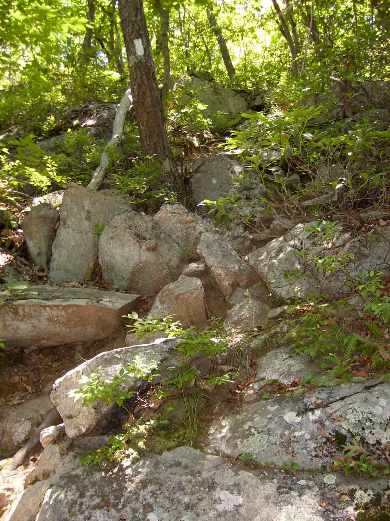
morning, hiking through Harriman State
Park. Within a few hours I passed
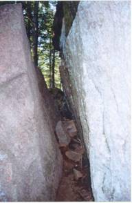
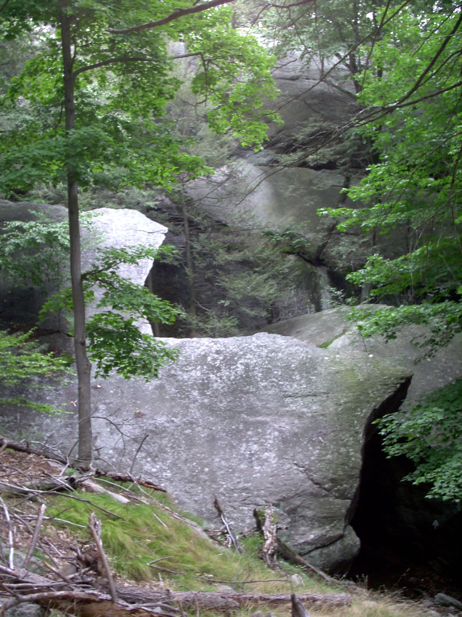
through a spot known as the “Lemon
Squeezer”, because the trail narrows
to less than 2 feet between
two large rocks. I had to maneuver
my pack and hoist myself a bit to get through.
The harder part was actually a high rock wall that follows the narrow
spot. The terrain
This was my first
backpacking trip of longer than 5 days.
I had done several 4-5 day trips in the Rockies
before we were married. I was nervous
about how the trip would go, because of my aborted trip the previous summer and
several recent trips during which I had been sick on the second day of the
hike. But I wanted to give it a shot
anyway. Tatiana drove me up to the Elk
Pen parking area near route 17,
were we had started the backpacking trip earlier that summer. We had not yet moved to Greenbelt, so it was a relatively short drive
of about 3 hours. I carried a week’s
worth of food in my pack, and had sent a box of food to the post office in Falls Village, CT. I started off on a rather warm, sunny
morning, hiking through Harriman State
Park. Within a few hours I passed
through a spot known as the “Lemon
Squeezer”, because the trail narrows
to less than 2 feet between
two large rocks. I had to maneuver
my pack and hoist myself a bit to get through.
The harder part was actually a high rock wall that follows the narrow
spot. The terrain  was quite interesting
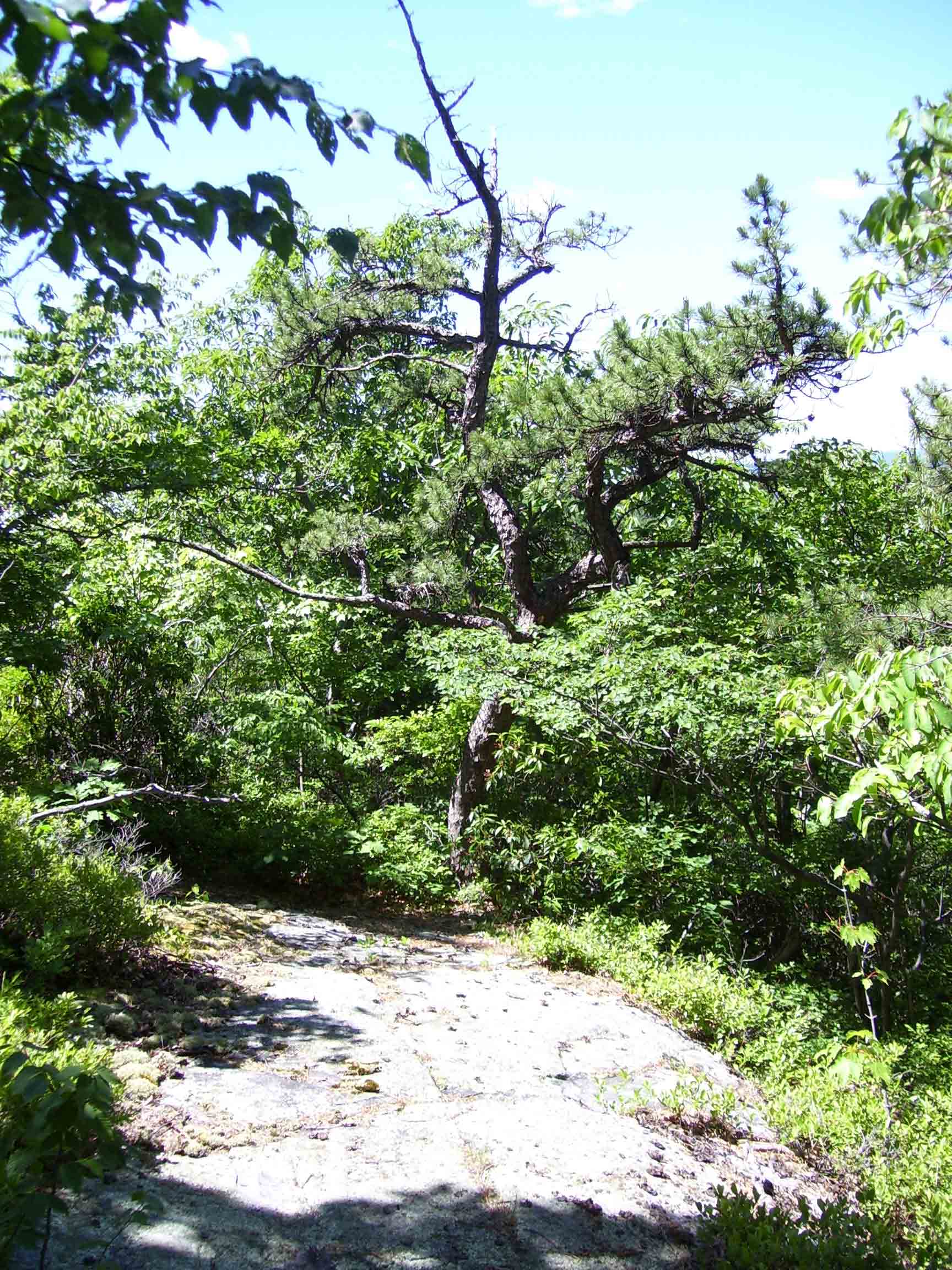
– lots of grassy undergrowth and rock outcroppings, with very gently sloping
terrain. The forests appeared a bit scraggly;
there were mostly oak trees, I
think but they were not very large trees.
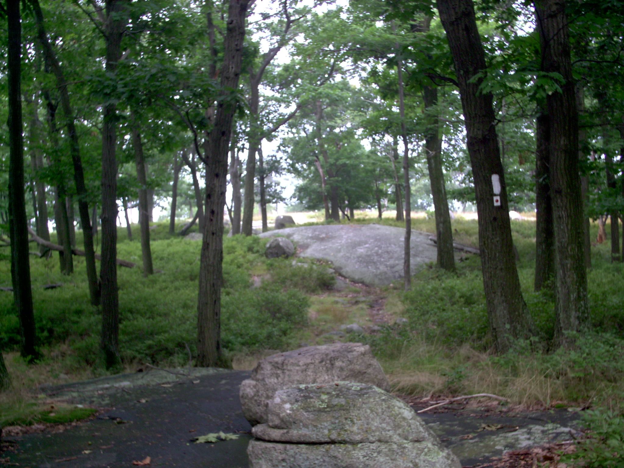
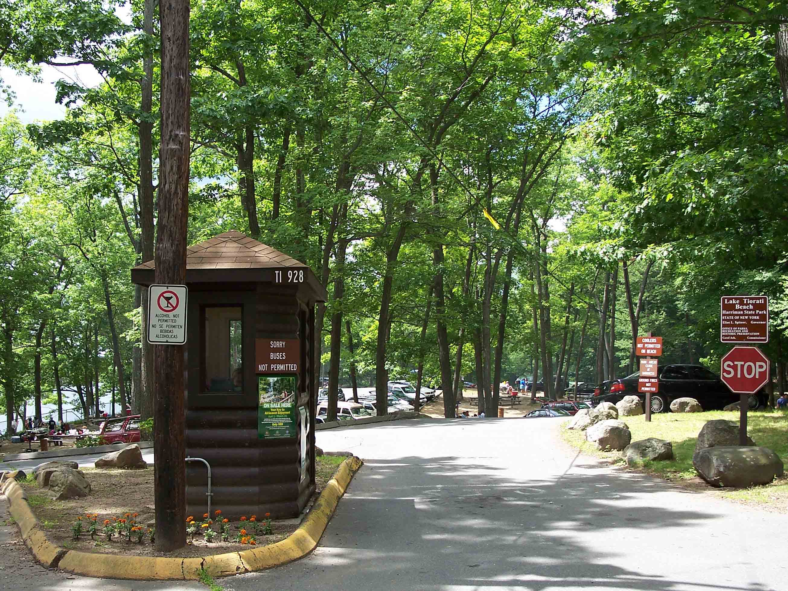
I wonder if the soil is poor, but I am not sure. Around midday I stopped at the Fingerboard
Shelter, and then by mid-afternoon was at the William Brian Shelter. There was no water at this shelter, and some
folks were already settling down for the day.
The only option for water was to walk downhill on a side trail to a
developed park area on Tiorati Circle. I continued on, soon crossing the Palisades Parkway. A short distance up the Parkway was a visitor
center, where I had purchased an Appalachian Trail bandana a few years earlier,
while traveling to Rensselaer for the
summer. Although the idea of getting a
cold drink for the vending machine was appealing, I continued on. Soon after I crossed a swiftly running
stream, which I knew was the closest water source to the shelter where I
intended to stay. I drank a large
quantity of water, filled up my containers, and pressed on to the West
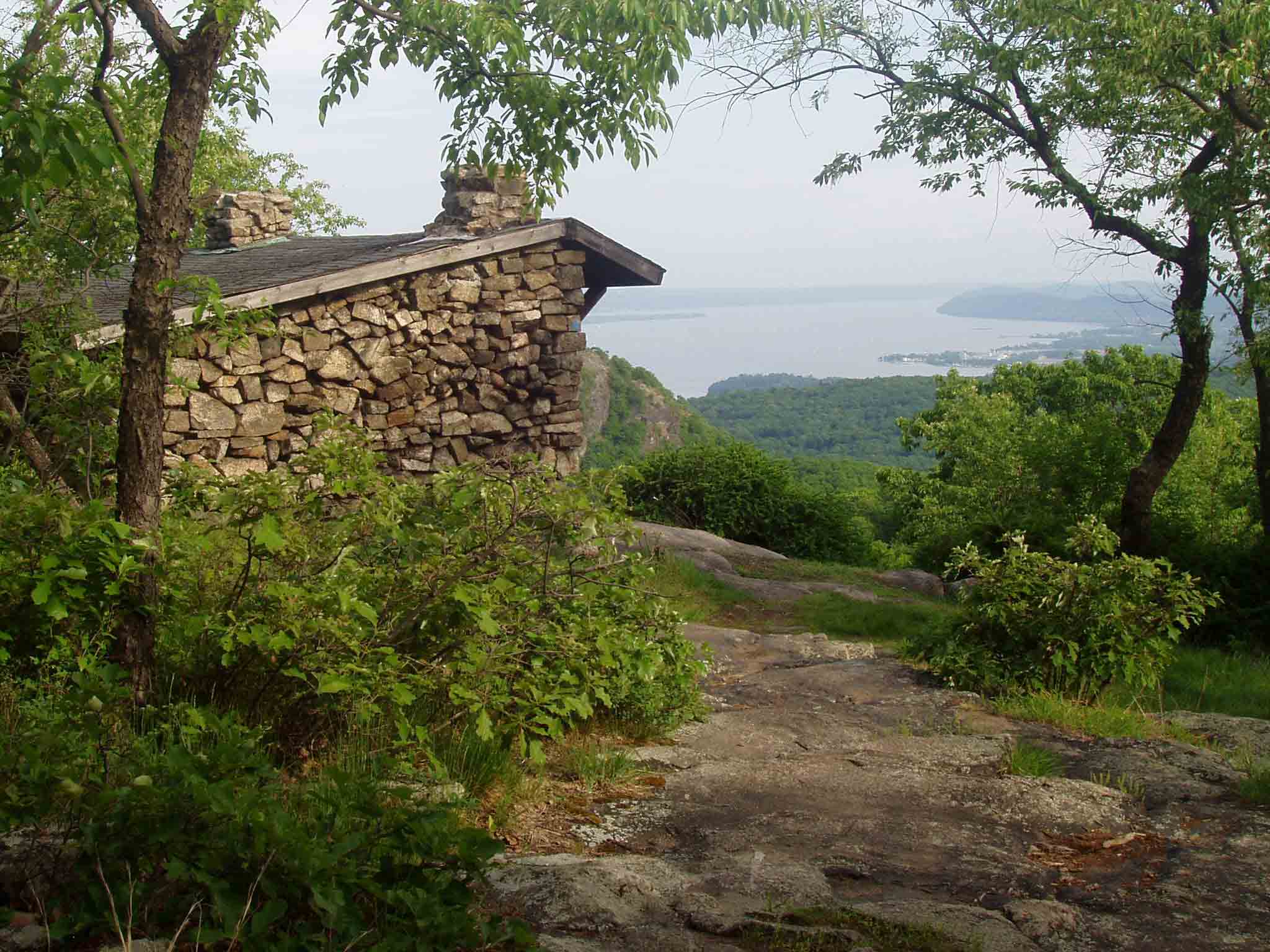
Mountain Shelter. The shelter is on
a side trail, and opens up to a grand
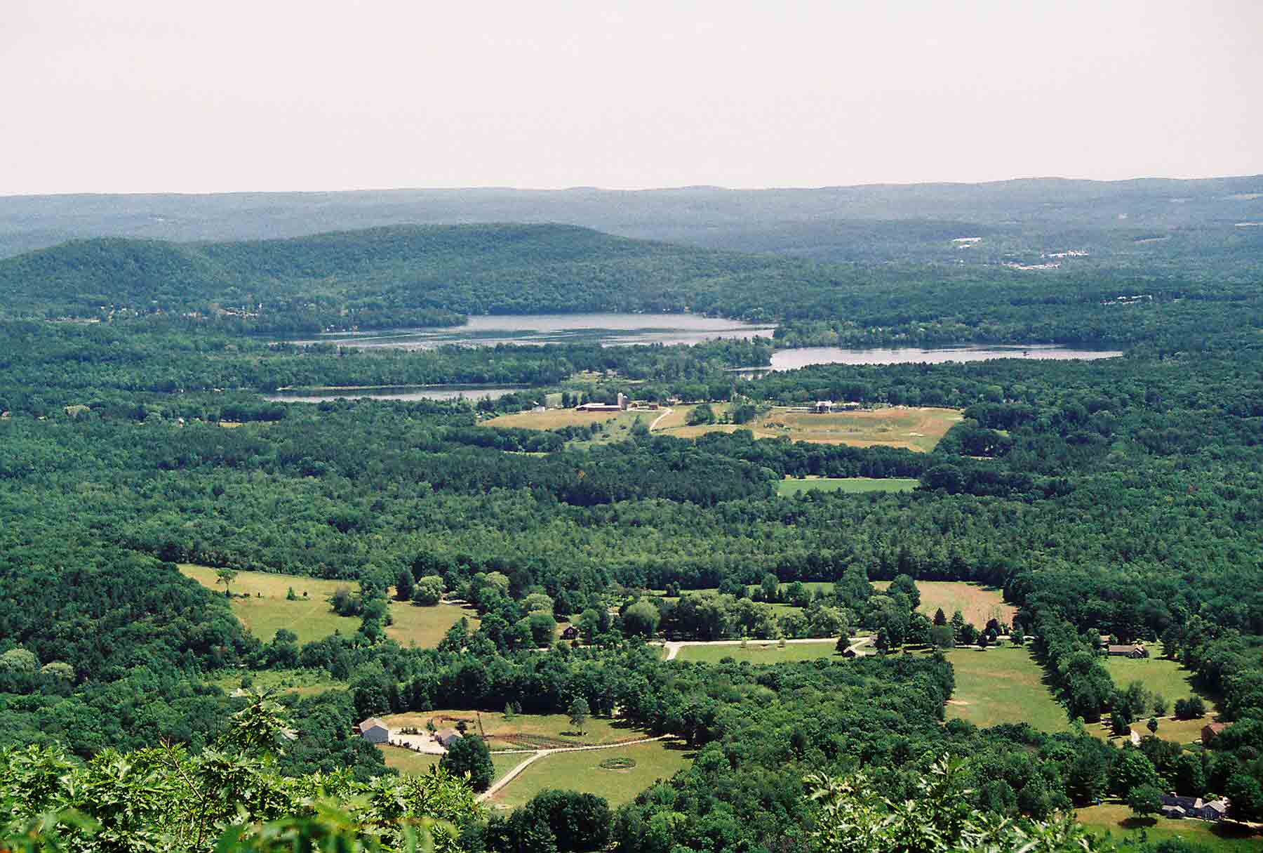
view of the Hudson River. One other
long-distance hiker was in the shelter.
He had hiked from the George Washington Bridge
on the Long Path,
a trail that runs north through the Catskills and Albany.
He was planning to take the AT north to Gorham, NH. I did not see him again after that night – I
assume he was traveling slower than I was.
There was also a small group of kids and a counselor from a camp. They hung around the shelter in the evening,
but slept in tents at night. Elevation
map of day 1
was quite interesting
– lots of grassy undergrowth and rock outcroppings, with very gently sloping
terrain. The forests appeared a bit scraggly;
there were mostly oak trees, I
think but they were not very large trees.
I wonder if the soil is poor, but I am not sure. Around midday I stopped at the Fingerboard
Shelter, and then by mid-afternoon was at the William Brian Shelter. There was no water at this shelter, and some
folks were already settling down for the day.
The only option for water was to walk downhill on a side trail to a
developed park area on Tiorati Circle. I continued on, soon crossing the Palisades Parkway. A short distance up the Parkway was a visitor
center, where I had purchased an Appalachian Trail bandana a few years earlier,
while traveling to Rensselaer for the
summer. Although the idea of getting a
cold drink for the vending machine was appealing, I continued on. Soon after I crossed a swiftly running
stream, which I knew was the closest water source to the shelter where I
intended to stay. I drank a large
quantity of water, filled up my containers, and pressed on to the West
Mountain Shelter. The shelter is on
a side trail, and opens up to a grand
view of the Hudson River. One other
long-distance hiker was in the shelter.
He had hiked from the George Washington Bridge
on the Long Path,
a trail that runs north through the Catskills and Albany.
He was planning to take the AT north to Gorham, NH. I did not see him again after that night – I
assume he was traveling slower than I was.
There was also a small group of kids and a counselor from a camp. They hung around the shelter in the evening,
but slept in tents at night. Elevation
map of day 1
Sun 7/11 Graymoor Friary (campsite) 12.5 Elevation
profile
 The next morning dawned with
similar warm and sunny weather. I
returned to the AT on the side trail, then followed a rugged section downhill
to a road crossing and back up a steep section to the top of Bear Mountain
. The trail was badly eroded from years
of use by “weekend warriors” from New
York City, and is currently (in 2007) being completely
relocated and rebuilt. On top there
stands a tall stone tower, which
was open for viewing. Restroom
facilities normally serve as a water source, but the water had been turned off
because of some sort of contamination issue.
I was desperately thirsty by now, so I purchased a cold coke from a
vending machine. A park employee assured
me that I could get water at the bottom of the mountain. On the way down I met many hikers heading up,
including someone pushing a bike. Not
sure what he was thinking. Below Bear Mountain the trail passes through a developed park
area that feels like an urban park, with an artificial lake, landscaped
walkways, picnic tables, and grills. It
was Sunday afternoon, and many people were picnicking. It was a strange feeling to walk through with
a pack. I was indeed able to refill on
water, and I proceeded through a tunnel under a busy road, past a public pool,
and into the park zoo. The zoo charges
admission but permits backpackers to pass through for free, since the official
route of the trail is through the zoo. I
stopped to observe a few of the animals, but did not spend a lot of time. The zoo is also marked by a statue of Walt
Whitman, which is inscribed with his poem “Song of the open road”:
The next morning dawned with
similar warm and sunny weather. I
returned to the AT on the side trail, then followed a rugged section downhill
to a road crossing and back up a steep section to the top of Bear Mountain
. The trail was badly eroded from years
of use by “weekend warriors” from New
York City, and is currently (in 2007) being completely
relocated and rebuilt. On top there
stands a tall stone tower, which
was open for viewing. Restroom
facilities normally serve as a water source, but the water had been turned off
because of some sort of contamination issue.
I was desperately thirsty by now, so I purchased a cold coke from a
vending machine. A park employee assured
me that I could get water at the bottom of the mountain. On the way down I met many hikers heading up,
including someone pushing a bike. Not
sure what he was thinking. Below Bear Mountain the trail passes through a developed park
area that feels like an urban park, with an artificial lake, landscaped
walkways, picnic tables, and grills. It
was Sunday afternoon, and many people were picnicking. It was a strange feeling to walk through with
a pack. I was indeed able to refill on
water, and I proceeded through a tunnel under a busy road, past a public pool,
and into the park zoo. The zoo charges
admission but permits backpackers to pass through for free, since the official
route of the trail is through the zoo. I
stopped to observe a few of the animals, but did not spend a lot of time. The zoo is also marked by a statue of Walt
Whitman, which is inscribed with his poem “Song of the open road”:
Afoot
and light-hearted I take to the open road,
Healthy, free, the world before me,
The long brown path before me leading wherever I choose.
This area has the lowest elevation on the entire trail at
124 feet above sea level. After emerging
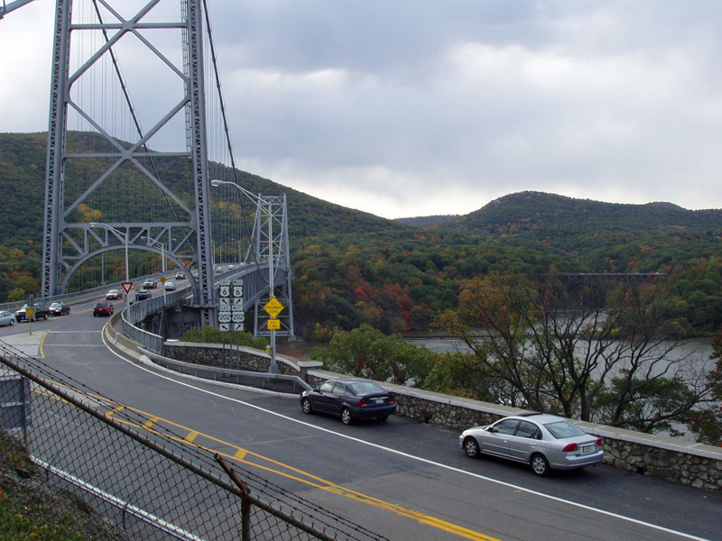
from the zoo, I crossed the Hudson River on the Bear
Mountain Bridge. The bridge is an
impressive edifice, a suspension
bridge anchored at the eastern end into a cliff face. As you cross, it looks as though the road
simply dead-ends in the cliff. In
reality the road splits and follows the cliff face in both directions. The trail follows the north face for a short
distance, and then climbs steeply into the woods. A few miles later, I came upon the road to
Graymoor Friary. Graymoor is a catholic
organization, which hosts the headquarters for its order as well as a home for
troubled men. The Friary provides free
tenting for hikers in an open field.
There was also a cold-water shower and a pavilion. When I arrived there was a soccer game going
on, and a number of hikers were hanging around the pavilion. The Friary also provides free dinner, and at
6:00 we trekked up to the large building and found our way to the expansive
dining room on the 4th floor.
The place felt empty and forlorn – only a few priests were eating
dinner, and the corridors looked as if they had not been remodeled in
decades. But I was grateful for the
spaghetti and meatballs. After eating I
called Tatiana to check in. She was at
an overnight retreat for the Chrysalis weekend she was planning to take part in
later in the summer. I slept well in my
tent next to the soccer field.
 When I awoke the next morning I had a
slight headache and did not feel great.
I was worried that I was getting sick again, but I was determined to
counteract the symptoms as best I could, and press on when able. I drank a lot of water, and headed off into
the woods. The hike was a struggle, but
I did not really feel any worse as I went on.
I stopped for a break at a stream around mid-day, and encountered two
southbound hikers who were “slackpacking” for the day – they were in the midst
of a long-distance hike with full packs, but had found someone to shuttle them
for the day and were hiking with light day packs. They spoke some encouraging words, and as I
continued to hike I felt considerably better.
The trail passed through Fahnestock State
Park, and as I came up to a rocky overlook of a lake, it began to lightly
rain. I continued hiking in the rain to
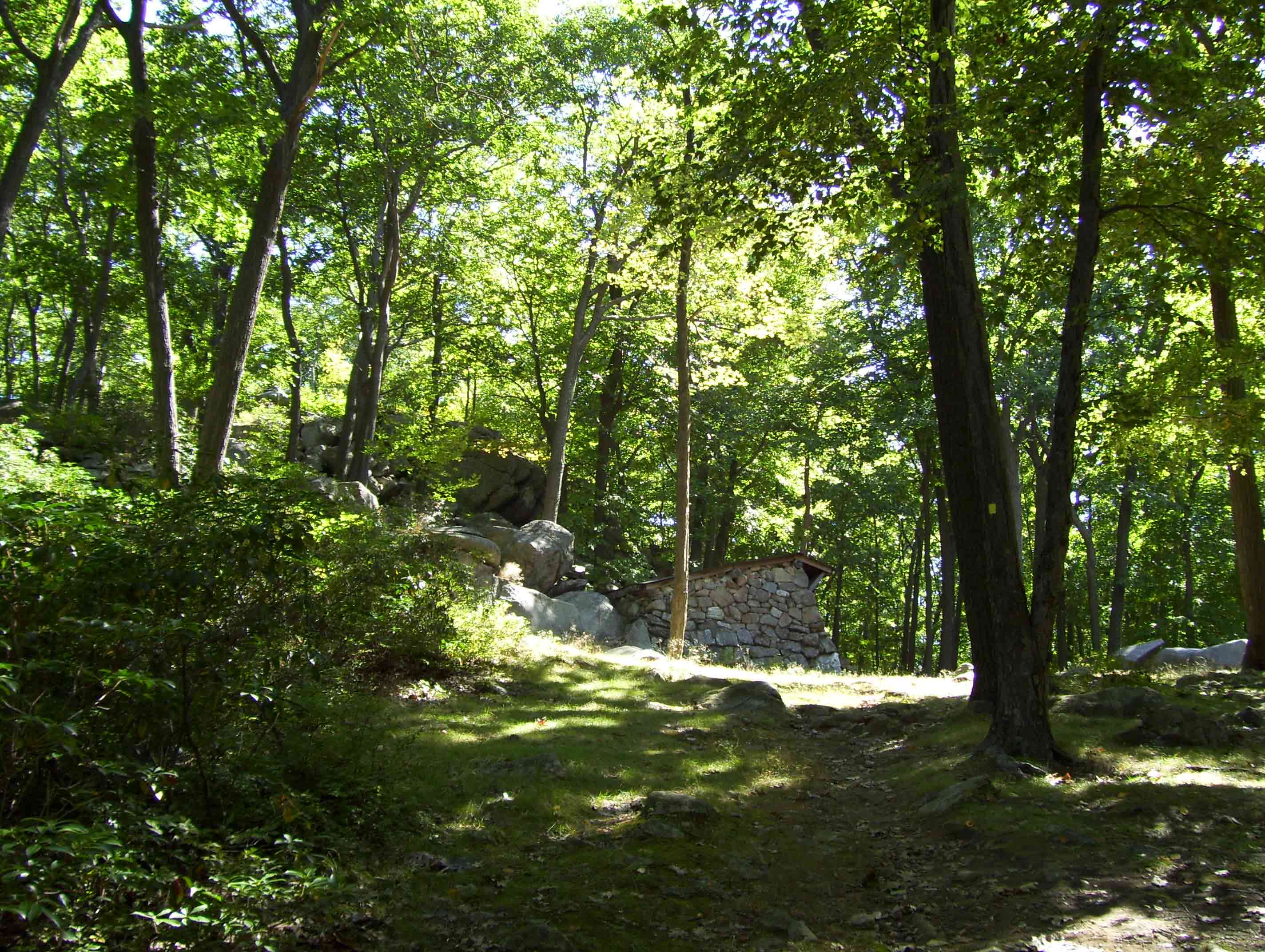
eventually arrive at the RPH
Shelter. I was feeling quite happy
with the situation. I had fought off
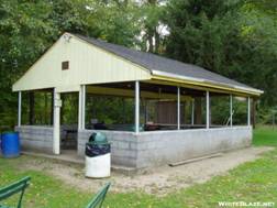
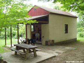
illness, and in the process had hiked my longest ever day with a backpack. The shelter was unusual. It was a 4-sided structure with concrete
walls and floor, equipped with bunk beds.
There was a covered porch with chairs, which was a nice place to hang
out in the rain – which continued the rest of the night. A trail crew had recently spend several days
at the shelter, and had left some extra food and drinks behind for hikers to
finish. I was joined by several
through-hikers who had been at Graymoor and who I would continue to see for a
few days. There were two middle-aged
guys, one called Hobbes and another named Stretch. Hobbes was from Iowa.
There were also two young guys – one named Cotton (because he did not
have any synthetic clothes when he started the hike) and another named
Leki-less (I did not get a story on his name, but I imagine he must have lost
his hiking poles at some point).
When I awoke the next morning I had a
slight headache and did not feel great.
I was worried that I was getting sick again, but I was determined to
counteract the symptoms as best I could, and press on when able. I drank a lot of water, and headed off into
the woods. The hike was a struggle, but
I did not really feel any worse as I went on.
I stopped for a break at a stream around mid-day, and encountered two
southbound hikers who were “slackpacking” for the day – they were in the midst
of a long-distance hike with full packs, but had found someone to shuttle them
for the day and were hiking with light day packs. They spoke some encouraging words, and as I
continued to hike I felt considerably better.
The trail passed through Fahnestock State
Park, and as I came up to a rocky overlook of a lake, it began to lightly
rain. I continued hiking in the rain to
eventually arrive at the RPH
Shelter. I was feeling quite happy
with the situation. I had fought off
illness, and in the process had hiked my longest ever day with a backpack. The shelter was unusual. It was a 4-sided structure with concrete
walls and floor, equipped with bunk beds.
There was a covered porch with chairs, which was a nice place to hang
out in the rain – which continued the rest of the night. A trail crew had recently spend several days
at the shelter, and had left some extra food and drinks behind for hikers to
finish. I was joined by several
through-hikers who had been at Graymoor and who I would continue to see for a
few days. There were two middle-aged
guys, one called Hobbes and another named Stretch. Hobbes was from Iowa.
There were also two young guys – one named Cotton (because he did not
have any synthetic clothes when he started the hike) and another named
Leki-less (I did not get a story on his name, but I imagine he must have lost
his hiking poles at some point).
Tues 7/13 Telephone Pioneers shelter 16.6 Elevation
profile
The rain lingered when I awoke the next day, but it stopped
soon after I started hiking. The trail
wound its way through deep woods. Early
on, I crossed the Taconic
Parkway, and later I-84. There were
a few viewpoints, and I passed a lake
where people sometimes swim. It’s
called “nuclear lake”, because of a rumor that the lake was contaminated with
radioactivity – a notion proved false by extensive testing. The trail in this section of New York is rugged, but
does not change overall elevation much – there are many short climbs where the
hiker loses or gains maybe 20-30 feet
of elevation over a rocky section.
Other than that, I don’t remember much from this section. At one of the road crossings it was possible
to hike a short distance to a mobile hot dog stand of some sort, and my fellow
hikers all stopped for lunch. I had
plenty of food, and had not developed cravings for “real food” after only a few
days on the trail, so I pressed on and was the first to arrive at the
shelter. The shelter
was of traditional wooden design, and there was a faint view through the trees
– there would have been a good view in the winter. The water source was poor, a barely flowing
stream of suspect quality.
 As
I started down the trail beyond the Telephone Pioneers Shelter, I was low on
water. The poor water source left me
looking for an alternative. Fortunately,
I knew from the guidebook about another source.
A mile or so down the trail there was a house near a road crossing where
a homeowner sympathetic to hikers provides water. I filled up at the outdoor faucet and continued
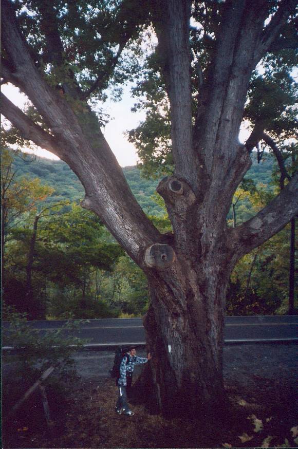
down the trail. Nearby was the Dover
Oak, the largest oak tree (and perhaps the largest tree of any sort) near
the trail. It is quite a large specimen,
with a spreading crown typical of
trees that grow in the open. A
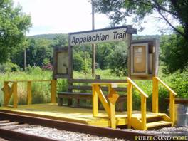
couple of miles further on the trail crossed a railroad line with an actual Appalachian Trail stop.
A hiker can board the train here and head to New York City. It is actually possible to reach US 17 in Harriman State Park, where I started the previous
Saturday, by train as well – but that requires walking a mile or two from the
station. Back in the woods, the trail
passed through the Pawling
Nature Preserve, which consists of protected forestland owned and managed
by the Nature Conservancy. After
ascending to a ridge, and crossed and re-crossed the Connecticut border several times. Near one of the crossings I met a
“ridgerunner” – a guy who was employed by the Appalachian Mountain Club (which
manages this section of trail) to keep an eye on things. The ridgerunners hike back and forth along
their assigned section, talking with other hikers, educating them about Leave
No Trace principles, and monitoring trail conditions. While we were talking he noticed an unusual
object in the bushes, and upon investigation it turned out to be a
geocache. Someone had placed the plastic
box full of random objects there near the trail, and posted the GPS coordinates
on the Internet. Other hikers/explorers
who found the cache would leave another object in the box. I took a break along 10 mile River, which
was a rather substantial stream that runs into the Housatonic River. The 10-mile was crossed via a wooden hiker bridge. I had planned to stop for the day at a
campsite along the next wooded ridge, but when I arrived I decided I still had
enough energy to make it to the next shelter.
I had worked out that if I could do a couple of longer days I would make
it beyond Stratton Mountain, Vermont by the end of my allotted 2 weeks, and I
was motivated to make it that far because I had hiked Stratton previously – it
was fun to think of doing it again. I
made it to the Mt.
Algo Shelter and stopped there for the night.
As
I started down the trail beyond the Telephone Pioneers Shelter, I was low on
water. The poor water source left me
looking for an alternative. Fortunately,
I knew from the guidebook about another source.
A mile or so down the trail there was a house near a road crossing where
a homeowner sympathetic to hikers provides water. I filled up at the outdoor faucet and continued
down the trail. Nearby was the Dover
Oak, the largest oak tree (and perhaps the largest tree of any sort) near
the trail. It is quite a large specimen,
with a spreading crown typical of
trees that grow in the open. A
couple of miles further on the trail crossed a railroad line with an actual Appalachian Trail stop.
A hiker can board the train here and head to New York City. It is actually possible to reach US 17 in Harriman State Park, where I started the previous
Saturday, by train as well – but that requires walking a mile or two from the
station. Back in the woods, the trail
passed through the Pawling
Nature Preserve, which consists of protected forestland owned and managed
by the Nature Conservancy. After
ascending to a ridge, and crossed and re-crossed the Connecticut border several times. Near one of the crossings I met a
“ridgerunner” – a guy who was employed by the Appalachian Mountain Club (which
manages this section of trail) to keep an eye on things. The ridgerunners hike back and forth along
their assigned section, talking with other hikers, educating them about Leave
No Trace principles, and monitoring trail conditions. While we were talking he noticed an unusual
object in the bushes, and upon investigation it turned out to be a
geocache. Someone had placed the plastic
box full of random objects there near the trail, and posted the GPS coordinates
on the Internet. Other hikers/explorers
who found the cache would leave another object in the box. I took a break along 10 mile River, which
was a rather substantial stream that runs into the Housatonic River. The 10-mile was crossed via a wooden hiker bridge. I had planned to stop for the day at a
campsite along the next wooded ridge, but when I arrived I decided I still had
enough energy to make it to the next shelter.
I had worked out that if I could do a couple of longer days I would make
it beyond Stratton Mountain, Vermont by the end of my allotted 2 weeks, and I
was motivated to make it that far because I had hiked Stratton previously – it
was fun to think of doing it again. I
made it to the Mt.
Algo Shelter and stopped there for the night.
Thurs 7/15 Pine Swamp Brook shelter 17.3 Elevation
profile
 Towards the last
few miles of the previous day I had noticed that my boots were rubbing in a
spot near my toes. I had purchased
these Vasque boots as a replacement for another pair that was wearing out. I selected exactly the same size and model as
the previous pair, which fit very well, without trying them on. I had been hiking in the new boots several
years, and had noticed that they were slightly larger than the others. That difference was now causing big
problems. My feet were really sore and
bleeding a bit. I knew from the trail
guide that the town of Kent,
just a short distance off the trail at the next road crossing, had an outfitter
– so I decided to see if I could replace the boots. I arrived in town before 8:00am, and the
outfitter was not open yet. I called
Tatiana and let her know what was going on, and walked around town a bit to
wait. Kent is an interesting small town,
but not your typical friendly trail town.
It is occupied by fancy boutique stores selling overpriced clothing and
serving things like scones and tea. At
the edge of town is a prestigious prep school called the Kent School. The outfitter was a nice place though, and I
was able to find a replacement pair of hiking shoes. I decided to try out low hikers with no ankle
support, which are very popular on the trail because of the weight savings. The Merrell shoes I chose had an excellent
sole (and in fact the sole is still in good shape after hundreds of miles,
while the upper has broken down a bit).
I hastened back up to the trail, pressing on so that I would not get
behind schedule. The trail through Connecticut is quite
varied. It follows ridge tops for a while, and
then drops down for several long
stretches to parallel the Housatonic
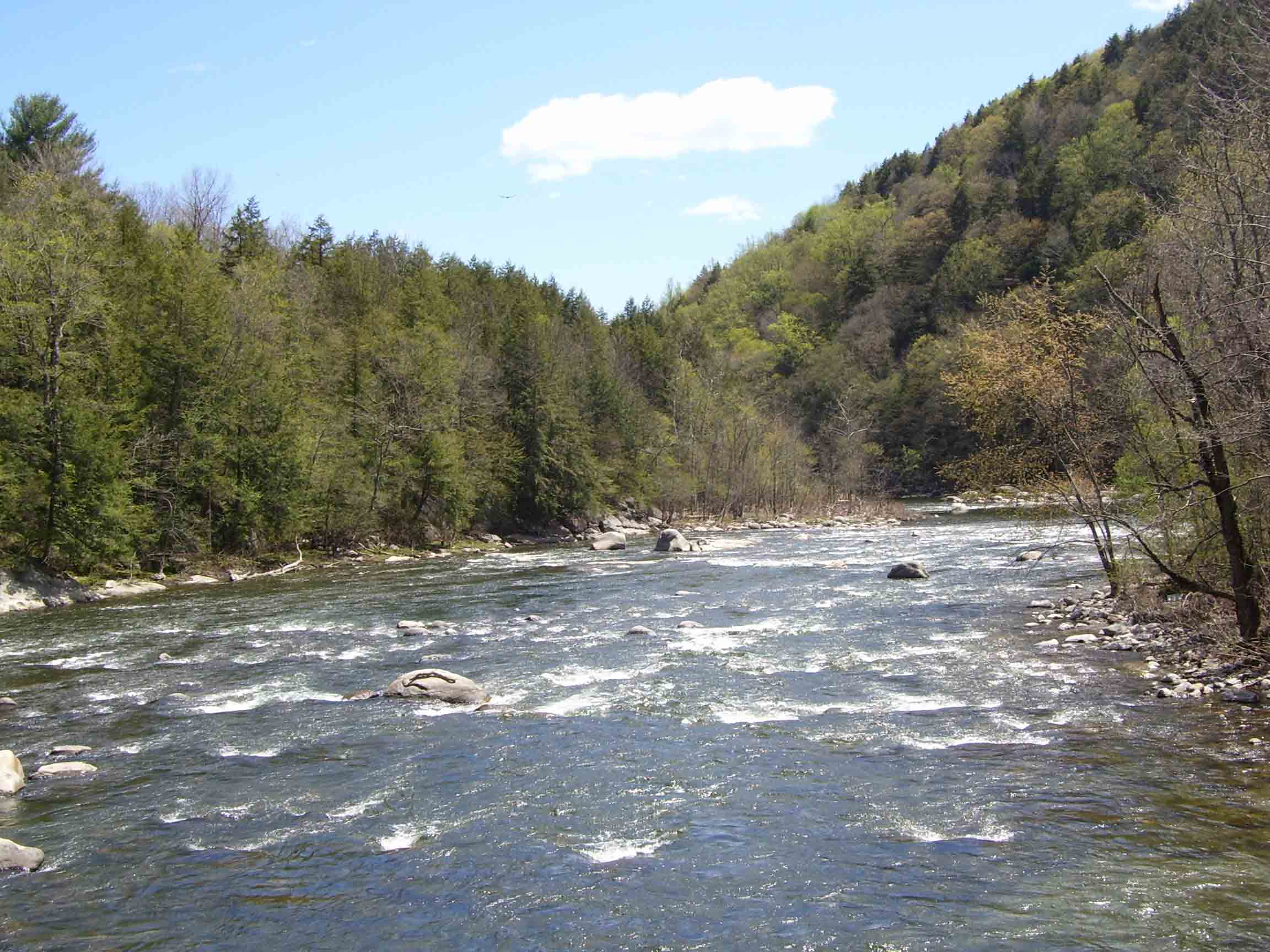
River. This made for fairly easy hiking. One of the ridges had a view from St.
John’s Ledges, and nearby I saw some rock climbers. Around midday I crossed a rushing, boulder filled stream
where several hikers were swimming. I
considered doing the same, but wanted to wait until the end of the day because
I figured I would just get sweaty right away.
[I have since decided that the best policy is to swim whenever
possible. Often by the time you reach
camp the weather has turned cool, or there is no good place to wash off the
sweat and dirt]. After a final steep climb,
I reached Pine
Swamp Brook shelter. True to its
name, this shelter was near a swampy area with questionable water. I set up my tent to avoid the mosquitoes,
which several other hikers were doing as well.
Towards the last
few miles of the previous day I had noticed that my boots were rubbing in a
spot near my toes. I had purchased
these Vasque boots as a replacement for another pair that was wearing out. I selected exactly the same size and model as
the previous pair, which fit very well, without trying them on. I had been hiking in the new boots several
years, and had noticed that they were slightly larger than the others. That difference was now causing big
problems. My feet were really sore and
bleeding a bit. I knew from the trail
guide that the town of Kent,
just a short distance off the trail at the next road crossing, had an outfitter
– so I decided to see if I could replace the boots. I arrived in town before 8:00am, and the
outfitter was not open yet. I called
Tatiana and let her know what was going on, and walked around town a bit to
wait. Kent is an interesting small town,
but not your typical friendly trail town.
It is occupied by fancy boutique stores selling overpriced clothing and
serving things like scones and tea. At
the edge of town is a prestigious prep school called the Kent School. The outfitter was a nice place though, and I
was able to find a replacement pair of hiking shoes. I decided to try out low hikers with no ankle
support, which are very popular on the trail because of the weight savings. The Merrell shoes I chose had an excellent
sole (and in fact the sole is still in good shape after hundreds of miles,
while the upper has broken down a bit).
I hastened back up to the trail, pressing on so that I would not get
behind schedule. The trail through Connecticut is quite
varied. It follows ridge tops for a while, and
then drops down for several long
stretches to parallel the Housatonic
River. This made for fairly easy hiking. One of the ridges had a view from St.
John’s Ledges, and nearby I saw some rock climbers. Around midday I crossed a rushing, boulder filled stream
where several hikers were swimming. I
considered doing the same, but wanted to wait until the end of the day because
I figured I would just get sweaty right away.
[I have since decided that the best policy is to swim whenever
possible. Often by the time you reach
camp the weather has turned cool, or there is no good place to wash off the
sweat and dirt]. After a final steep climb,
I reached Pine
Swamp Brook shelter. True to its
name, this shelter was near a swampy area with questionable water. I set up my tent to avoid the mosquitoes,
which several other hikers were doing as well.
I started out with some nervousness the next day, know that
I needed to re-supply. Obtaining the
next round of supplies is not complicated, but I was a bit concerned simply
because it was something I had not done.
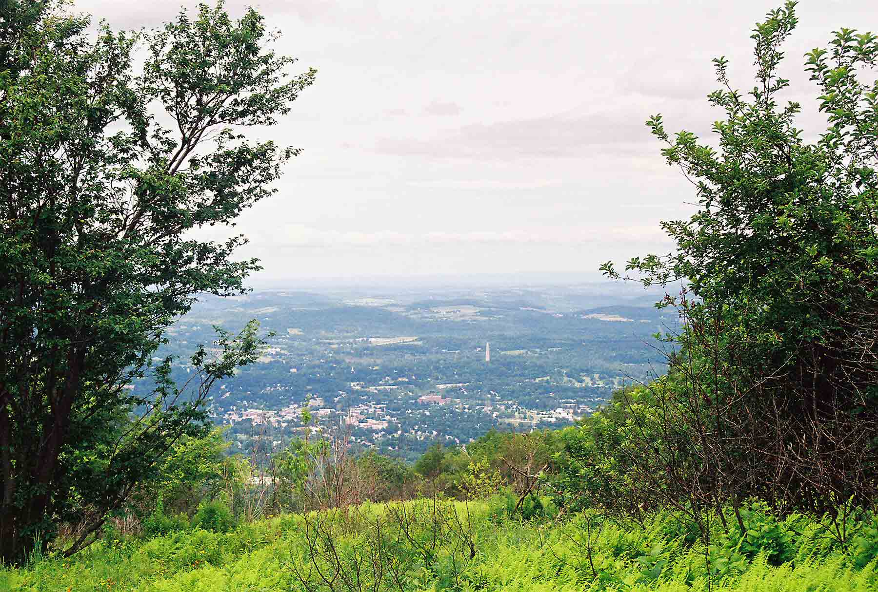
The terrain was similar to the previous day, with stretches of wooded
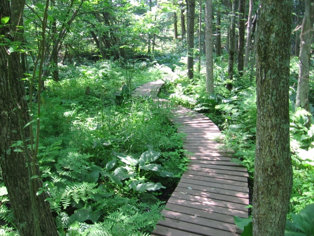
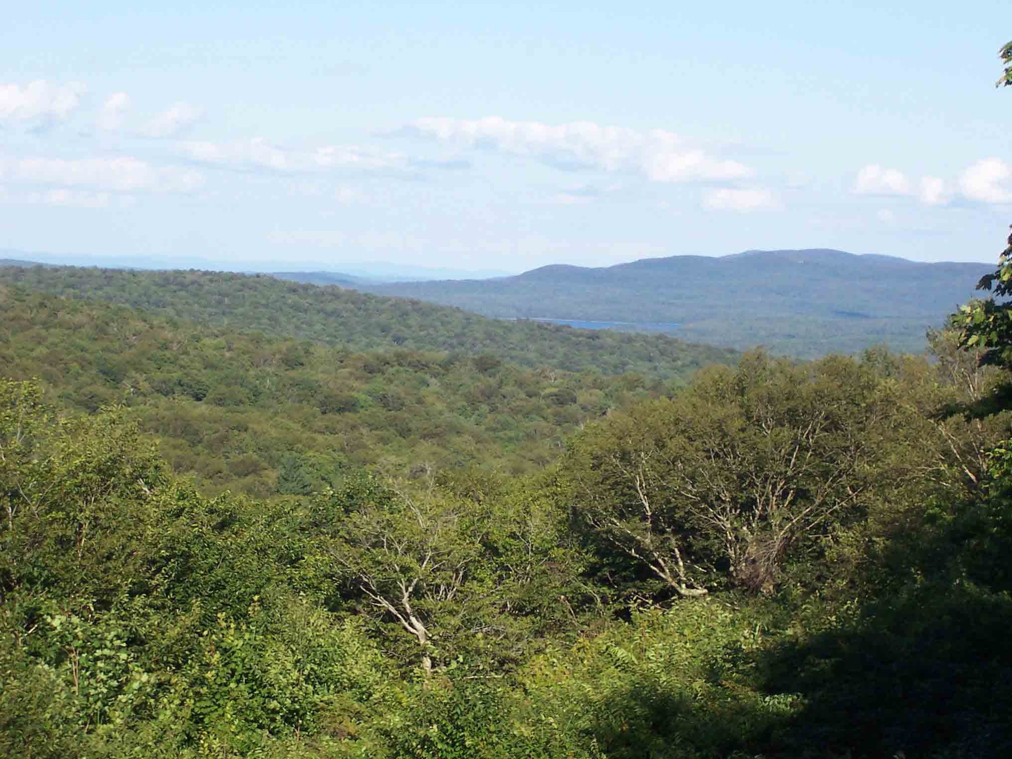
ridgeline (interspersed with occasional views such as this one at Rand’s View) complimented by level
walking along the river. Towards the end
of one of these level stretches, the trail passes through a stand of red
pine. The trail here is so easy that it
is designated as accessible to the disabled.
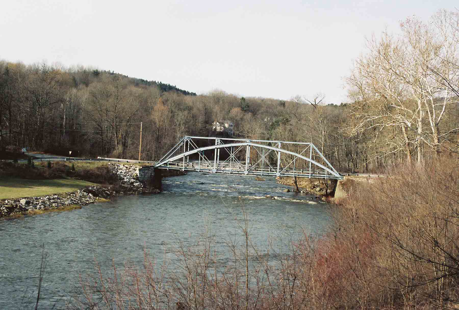
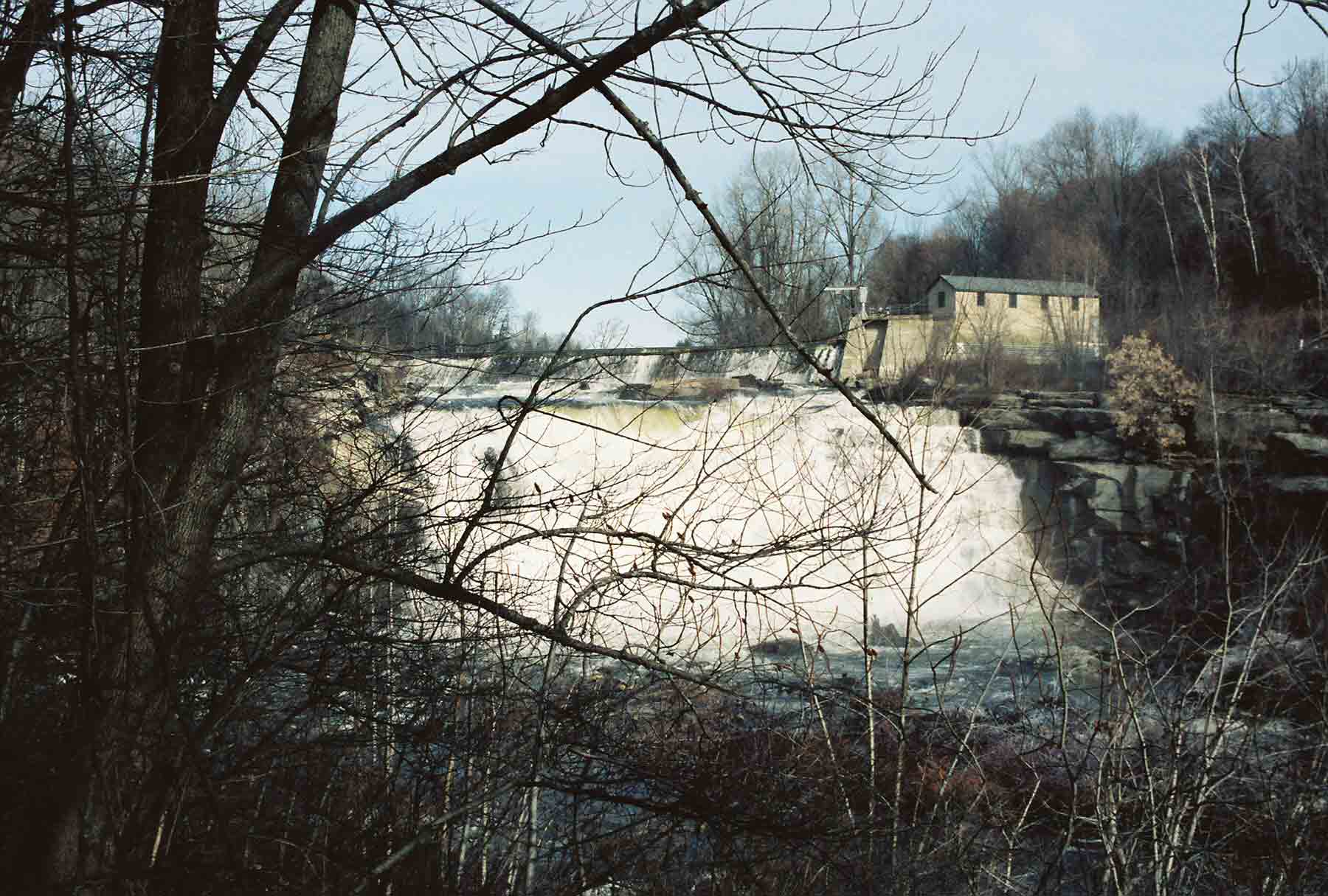
After exiting the woods the trail crosses a grassy area near a power plant,
then an iron bridge over
the river , just downstream from a 20-30 foot waterfall. After reaching the falls, I consulted the map
and realized I had missed the turnoff to the post office in Falls Village. I had to retrace my steps for perhaps a half
mile to reach town. Falls Village
is a quintessential New England town, which
historic houses and shops. There is not
much to the town, but fortunately the post office was open and I retrieved my
food. The rest of the day proved to be
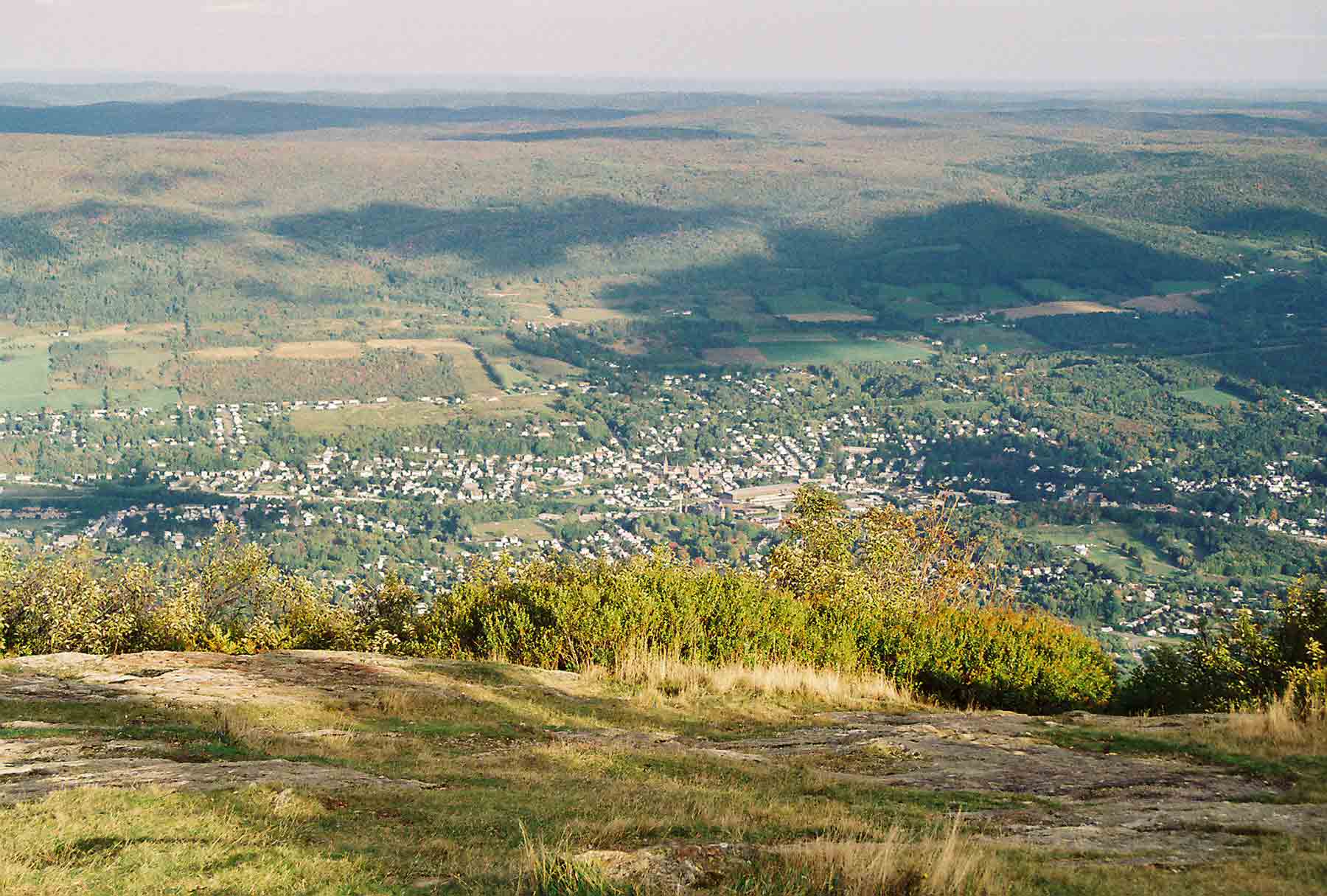
rather challenging, hiking in hot weather and with a heavy pack. After passing near the road to Salisbury, the trail
abruptly ascended the most significant climb I had attempted in the previous
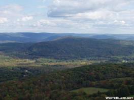
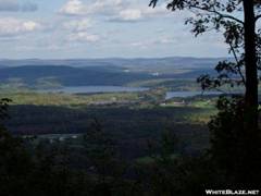
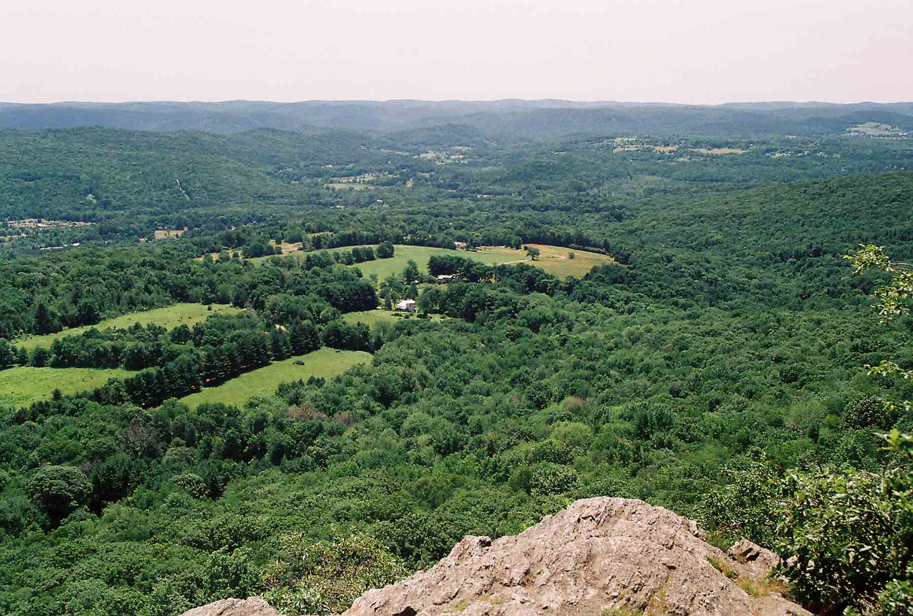
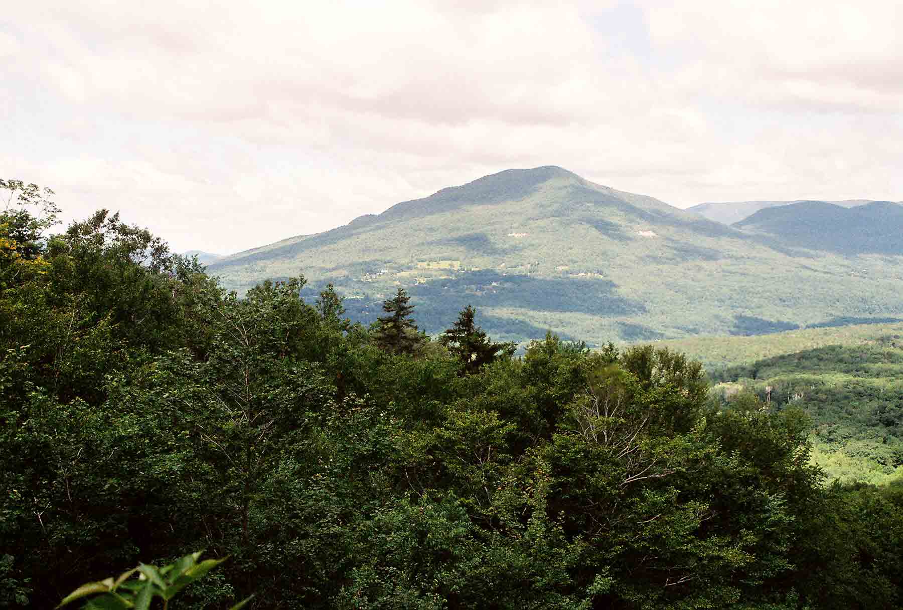
week. The climb culminated at a viewpoint called Lions Head, which
is a rocky outcropping on the southern tip of a rocky
ridgeline that extends for 16 miles into Massachusetts. The view from Lions Head, seen
here, was quite good. Shortly after
reaching the view I came to the Riga
Shelter, where I would spend the night.
This section of trail is probably the most popular in southern New England. There
were several shelters and campsites nearby, and lots of people camped at
each. Only four people occupied the Riga shelter itself. Two were camp counselors for a group that was
staying in tents. The other guy was an
old-school hiker who was raving about the fact that he had managed to get his
pack weight down from 80 pounds to 70.
He also did not seem to understand backcountry cell phone etiquette (one
hiking guide suggests using a cell phone only in places were you would also use
the bathroom) and proceeded to make a call, from the shelter, to arrange a
blind date with someone he had been set up with. It was quite an evening, but I enjoyed the
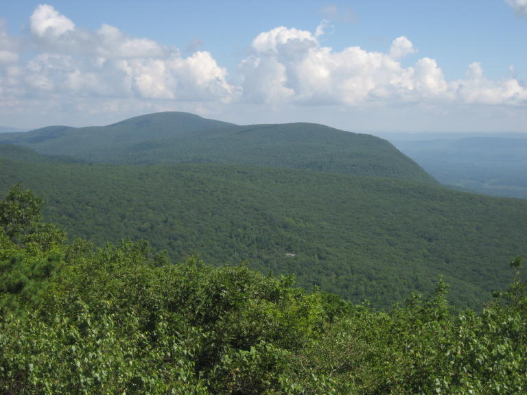
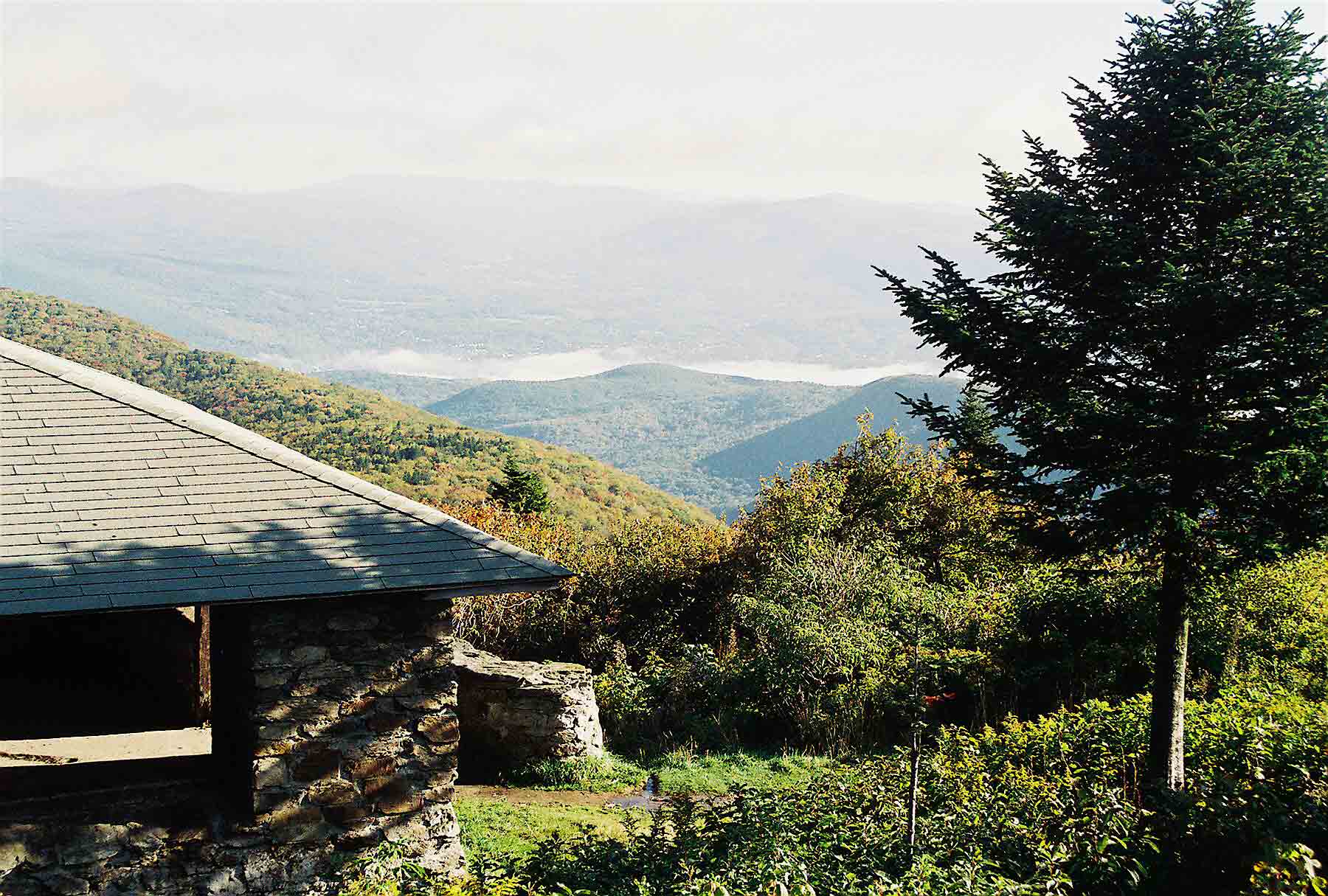
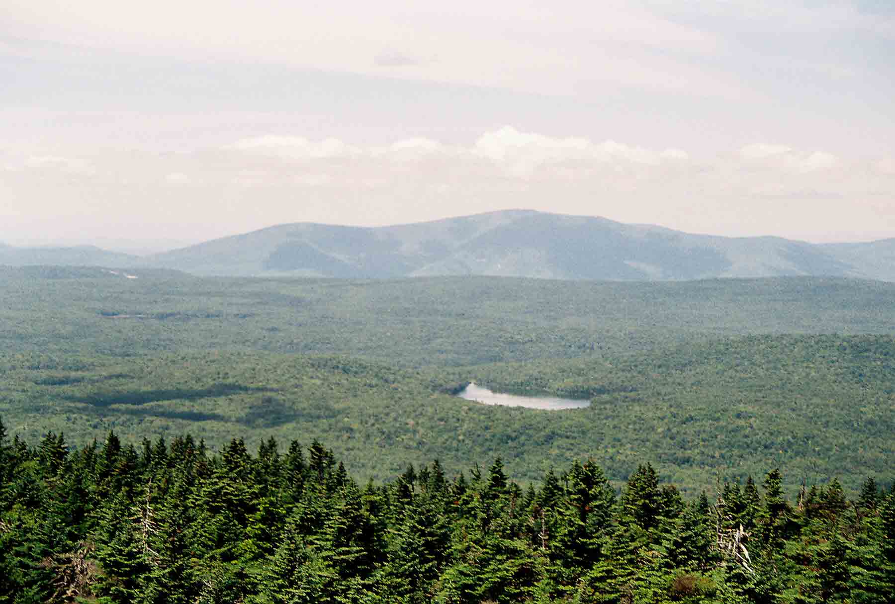
view from the shelter, which looked down on the valley below and ridges in the
distances to the east (see picture below).
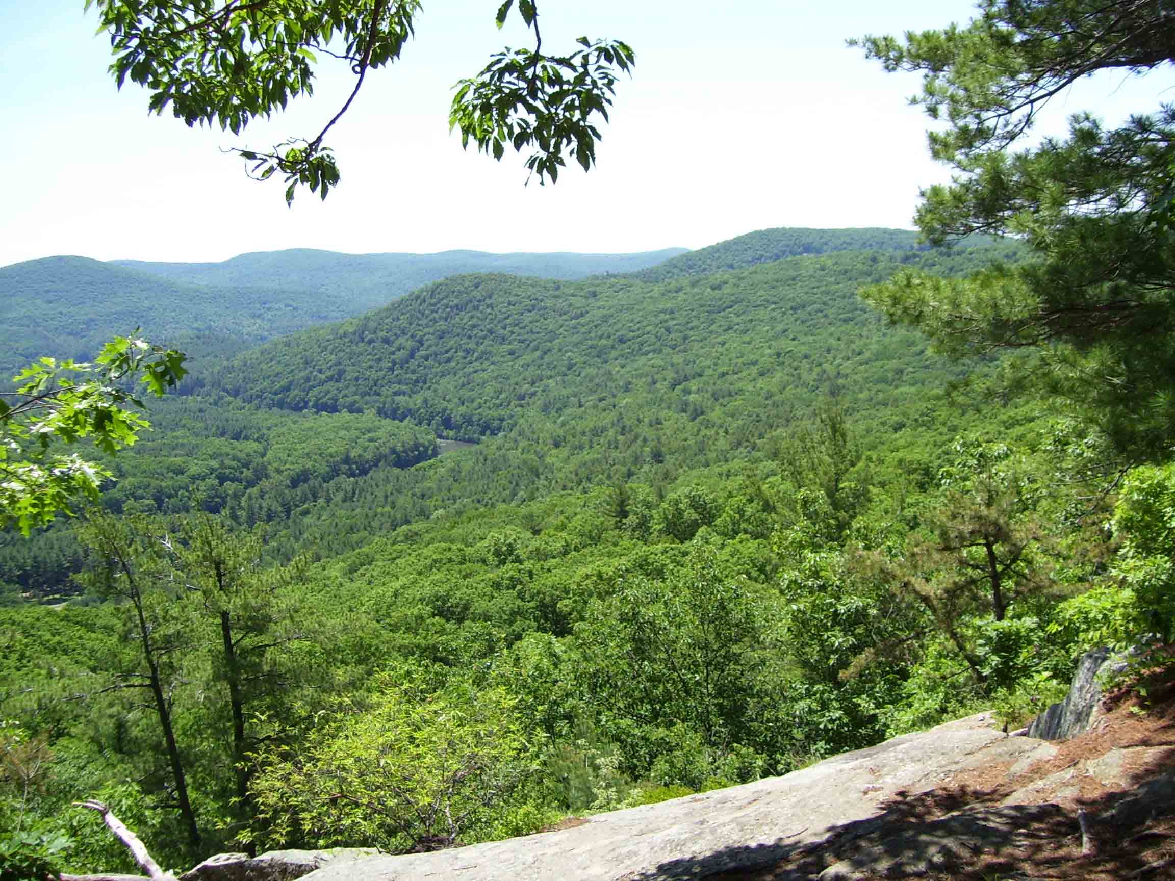
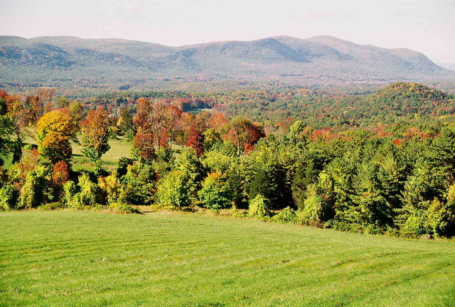
 I started the morning
with this great view from the shelter.
Shelters with a view are relatively uncommon along the trail, so this
was a real treat. The day ahead turned
out to be the toughest of the trip. I
started by clambering over the remaining 15 miles of rocky
trail on the ridge running into Massachusetts. The trail climbed over Bear Mountain, the
highest mountain entirely within the state of Connecticut
(one can find a higher elevation on a trail ascending another mountain whose
peak is in Massachusetts
on the next ridge west). There was a large pile of rocks with a view on top. The scramble down from the peak resembled
some of the tough climbs in New
Hampshire. The
trail proceeded through beautiful Sages
Ravine, where a swift-running stream paralleled the trail through deep
woods, then ascended to glacier-scarred Race Mountain. The final high point
was Mount Everett, where an old
fire tower was reduced to concrete supports.
From there the trail followed the ridge to Jug
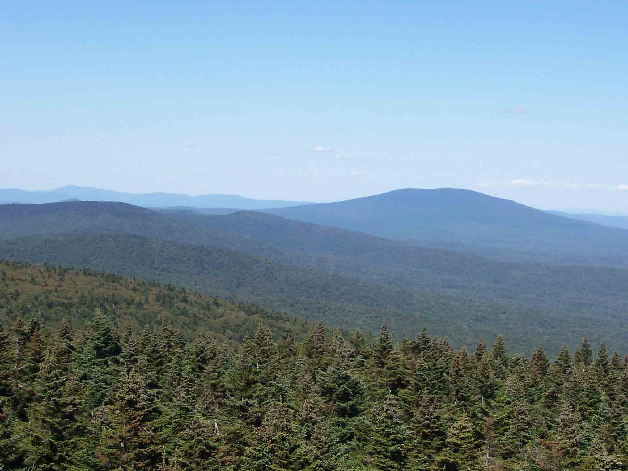
End, the northern parallel to Lions Head, where a view of the Berkshires
unfolded to the north. I felt like I was
dropping off the end of the earth as I descended steeply from Jug End,
eventually reaching a parking area near a gravel road. Many day hikers were out, enjoying a warm
weekend day. I had hoped to find water
at a spring, but it was dry. The next
several miles proved to be hot and dry, as I hiked over swampy land with no
good water source. I was completely out
of water and getting a little worried when I reached US route 7 near Great
Barrington. A garden center was located
just down the road, and I walked over to see if I could get water. I was obviously not the first hiker to asked,
as a distracted employee pointed out several jugs of water on the floor. I gladly drank up and refilled my bottles,
then continued on. I still had to hike
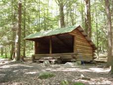
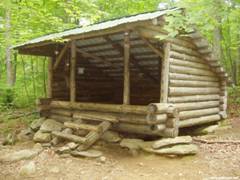
over 5 miles to reach the Tom
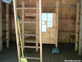
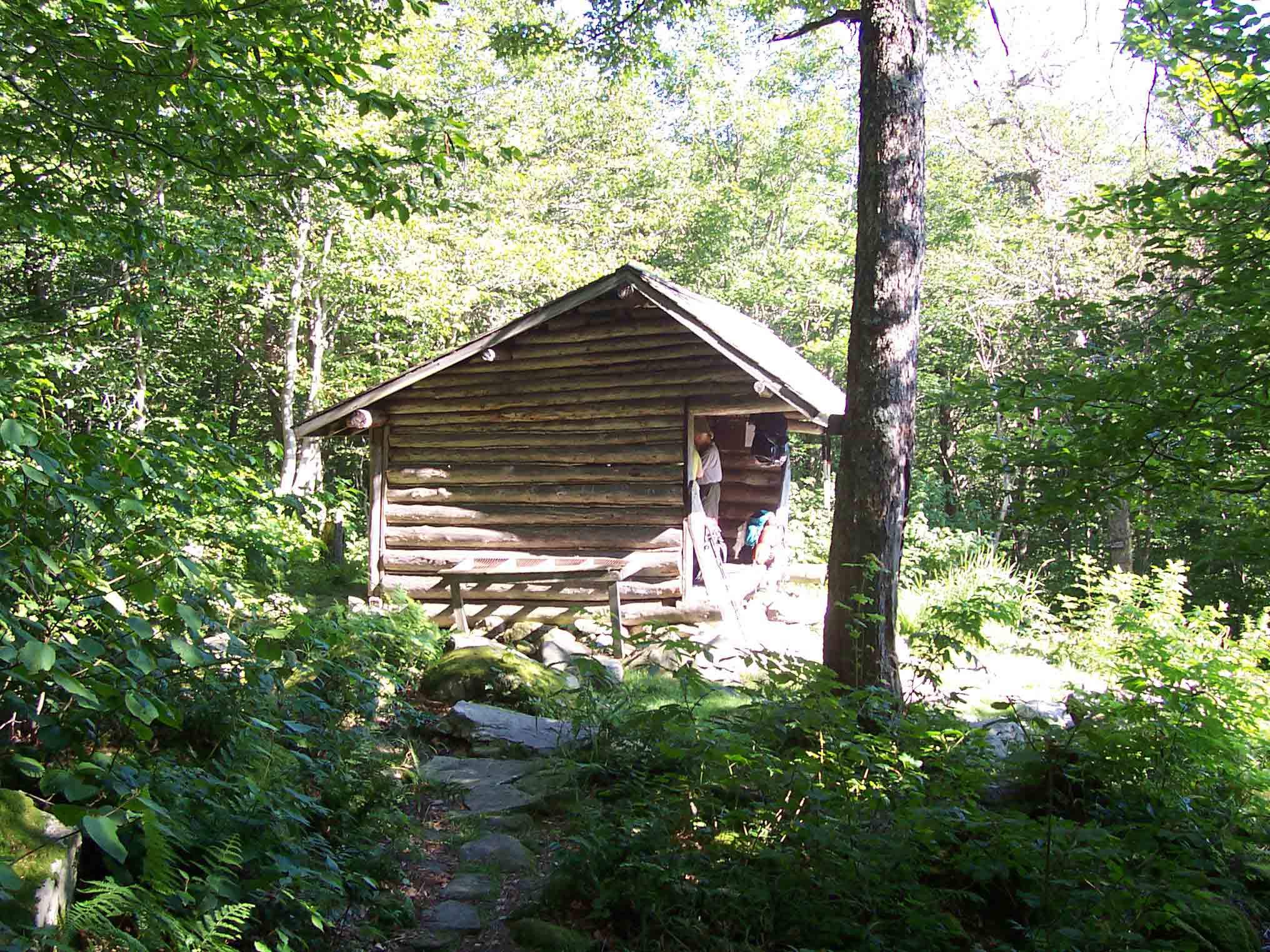
Leonard shelter (pictured here). The
woods were warm and swarming with mosquitoes.
Rarely have I encountered mosquitoes
this viscous during daylight hours while hiking. When I finally reached the shelter, I found
it full in spite of its large size – with a loft providing space for 12 or more
hikers. I set up my tent, struggled down
a steep side trail to get water, and after making dinner happily rested in my
tent. This turned out to be the longest
hiking day of the trip.
I started the morning
with this great view from the shelter.
Shelters with a view are relatively uncommon along the trail, so this
was a real treat. The day ahead turned
out to be the toughest of the trip. I
started by clambering over the remaining 15 miles of rocky
trail on the ridge running into Massachusetts. The trail climbed over Bear Mountain, the
highest mountain entirely within the state of Connecticut
(one can find a higher elevation on a trail ascending another mountain whose
peak is in Massachusetts
on the next ridge west). There was a large pile of rocks with a view on top. The scramble down from the peak resembled
some of the tough climbs in New
Hampshire. The
trail proceeded through beautiful Sages
Ravine, where a swift-running stream paralleled the trail through deep
woods, then ascended to glacier-scarred Race Mountain. The final high point
was Mount Everett, where an old
fire tower was reduced to concrete supports.
From there the trail followed the ridge to Jug
End, the northern parallel to Lions Head, where a view of the Berkshires
unfolded to the north. I felt like I was
dropping off the end of the earth as I descended steeply from Jug End,
eventually reaching a parking area near a gravel road. Many day hikers were out, enjoying a warm
weekend day. I had hoped to find water
at a spring, but it was dry. The next
several miles proved to be hot and dry, as I hiked over swampy land with no
good water source. I was completely out
of water and getting a little worried when I reached US route 7 near Great
Barrington. A garden center was located
just down the road, and I walked over to see if I could get water. I was obviously not the first hiker to asked,
as a distracted employee pointed out several jugs of water on the floor. I gladly drank up and refilled my bottles,
then continued on. I still had to hike
over 5 miles to reach the Tom
Leonard shelter (pictured here). The
woods were warm and swarming with mosquitoes.
Rarely have I encountered mosquitoes
this viscous during daylight hours while hiking. When I finally reached the shelter, I found
it full in spite of its large size – with a loft providing space for 12 or more
hikers. I set up my tent, struggled down
a steep side trail to get water, and after making dinner happily rested in my
tent. This turned out to be the longest
hiking day of the trip.
Sun 7/18 Upper Goose Pond Cabin 21.6 Elevation
profile
 By now I was
on a different schedule than I had anticipated, because I had been able to do
some longer days. As I looked at options
for camping Sunday night, I was delighted to learn that I could reach Upper
Good Pond Cabin, which is an enclosed structure with a volunteer caretaker who
provides breakfast. I set off feeling
fresh and ready to hike. Along the way I
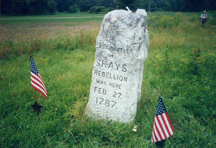
passed the marker for Shay’s
Rebellion, an uprising against taxes in the 1700s. Around midday I passed the Shaker Campsite, a
wooded area with tent platforms. I took
a quick break, but was soon chased away by mosquitoes – and was very glad I did
not need to stay the night. A few miles
later I passed the Tyringham Cobble, a small hill near a town with the same
name. After crossing a road I headed up
into the woods toward Upper Goose Pond.
The pond was surrounded by forest that was beginning to look more
“northern” in quality, with Sugar Maples and Birches in abundance. The trail began to take on the rooted quality
typical of northern New England as well. The Upper Goose Pond Cabin was reached via a
½ mile side trail. Normally I would
avoid going this far off the trail to camp, but the cabin was worth the extra
distance. Upon arriving I found a dozen
other hikers, but there was bunk space still available. I took a swim in the
pond and enjoyed talking with other hikers the rest of the evening. Most of these people were long distance
hikers, and it was nice to be around others with a similar mindset after
spending two nights at shelters with groups of kids and weekenders. The caretakers were a small family – parents
and a pre-teen daughter – who were serving for their first night and were
delighted to hang out with hikers. The
next morning they provided a fabulous pancake breakfast!
By now I was
on a different schedule than I had anticipated, because I had been able to do
some longer days. As I looked at options
for camping Sunday night, I was delighted to learn that I could reach Upper
Good Pond Cabin, which is an enclosed structure with a volunteer caretaker who
provides breakfast. I set off feeling
fresh and ready to hike. Along the way I
passed the marker for Shay’s
Rebellion, an uprising against taxes in the 1700s. Around midday I passed the Shaker Campsite, a
wooded area with tent platforms. I took
a quick break, but was soon chased away by mosquitoes – and was very glad I did
not need to stay the night. A few miles
later I passed the Tyringham Cobble, a small hill near a town with the same
name. After crossing a road I headed up
into the woods toward Upper Goose Pond.
The pond was surrounded by forest that was beginning to look more
“northern” in quality, with Sugar Maples and Birches in abundance. The trail began to take on the rooted quality
typical of northern New England as well. The Upper Goose Pond Cabin was reached via a
½ mile side trail. Normally I would
avoid going this far off the trail to camp, but the cabin was worth the extra
distance. Upon arriving I found a dozen
other hikers, but there was bunk space still available. I took a swim in the
pond and enjoyed talking with other hikers the rest of the evening. Most of these people were long distance
hikers, and it was nice to be around others with a similar mindset after
spending two nights at shelters with groups of kids and weekenders. The caretakers were a small family – parents
and a pre-teen daughter – who were serving for their first night and were
delighted to hang out with hikers. The
next morning they provided a fabulous pancake breakfast!
After breakfast I set off again down the trail. Before long, it started to rain. As it turned out, the rain would last all
day. Hiking in an all-day rain is a
challenge. There is no good place 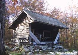 to take a break,
so you are tempted to continue hiking – putting you at risk from exhaustion if
you don’t eat or drink enough. There was
a shelter about halfway through the day, and I stopped for a break to get out
of the run. The other memorable feature
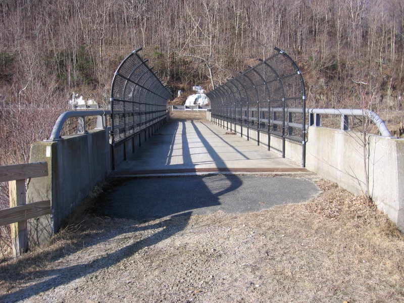
of this section was crossing I-90, the Massachusetts Turnpike. The trail crosses on an interesting
bridge that looks like it was designed
to carry vehicle traffic but for some reason was never finished. Sometime in the afternoon I came upon a
“trail magic” site, where a local resident puts out a cooler of food and drinks
for hikers during peak season. The
“trail angel” was restocking the cooler, and had cans of Mountain Dew – I
gladly stuffed one in my pack for later.
She told me that when I arrived at Mount Greylock
I should say hello to her husband, who was a volunteer receptionist at the
lodge there. I arrived at the Kay
Wood Shelter to find a small group of hikers already gathered. The shelter was large, with a high ceiling
and upper loft space. Other hikers came
in later in the evening, and we had some lively conversation. One guy was from Maine, and regaled us with stories about
life in the northern woods. His
companion told us about a time when he hiked the entire hundred-mile wilderness
in Maine in 3
days, surviving on Army MREs. Another
couple was through-hiking and called themselves “Machine” and “Waterloo”. Machine was an appropriate name – he was a
fast hiker. They had camped at the buggy
Shaker site the previous night, meaning they had hiked 28 miles that day. Another couple had been out on the trail for
a few months but where planning to get off at the Vermont border, then do some bicycle touring
for a few weeks. They set up their tent
in the loft.
to take a break,
so you are tempted to continue hiking – putting you at risk from exhaustion if
you don’t eat or drink enough. There was
a shelter about halfway through the day, and I stopped for a break to get out
of the run. The other memorable feature
of this section was crossing I-90, the Massachusetts Turnpike. The trail crosses on an interesting
bridge that looks like it was designed
to carry vehicle traffic but for some reason was never finished. Sometime in the afternoon I came upon a
“trail magic” site, where a local resident puts out a cooler of food and drinks
for hikers during peak season. The
“trail angel” was restocking the cooler, and had cans of Mountain Dew – I
gladly stuffed one in my pack for later.
She told me that when I arrived at Mount Greylock
I should say hello to her husband, who was a volunteer receptionist at the
lodge there. I arrived at the Kay
Wood Shelter to find a small group of hikers already gathered. The shelter was large, with a high ceiling
and upper loft space. Other hikers came
in later in the evening, and we had some lively conversation. One guy was from Maine, and regaled us with stories about
life in the northern woods. His
companion told us about a time when he hiked the entire hundred-mile wilderness
in Maine in 3
days, surviving on Army MREs. Another
couple was through-hiking and called themselves “Machine” and “Waterloo”. Machine was an appropriate name – he was a
fast hiker. They had camped at the buggy
Shaker site the previous night, meaning they had hiked 28 miles that day. Another couple had been out on the trail for
a few months but where planning to get off at the Vermont border, then do some bicycle touring
for a few weeks. They set up their tent
in the loft.
Tues 7/20 Mt. Greylock
hostel 20.0 Elevation
profile
 Tuesday
morning dawned clear, the rain gone. I
reached the town of Dalton
almost immediately, and stopped at a house
where a guy named Tom hosts hikers for free. He offered me a bowl of ice cream – certainly
the most unusual breakfast I have eaten.
I used a pay phone to call Tatiana, then continued on up the trail. There was a nice view at a spot called the
Cobbles where I had lunch, then dropped down again to another town called Cheshire. I did not linger, because I had decided I
wasted to make it to the top of Mt.
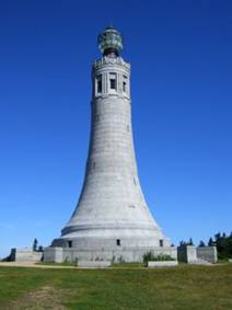
Greylock. Greylock is the highest
mountain in Massachusetts at 3491’, and I had
climbed it during one of the summers I spent at Rensselaer
while doing my graduate degree. The peak
is marked by an unusual tower that resembles a lighthouse and serves as a
veteran’s memorial. The climb was steady
and moderately difficult. Toward the top
I encountered muddy, wet, rooted trails and spruce/fir forest. Had I been through-hiking, this would be the
first spruce-fir forest I had seen since Mt.
Rogers in southern Virginia.
At the top
of Greylock is Bascom Lodge,
reachable by auto. The lodge caters to outdoor-oriented
travelers who want more comfort than a tent.
They had recently opened a hostel, which consisted of a bunkroom in a
musty storage area in one of the outbuildings.
I cooked dinner in a shelter area used for winter refuge during the ski
season, and made use of the shower in the lodge. The Appalachian Mountain Club had formerly
operated the lodge, but its management had recently been taken over by Nature’s
Classroom – an environmental education group for which I worked in the summer
of 1995. When I was checked in, the guy
behind the desk asked me if I had seen the trail magic near a particular road
crossing. I realized that he was the
husband of the person I had met stocking the cooler the previous day. I cooked dinner inside a stone structure that
serves as a warming hut during the winter ski season.
Tuesday
morning dawned clear, the rain gone. I
reached the town of Dalton
almost immediately, and stopped at a house
where a guy named Tom hosts hikers for free. He offered me a bowl of ice cream – certainly
the most unusual breakfast I have eaten.
I used a pay phone to call Tatiana, then continued on up the trail. There was a nice view at a spot called the
Cobbles where I had lunch, then dropped down again to another town called Cheshire. I did not linger, because I had decided I
wasted to make it to the top of Mt.
Greylock. Greylock is the highest
mountain in Massachusetts at 3491’, and I had
climbed it during one of the summers I spent at Rensselaer
while doing my graduate degree. The peak
is marked by an unusual tower that resembles a lighthouse and serves as a
veteran’s memorial. The climb was steady
and moderately difficult. Toward the top
I encountered muddy, wet, rooted trails and spruce/fir forest. Had I been through-hiking, this would be the
first spruce-fir forest I had seen since Mt.
Rogers in southern Virginia.
At the top
of Greylock is Bascom Lodge,
reachable by auto. The lodge caters to outdoor-oriented
travelers who want more comfort than a tent.
They had recently opened a hostel, which consisted of a bunkroom in a
musty storage area in one of the outbuildings.
I cooked dinner in a shelter area used for winter refuge during the ski
season, and made use of the shower in the lodge. The Appalachian Mountain Club had formerly
operated the lodge, but its management had recently been taken over by Nature’s
Classroom – an environmental education group for which I worked in the summer
of 1995. When I was checked in, the guy
behind the desk asked me if I had seen the trail magic near a particular road
crossing. I realized that he was the
husband of the person I had met stocking the cooler the previous day. I cooked dinner inside a stone structure that
serves as a warming hut during the winter ski season.

I descended from Greylock and into the town of North Adams the next day. The trail crosses through a small cross
section of this town, and a grocery store could be found a short distance down
a busy road. I stopped to get a few
extra supplies, include a fresh apple.
The hike into the mountains from town was steep but manageable, and I
soon found myself crossing
the border into Vermont and the Green Mountains.
The weather was perfect for hiking, with low humidity, moderate warm
temperatures, and blue skies. All was
well except for the extremely wet and muddy trail. Vermont
is known for muddy conditions in the spring – so much so that April and May are
referred to as mud season – but conditions seemed unusual for July. I think it had rained quite a lot in the
previous days. Some muddy areas were lined
with logs (“bog bridges” to prevent damage to the trail, but these were not
always effective. The trail passed
several ponds with evidence of beaver activity, and toward the end of the day
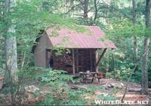
followed a rushing stream. The Congdon
Shelter was close to the trail. It
was an old shelter, the first I had seen in classic Vermont style – built to
look a bit more like a rustic cabin, with a cross-hatched window in the back
and side walls, a small table inside, and bunks for sleeping. One shelter occupant was a guy planning to
hike the entire Long
Trail, which shares treadway with the AT for 105 miles before continuing
north to Canada when the AT
turns east toward New Hampshire.

Thursday provided similar weather to the previous, perfect
for a summer hike. Around mid-morning I
scrambled down a steep descent to route 9, which leads to Bennington, VT. I had hiked this section one Saturday while
on break from graduate studies at RPI, and had met a 60+ year old woman who was
through-hiking the trail for the second time.
She was slack-packing, carrying only a small day pack while someone else
waited for her at a road crossing with a ride to a place to stay. I remember that she told me her favorite
section of trail was near Berlin,
New Hampshire – which would be
what most people refer to as the Mahoosuc range. I would later learn that the Mahoosucs are
perhaps the toughest stretch of the entire trail. The climb back up from route 9 was an equally
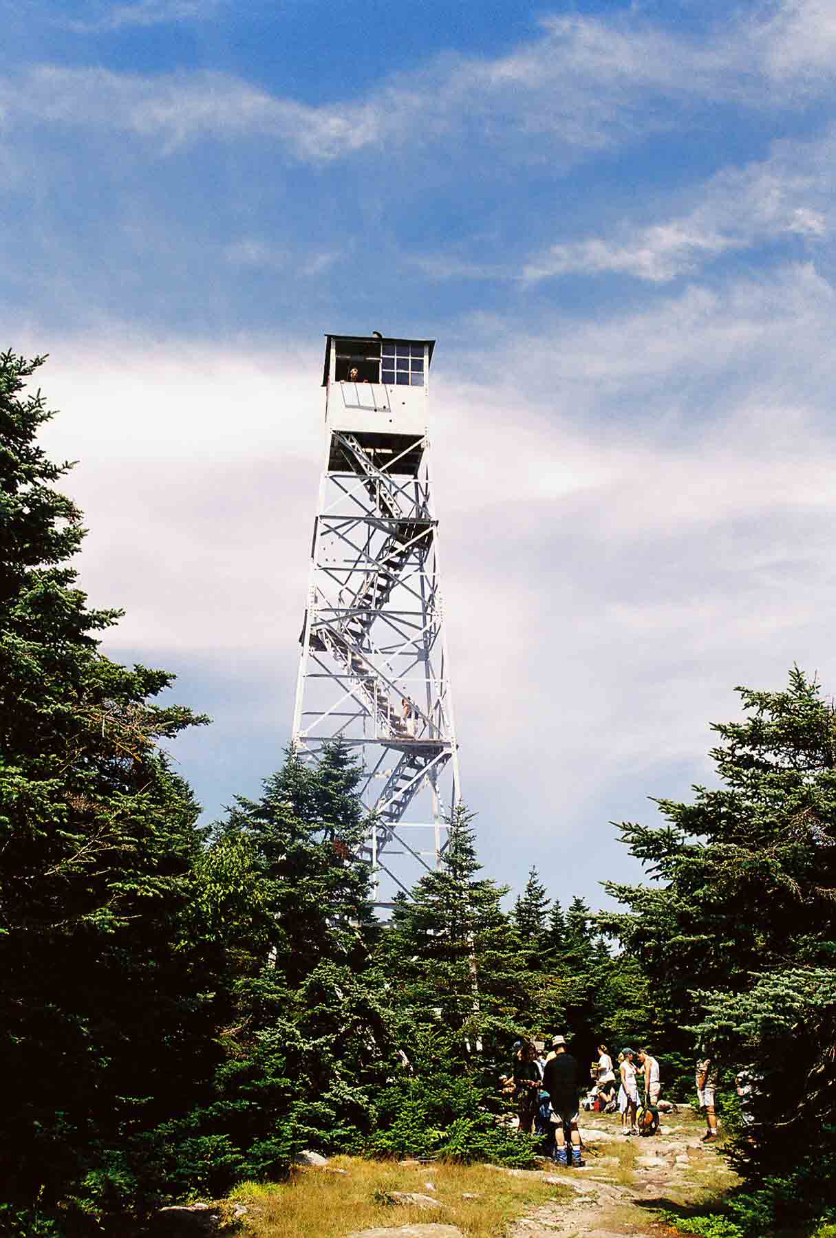
steep ascent, but I soon found myself back along the mountain tops. Around mid-afternoon I climbed Glastonbury Mountain, on top of which stands a large
fire tower. I climbed the tower and enjoyed the view. Since there was still time left in the day, I
hiked on toward Kid
Gore shelter. The shelter was
unusual. It was designed like the one at Congdon,
but was small and had space for 4-6 people on bunks. The unusual part was the location of another
shelter merely 100 yards away through the woods. When I arrived, a hiker was resting there,
but he moved on later. I could hear
voices from the other shelter, but nobody else showed up – so I had the place
to myself. I went to sleep with a nice view of a valley/field below
the shelter.
Fri 7/23 Stratton Pond Shelter 15.1 Elevation
profile
 When I awoke in the morning,
a cloud obscured the view. I figured
that rain would be coming – it was just a question of when. The trail was relatively easy as I approached
the gravel Kelly Stand Road,
which had a small trailhead for climbing Stratton Mountain. I had been there with my friend Ryan from RPI
several years earlier – we climbed the mountain on a day hike, enjoyed the view from the tower, and talked with the
caretakers – sponsored by the Green Mountain Club to keep an eye on this
popular spot. As I moved along the
trail, thunder began to rumble and the rain felt imminent. When I reached the road, I noticed a group of
hikers that were probably waiting to be picked up. They were working furiously to pitch a tarp
for shelter from the rain. I moved on
and began the ascent. About halfway to
the top, the rain started. It came down
hard, making the hiking fairly unpleasant.
In addition, the relatively high elevation (3936’) made for cool
temperatures. Rainy and cold is not a
fun combination, and this trip I spent no time at the top of the peak. The caretakers, if they were around, were
shut inside their tiny cabin. I
descended the mountain and arrived at Stratton
Pond shelter. It was a beautiful new
shelter with space for 10 or more people and an overhang in front to provide
space for cooking out of the rain. Some
other through-hikers were there, but they moved on so they could get to Manchester in time for the
post office the next morning. I had
arrived relatively early (probably 2:00 or 3:00), but I found a book in the
shelter and spent much of the afternoon reading it. I had read that this was one of the most
popular shelters on the trail, but there was no evidence of that distinction –
a few hikers showed up, including a southbound through-hiker, but no crowds. The caretaker did not show either. The rain continued the rest of the day and
into the night.
When I awoke in the morning,
a cloud obscured the view. I figured
that rain would be coming – it was just a question of when. The trail was relatively easy as I approached
the gravel Kelly Stand Road,
which had a small trailhead for climbing Stratton Mountain. I had been there with my friend Ryan from RPI
several years earlier – we climbed the mountain on a day hike, enjoyed the view from the tower, and talked with the
caretakers – sponsored by the Green Mountain Club to keep an eye on this
popular spot. As I moved along the
trail, thunder began to rumble and the rain felt imminent. When I reached the road, I noticed a group of
hikers that were probably waiting to be picked up. They were working furiously to pitch a tarp
for shelter from the rain. I moved on
and began the ascent. About halfway to
the top, the rain started. It came down
hard, making the hiking fairly unpleasant.
In addition, the relatively high elevation (3936’) made for cool
temperatures. Rainy and cold is not a
fun combination, and this trip I spent no time at the top of the peak. The caretakers, if they were around, were
shut inside their tiny cabin. I
descended the mountain and arrived at Stratton
Pond shelter. It was a beautiful new
shelter with space for 10 or more people and an overhang in front to provide
space for cooking out of the rain. Some
other through-hikers were there, but they moved on so they could get to Manchester in time for the
post office the next morning. I had
arrived relatively early (probably 2:00 or 3:00), but I found a book in the
shelter and spent much of the afternoon reading it. I had read that this was one of the most
popular shelters on the trail, but there was no evidence of that distinction –
a few hikers showed up, including a southbound through-hiker, but no crowds. The caretaker did not show either. The rain continued the rest of the day and
into the night.
I had a last reached my last day. Tatiana was driving up from Cecil County
to pick me up, and I had plenty of time to reach the road, so I lingered over
breakfast. When I hit the trail I
discovered that although the weather had cleared, the effects of the rain could
not be avoided. The trail, which had
just begun to dry out after a spell of good weather, had returned to wet
mud. It was impossible to avoid getting
my boots wet and muddy (they were still rather wet from yesterday’s downpour,
so in some ways I suppose it did not matter).
The route was relatively easy though, with a couple of occasional views
towards the west, where I knew that the scenic route 7 made its way north. Eventually I reached Vermont route 11/30. Bromley
Mountain lay ahead, waiting for the next hike. A parking lot lay across the road. Tatiana was not there yet, but showed up
almost right away – good timing!! We
took our time on the route home, following US 7 for much of the way so that I
could show Tatiana the area where the trail had passed. We had dinner at a classic NY diner near the
foot of the George
Washington Bridge
and then made our way home.